
Magnitude |
:3.2 |
| Date & Time (UTC) | 2010-11-24 13:03:29.2 |
| Date & Time (Local) | 1389/9/3 16:33:29.2 |
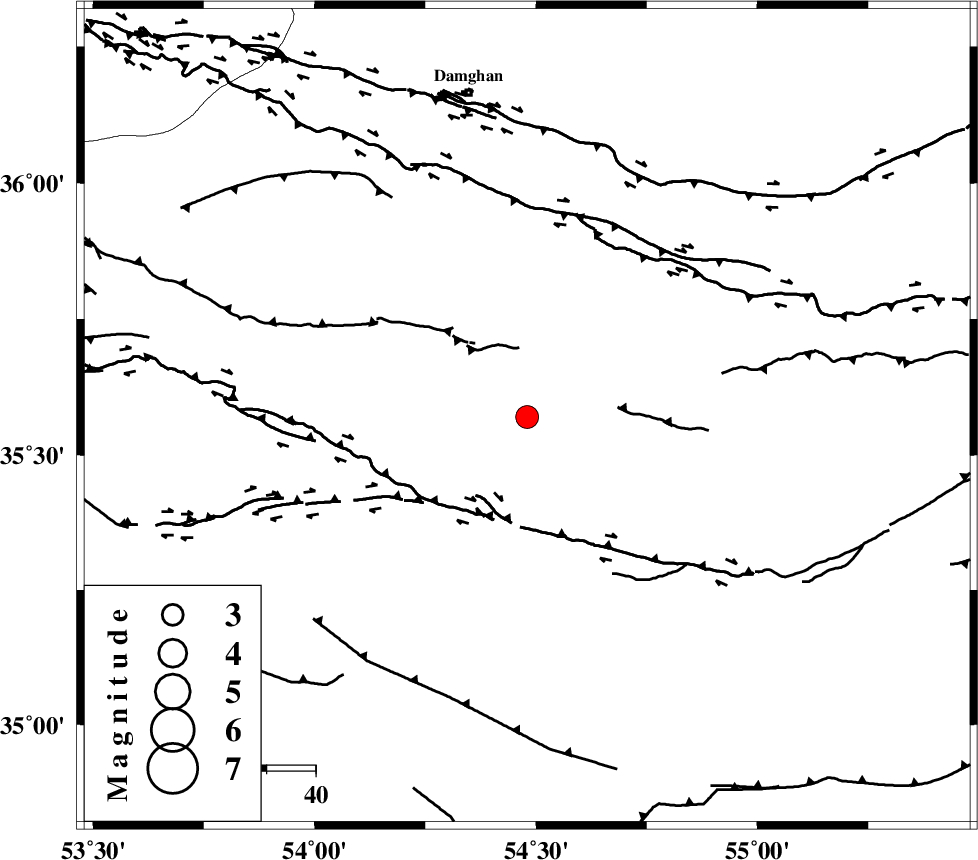
| Location | Lat:35.57 Lon: 54.48 |
| Region | Semnan Province, 67 km South-East of Damghan |
Nearest Cities |
|
| 59 km South East of Amirabad, Semnan Province | |
| 62 km South East of Seydabad, Semnan Province | |
| 67 km South East of Damghan, Semnan Province | |
| 70 km South East of Darvar, Semnan Province | |
| 72 km South of Mehmandust, Semnan Province | |
| Depth | 14 km |
| Agency | |
Faults within 150 km: |
|
| TORUD_F (Length: 136 km) , Distance to epicenter: 31 km | |
| ATARI_F (Length: 185 km) , Distance to epicenter: 67 km | |
| MEYAMEY_F (Length: 141 km) , Distance to epicenter: 74 km | |
| Number of Phases | 8 |
| RMS | 0.1 |
| Number of Stations | 6 |
| Error in Latitude | >2.3 km |
| Error in Longitude | 1.6 km |
| Error in Depth | 4.3 km |
Download waveform in seisan format
to download seisan software Click here
to access information about IIEES stations Click here
Amplitude | ||||||||
| UID | Agency | Station | Component | Amplitude | Period | Arrival Time | Proccessing Time | Signal Clip |
| 74410 | IIEES | DAMV | E | 189.8 | 0.4 | 2010-11-24 13:04:34 | 2010-11-24 01:20:00 | n |
| 74411 | IIEES | DAMV | N | 136.9 | 0.4 | 2010-11-24 13:04:38 | 2010-11-24 01:20:00 | n |
Phase | ||||||||||||
| Agency | Station | Component | Phase Type | Phase Quality | First Motion | Observed Arrival Time | Time Residual | Loc. Flag | Input Weight | Distance | Azimuth | |
| IIEES | DAMV | Z | P | E | 2010-11-24 13:04:05 | -0.1 | y | 228 | 272 | |||
| IIEES | DAMV | N | Sg | E | 2010-11-24 13:04:33 | -0.1 | y | 228 | 272 | |||
| IIEES | MRVT | Z | P | E | 2010-11-24 13:04:10 | 0.1 | y | 273 | 31 | |||
| IIEES | MRVT | N | Sg | E | 2010-11-24 13:04:45 | 0 | y | 273 | 31 | |||
| IIEES | CHTH | Z | P | E | 2010-11-24 13:04:15 | 0.2 | y | 306 | 278 | |||
| IIEES | GHVR | Z | P | E | 2010-11-24 13:04:16 | 0.1 | y | 319 | 249 | |||
| IIEES | TABS | Z | P | E | 2010-11-24 13:04:16 | -0.1 | y | 323 | 131 | |||
| IIEES | ASAO | Z | P | E | 2010-11-24 13:04:29 | 0 | y | 422 | 256 | |||