
Magnitude |
:2.6 |
| Date & Time (UTC) | 2010-10-22 19:13:31.5 |
| Date & Time (Local) | 1389/7/30 22:43:31.5 |
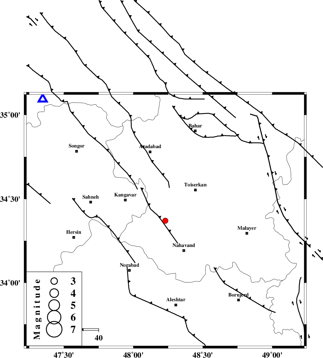
| Location | Lat:34.37 Lon: 48.23 |
| Region | Hamedan Province, 23 km North-West of Nahavand |
Nearest Cities |
|
| 6 km North of Firuzan, Hamedan Province | |
| 13 km North of Shahrak, Hamedan Province | |
| 14 km South of Farsang, Hamedan Province | |
| 17 km North of Barzul, Hamedan Province | |
| 18 km West of Miyandeh, Hamedan Province | |
| Depth | 14 km |
| Agency | |
Faults within 150 km: |
|
| NAHAVAND_F (Length: 102 km) , Distance to epicenter: 6 km | |
| SAHANEH_F (Length: 77 km) , Distance to epicenter: 16 km | |
| DINEHVAR_F (Length: 46 km) , Distance to epicenter: 40 km | |
| Number of Phases | 4 |
| RMS | 0.1 |
| Number of Stations | 3 |
| Error in Latitude | >4.9 km |
| Error in Longitude | 2.7 km |
| Error in Depth | 5.2 km |
Download waveform in seisan format
to download seisan software Click here
to access information about IIEES stations Click here
Amplitude | ||||||||
| UID | Agency | Station | Component | Amplitude | Period | Arrival Time | Proccessing Time | Signal Clip |
| 72250 | IIEES | SNGE | E | 190.8 | 0.04 | 2010-10-22 19:14:06 | 2010-10-23 01:54:00 | n |
| 72251 | IIEES | SNGE | N | 256.9 | 0.38 | 2010-10-22 19:14:06 | 2010-10-23 01:54:00 | n |
| 72252 | IIEES | GHVR | E | 16.9 | 0.3 | 2010-10-22 19:14:54 | 2010-10-23 01:54:00 | n |
Phase | ||||||||||||
| Agency | Station | Component | Phase Type | Phase Quality | First Motion | Observed Arrival Time | Time Residual | Loc. Flag | Input Weight | Distance | Azimuth | |
| IIEES | SNGE | Z | Pg | E | 2010-10-22 19:13:50 | 0 | y | 114 | 315 | |||
| IIEES | KHMZ | Z | Pg | E | 2010-10-22 19:14:00 | -0.1 | y | 175 | 113 | |||
| IIEES | GHVR | Z | Pn | E | 2010-10-22 19:14:13 | 0.2 | y | 278 | 87 | |||
| IIEES | GHVR | E | Sg | E | 2010-10-22 19:14:49 | -0.1 | y | 278 | 87 | |||