
Magnitude |
:3.5 |
| Date & Time (UTC) | 2010-10-04 10:18:02.1 |
| Date & Time (Local) | 1389/7/12 13:48:02.1 |
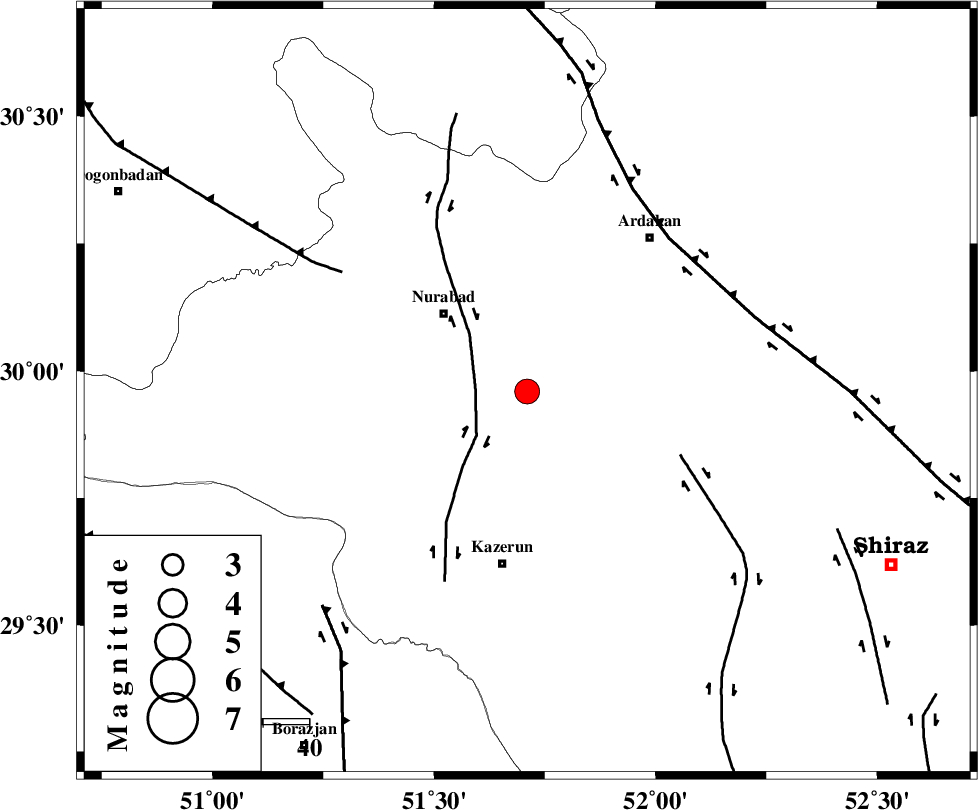
| Location | Lat:29.96 Lon: 51.71 |
| Region | Fars Province, 25 km South-East of Nurabad |
Nearest Cities |
|
| 18 km North of Nodan, Fars Province | |
| 19 km North of Seyyed hasan, Fars Province | |
| 22 km South East of Gachgaran, Fars Province | |
| 25 km South East of Nurabad, Fars Province | |
| 33 km South East of Ahangari, Fars Province | |
| Depth | 6 km |
| Agency | |
Faults within 150 km: |
|
| KAZERUN_F (Length: 96 km) , Distance to epicenter: 11 km | |
| KAREBASS_F (Length: 98 km) , Distance to epicenter: 36 km | |
| HZF3 (Length: 197 km) , Distance to epicenter: 46 km | |
| Number of Phases | 8 |
| RMS | 0.1 |
| Number of Stations | 7 |
| Error in Latitude | >2.5 km |
| Error in Longitude | 4.3 km |
| Error in Depth | 8.2 km |
Download waveform in seisan format
to download seisan software Click here
to access information about IIEES stations Click here
Amplitude | ||||||||
| UID | Agency | Station | Component | Amplitude | Period | Arrival Time | Proccessing Time | Signal Clip |
| 71450 | IIEES | AHRM | N | 1018.7 | 0.57 | 2010-10-04 10:18:43 | 2010-10-04 10:44:00 | n |
| 71451 | IIEES | AHRM | E | 2056.8 | 0.48 | 2010-10-04 10:18:44 | 2010-10-04 10:44:00 | n |
| 71452 | IIEES | GHIR | N | 268.9 | 0.21 | 2010-10-04 10:19:30 | 2010-10-04 10:44:00 | n |
| 71453 | IIEES | BNDS | N | 39.6 | 0.53 | 2010-10-04 10:20:21 | 2010-10-04 10:44:00 | n |
Phase | ||||||||||||
| Agency | Station | Component | Phase Type | Phase Quality | First Motion | Observed Arrival Time | Time Residual | Loc. Flag | Input Weight | Distance | Azimuth | |
| IIEES | AHRM | Z | Pg | E | 2010-10-04 10:18:24 | 0 | y | 127 | 199 | |||
| IIEES | AHRM | E | Sg | E | 2010-10-04 10:18:40 | 0 | y | 127 | 199 | |||
| IIEES | GHIR | Z | Pn | E | 2010-10-04 10:18:38 | 0.1 | y | 223 | 146 | |||
| IIEES | NASN | Z | Pn | E | 2010-10-04 10:18:52 | 0 | y | 332 | 18 | |||
| IIEES | SHGR | Z | Pn | E | 2010-10-04 10:18:56 | 0.1 | y | 366 | 311 | |||
| IIEES | KHMZ | Z | Pn | E | 2010-10-04 10:19:07 | 0.1 | y | 451 | 339 | |||
| IIEES | BNDS | Z | Pn | E | 2010-10-04 10:19:15 | -0.1 | y | 520 | 122 | |||
| IIEES | DAMV | Z | Pn | E | 2010-10-04 10:19:28 | -0.4 | y | 630 | 2 | |||