
Magnitude |
:2.8 |
| Date & Time (UTC) | 2010-09-21 09:53:39.6 |
| Date & Time (Local) | 1389/6/30 14:23:39.6 |
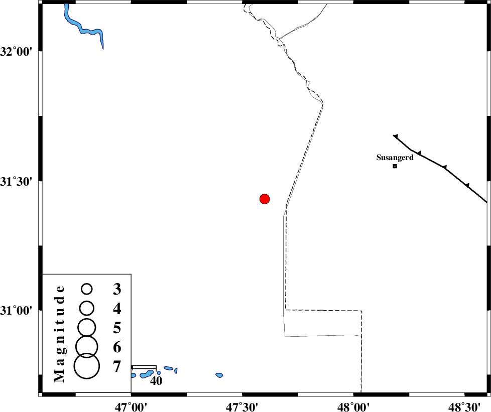
| Location | Lat:31.43 Lon: 47.6 |
| Region | Iraq, 58 km South-West of Susangerd |
Nearest Cities |
|
| 45 km West of Hoveizeh, Khoozestan Province | |
| 49 km South West of Bostan, Khoozestan Province | |
| 57 km South West of Susangerd, Khoozestan Province | |
| 64 km South West of Jalaliyeh, Khoozestan Province | |
| 79 km West of Hamidiyeh, Khoozestan Province | |
| Depth | 30 km |
| Agency | |
Faults within 150 km: |
|
| AHVAZ_F (Length: 99 km) , Distance to epicenter: 61 km | |
| MFF6 (Length: 144 km) , Distance to epicenter: 139 km | |
| DEZFUL_EMBAYMENT (Length: 228 km) , Distance to epicenter: 140 km | |
| Number of Phases | 7 |
| RMS | 0.2 |
| Number of Stations | 6 |
| Error in Latitude | >8.6 km |
| Error in Longitude | 6.9 km |
| Error in Depth | 7.5 km |
Download waveform in seisan format
to download seisan software Click here
to access information about IIEES stations Click here
Amplitude | ||||||||
| UID | Agency | Station | Component | Amplitude | Period | Arrival Time | Proccessing Time | Signal Clip |
| 70793 | IIEES | SHGR | N | 267.2 | 0.44 | 2010-09-21 09:54:22 | 2010-09-21 10:10:00 | n |
| 70794 | IIEES | ASAO | N | 11.8 | 0.6 | 2010-09-21 09:55:37 | 2010-09-21 10:10:00 | n |
Phase | ||||||||||||
| Agency | Station | Component | Phase Type | Phase Quality | First Motion | Observed Arrival Time | Time Residual | Loc. Flag | Input Weight | Distance | Azimuth | |
| IIEES | SHGR | Z | Pg | E | 2010-09-21 09:54:02 | 0.1 | y | 137 | 56 | |||
| IIEES | SHGR | E | Sg | E | 2010-09-21 09:54:18 | -0.1 | y | 137 | 56 | |||
| IIEES | KHMZ | Z | Pn | E | 2010-09-21 09:54:28 | 0.4 | y | 339 | 40 | |||
| IIEES | SNGE | Z | Pn | E | 2010-09-21 09:54:36 | -0.2 | y | 407 | 357 | |||
| IIEES | ASAO | Z | Pn | E | 2010-09-21 09:54:37 | 0 | y | 414 | 33 | |||
| IIEES | GHVR | Z | Pn | E | 2010-09-21 09:54:45 | -0.1 | y | 481 | 44 | |||
| IIEES | NASN | Z | Pn | E | 2010-09-21 09:54:49 | -0.2 | y | 515 | 71 | |||