
Magnitude |
:2.9 |
| Date & Time (UTC) | 2010-08-27 20:00:51.6 |
| Date & Time (Local) | 1389/6/6 00:30:51.6 |
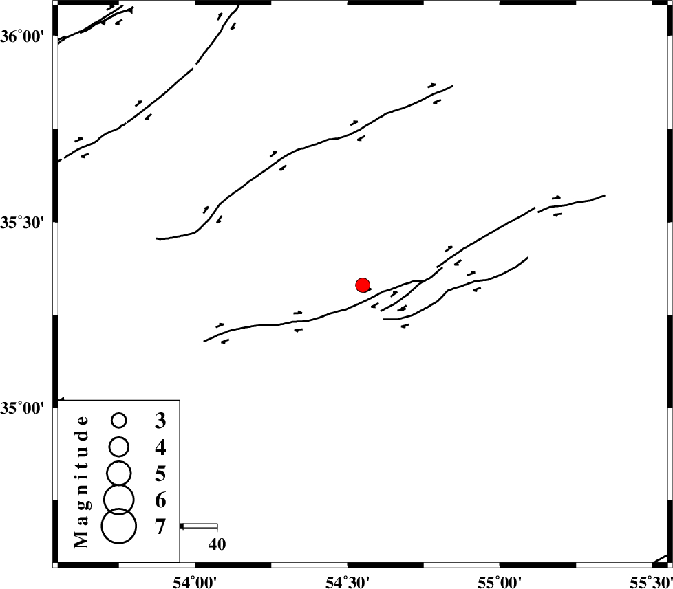
| Location | Lat:35.33 Lon: 54.55 |
| Region | Semnan Province, 95 km South-East of Damghan |
Nearest Cities |
|
| 86 km South East of Amirabad, Semnan Province | |
| 88 km South East of Seydabad, Semnan Province | |
| 94 km South East of Darvar, Semnan Province | |
| 95 km South East of Damghan, Semnan Province | |
| 99 km South of Mehmandust, Semnan Province | |
| Depth | 14 km |
| Agency | |
Faults within 150 km: |
|
| TORUD_F (Length: 136 km) , Distance to epicenter: 9 km | |
| ATARI_F (Length: 185 km) , Distance to epicenter: 88 km | |
| KUH_E_GUGERD_F (Length: 73 km) , Distance to epicenter: 94 km | |
| Number of Phases | 5 |
| RMS | 0.3 |
| Number of Stations | 4 |
| Error in Latitude | >6.9 km |
| Error in Longitude | 4.5 km |
| Error in Depth | 9.4 km |
Download waveform in seisan format
to download seisan software Click here
to access information about IIEES stations Click here
Amplitude | ||||||||
| UID | Agency | Station | Component | Amplitude | Period | Arrival Time | Proccessing Time | Signal Clip |
| 69583 | IIEES | MRVT | N | 37.5 | 0.28 | 2010-08-27 20:02:13 | 2010-08-29 12:45:00 | n |
| 69584 | IIEES | MRVT | E | 45.3 | 0.76 | 2010-08-27 20:02:16 | 2010-08-29 12:45:00 | n |
| 69585 | IIEES | TABS | N | 53.9 | 0.43 | 2010-08-27 20:02:32 | 2010-08-29 12:45:00 | n |
| 69586 | IIEES | TABS | E | 27.5 | 0.44 | 2010-08-27 20:02:36 | 2010-08-29 12:45:00 | n |
| 69587 | IIEES | GHVR | E | 63.2 | 0.32 | 2010-08-27 20:02:26 | 2010-08-29 12:45:00 | n |
| 69588 | IIEES | GHVR | N | 49.2 | 0.52 | 2010-08-27 20:02:33 | 2010-08-29 12:45:00 | n |
Phase | ||||||||||||
| Agency | Station | Component | Phase Type | Phase Quality | First Motion | Observed Arrival Time | Time Residual | Loc. Flag | Input Weight | Distance | Azimuth | |
| IIEES | SHRO | N | Pg | E | 2010-08-27 20:01:16 | -0.4 | y | 153 | 60 | |||
| IIEES | MRVT | Z | Pn | E | 2010-08-27 20:01:36 | 0.4 | y | 293 | 28 | |||
| IIEES | TABS | Z | PN5 | E | 2010-08-27 20:01:36 | 0.2 | y | 301 | 128 | |||
| IIEES | GHVR | Z | Pn | E | 2010-08-27 20:01:38 | -0.2 | y | 316 | 254 | |||
| IIEES | GHVR | E | Sg | E | 2010-08-27 20:02:20 | 0 | y | 316 | 254 | |||