
Magnitude |
:2.5 |
| Date & Time (UTC) | 2010-07-06 23:57:11.7 |
| Date & Time (Local) | 1389/4/16 04:27:11.7 |
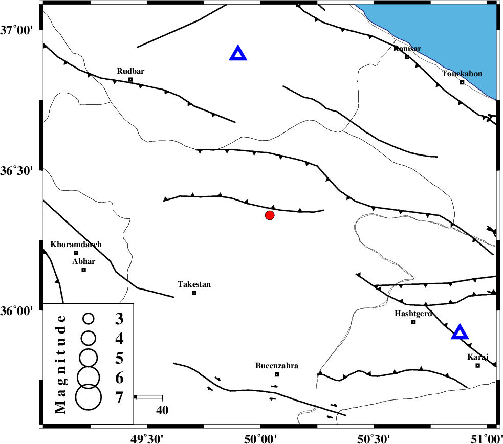
| Location | Lat:36.34 Lon: 50.04 |
| Region | Ghazvin Province, 8 km Qazvin |
Nearest Cities |
|
| 9 km North of Qazvin, Ghazvin Province | |
| 15 km North East of Mahmud Abad, Ghazvin Province | |
| 17 km North West of Sharifabad, Ghazvin Province | |
| 23 km West of Rajaeedasht, Ghazvin Province | |
| 25 km North East of Aqababa, Ghazvin Province | |
| Depth | 15 km |
| Agency | |
Faults within 150 km: |
|
| N_QAZVIN_F (Length: 72 km) , Distance to epicenter: 4 km | |
| ALAMUTRUD_F (Length: 140 km) , Distance to epicenter: 25 km | |
| RUDBAR_F (Length: 93 km) , Distance to epicenter: 39 km | |
| Number of Phases | 6 |
| RMS | 0.4 |
| Number of Stations | 5 |
| Error in Latitude | >16.1 km |
| Error in Longitude | 7.3 km |
| Error in Depth | 13.8 km |
Download waveform in seisan format
to download seisan software Click here
to access information about IIEES stations Click here
Amplitude | ||||||||
| UID | Agency | Station | Component | Amplitude | Period | Arrival Time | Proccessing Time | Signal Clip |
| 65873 | IIEES | CHTH | N | 82 | 0.36 | 2010-07-06 23:57:46 | 2010-07-14 10:36:00 | n |
| 65874 | IIEES | ASAO | N | 91.7 | 0.69 | 2010-07-06 23:58:15 | 2010-07-14 10:36:00 | n |
Phase | ||||||||||||
| Agency | Station | Component | Phase Type | Phase Quality | First Motion | Observed Arrival Time | Time Residual | Loc. Flag | Input Weight | Distance | Azimuth | |
| IIEES | THKV | Z | Pg | E | 2010-07-06 23:57:26 | -0.2 | y | 88.8 | 121 | |||
| IIEES | CHTH | Z | Pg | E | 2010-07-06 23:57:29 | -0.6 | y | 109 | 115 | |||
| IIEES | CHTH | N | Sg | E | 2010-07-06 23:57:44 | 0.5 | y | 109 | 115 | |||
| IIEES | ASAO | Z | Pg | E | 2010-07-06 23:57:44 | -0.4 | y | 198 | 180 | |||
| IIEES | GHVR | Z | Pn | E | 2010-07-06 23:57:48 | 0.5 | y | 233 | 152 | |||
| IIEES | SNGE | Z | Pn | E | 2010-07-06 23:57:54 | 0.3 | y | 280 | 241 | |||