
Magnitude |
:3 |
| Date & Time (UTC) | 2010-06-02 18:56:19.8 |
| Date & Time (Local) | 1389/3/12 23:26:19.8 |
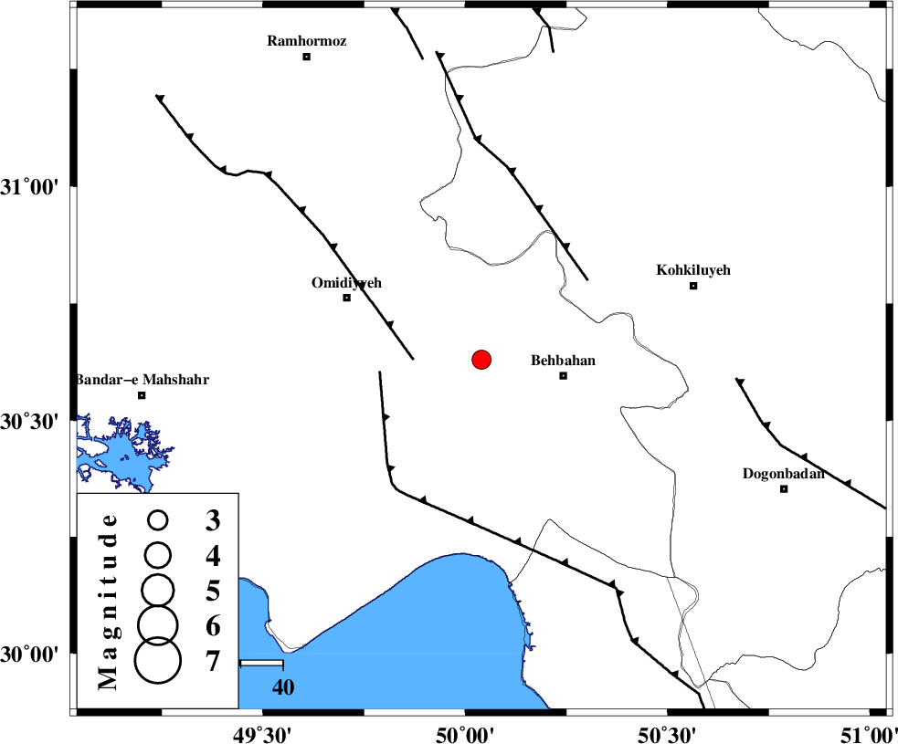
| Location | Lat:30.63 Lon: 50.04 |
| Region | Khoozestan Province, 20 km West of Behbahan |
Nearest Cities |
|
| 16 km West of Dodange-ye bozorg, Khoozestan Province | |
| 20 km North West of Behbahan, Khoozestan Province | |
| 21 km East of Aghajari, Khoozestan Province | |
| 24 km South East of Jolaki, Khoozestan Province | |
| 25 km West of Mansuriyeh, Khoozestan Province | |
| Depth | 33 km |
| Agency | |
Faults within 150 km: |
|
| AGHAJARI_F (Length: 88 km) , Distance to epicenter: 16 km | |
| RAG_E_SEFID_F (Length: 84 km) , Distance to epicenter: 24 km | |
| MFF4 (Length: 62 km) , Distance to epicenter: 31 km | |
| Number of Phases | 6 |
| RMS | 0.1 |
| Number of Stations | 5 |
| Error in Latitude | >6.5 km |
| Error in Longitude | 5.2 km |
| Error in Depth | 5 km |
Download waveform in seisan format
to download seisan software Click here
to access information about IIEES stations Click here
Amplitude | ||||||||
| UID | Agency | Station | Component | Amplitude | Period | Arrival Time | Proccessing Time | Signal Clip |
| 63764 | IIEES | SHGR | E | 287.1 | 0.44 | 2010-06-02 18:57:19 | 2010-06-07 09:05:00 | n |
| 63765 | IIEES | SHGR | N | 229.4 | 0.44 | 2010-06-02 18:57:25 | 2010-06-07 09:05:00 | n |
| 63766 | IIEES | ASAO | N | 13.7 | 0.6 | 2010-06-02 18:58:25 | 2010-06-07 09:05:00 | n |
| 63767 | IIEES | ASAO | E | 12.2 | 0.52 | 2010-06-02 18:58:28 | 2010-06-07 09:05:00 | n |
Phase | ||||||||||||
| Agency | Station | Component | Phase Type | Phase Quality | First Motion | Observed Arrival Time | Time Residual | Loc. Flag | Input Weight | Distance | Azimuth | |
| IIEES | SHGR | Z | Pg | E | 2010-06-02 18:56:52 | 0 | y | 202 | 325 | |||
| IIEES | SHGR | N | Sg | E | 2010-06-02 18:57:16 | 0 | y | 202 | 325 | |||
| IIEES | KHMZ | Z | PN5 | E | 2010-06-02 18:57:08 | 0.1 | y | 345 | 359 | |||
| IIEES | NASN | Z | Pn | E | 2010-06-02 18:57:10 | 0 | y | 356 | 47 | |||
| IIEES | ASAO | Z | Pn | E | 2010-06-02 18:57:19 | -0.1 | y | 435 | 360 | |||
| IIEES | SNGE | Z | Pn | E | 2010-06-02 18:57:34 | 0 | y | 556 | 334 | |||