
Magnitude |
:2.7 |
| Date & Time (UTC) | 2010-05-22 06:29:44.1 |
| Date & Time (Local) | 1389/3/1 10:59:44.1 |
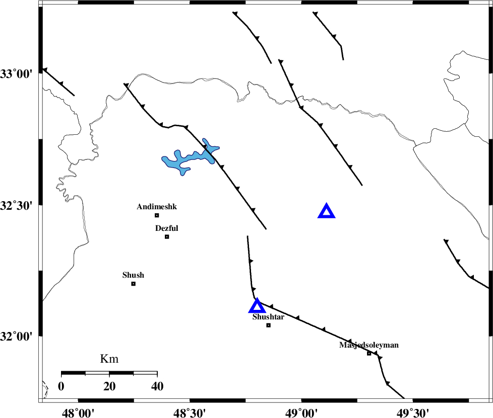
| Location | Lat:32.51 Lon: 48.84 |
| Region | Khoozestan Province, 29 km North-West of Lali |
Nearest Cities |
|
| 1 km North of Sardasht, Khoozestan Province | |
| 21 km North East of Mahur berenji, Khoozestan Province | |
| 29 km North West of Lali, Khoozestan Province | |
| 30 km North of Gatvand, Khoozestan Province | |
| 32 km South of Shuy, Khoozestan Province | |
| Depth | 14 km |
| Agency | |
Faults within 150 km: |
|
| BALARUD_F_Z2 (Length: 58 km) , Distance to epicenter: 20 km | |
| DEZFUL_EMBAYMENT (Length: 228 km) , Distance to epicenter: 20 km | |
| MFF2 (Length: 205 km) , Distance to epicenter: 25 km | |
| Number of Phases | 5 |
| RMS | 0.1 |
| Number of Stations | 6 |
| Error in Latitude | >2.4 km |
| Error in Longitude | 5.9 km |
| Error in Depth | 7.6 km |
Download waveform in seisan format
to download seisan software Click here
to access information about IIEES stations Click here
Amplitude | ||||||||
| UID | Agency | Station | Component | Amplitude | Period | Arrival Time | Proccessing Time | Signal Clip |
| 62790 | IIEES | SHGR | N | 727.2 | 0.38 | 2010-05-22 06:30:06 | 2010-05-22 06:39:00 | n |
| 62791 | IIEES | KHMZ | E | 73.6 | 0.53 | 2010-05-22 06:30:34 | 2010-05-22 06:39:00 | n |
| 62792 | IIEES | ASAO | N | 53.4 | 0.47 | 2010-05-22 06:31:04 | 2010-05-22 06:39:00 | n |
| 62793 | IIEES | ASAO | E | 44.2 | 0.52 | 2010-05-22 06:31:05 | 2010-05-22 06:39:00 | n |
| 62794 | IIEES | GHVR | N | 23.7 | 0.58 | 2010-05-22 06:31:20 | 2010-05-22 06:39:00 | n |
| 62795 | IIEES | SNGE | E | 28.3 | 0.5 | 2010-05-22 06:31:22 | 2010-05-22 06:39:00 | n |
| 62796 | IIEES | SNGE | N | 22.2 | 0.45 | 2010-05-22 06:31:25 | 2010-05-22 06:39:00 | n |
Phase | ||||||||||||
| Agency | Station | Component | Phase Type | Phase Quality | First Motion | Observed Arrival Time | Time Residual | Loc. Flag | Input Weight | Distance | Azimuth | |
| IIEES | SHGR | Z | Pg | E | 2010-05-22 06:29:52 | 0 | y | 44.9 | 185 | |||
| IIEES | ASAO | Z | Pn | E | 2010-05-22 06:30:23 | 0.2 | y | 251 | 26 | |||
| IIEES | SNGE | Z | Pn | E | 2010-05-22 06:30:31 | 0 | y | 318 | 335 | |||
| IIEES | SNGE | E | Sg | E | 2010-05-22 06:31:13 | -0.1 | y | 318 | 335 | |||
| IIEES | NASN | Z | Pn | E | 2010-05-22 06:30:38 | -0.2 | y | 374 | 84 | |||