
Magnitude |
:3.1 |
| Date & Time (UTC) | 2009-12-26 15:18:58.4 |
| Date & Time (Local) | 1388/10/5 18:48:58.4 |
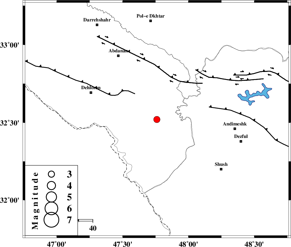
| Location | Lat:32.52 Lon: 47.76 |
| Region | Ilam Province, 56 km West of Andimeshk |
Nearest Cities |
|
| 38 km East of Musian, Ilam Province | |
| 46 km South East of Sarabbagh, Ilam Province | |
| 49 km South West of Hoseinieh, Khoozestan Province | |
| 51 km South East of Dehloran, Ilam Province | |
| 52 km South West of Bidruyeh, Khoozestan Province | |
| Depth | 15 km |
| Agency | |
Faults within 150 km: |
|
| MFF6 (Length: 144 km) , Distance to epicenter: 24 km | |
| BALARUD_F_Z1 (Length: 87 km) , Distance to epicenter: 32 km | |
| DEZFUL_EMBAYMENT (Length: 228 km) , Distance to epicenter: 38 km | |
| Number of Phases | 6 |
| RMS | 0.4 |
| Number of Stations | 5 |
| Error in Latitude | >6.1 km |
| Error in Longitude | 7 km |
| Error in Depth | 0 km |
Download waveform in seisan format
to download seisan software Click here
to access information about IIEES stations Click here
Amplitude | ||||||||
| UID | Agency | Station | Component | Amplitude | Period | Arrival Time | Proccessing Time | Signal Clip |
| 59611 | IIEES | SHGR | N | 853.2 | 0.32 | 2009-12-26 15:19:37 | 2010-02-08 11:55:00 | n |
| 59612 | IIEES | SHGR | E | 582.2 | 0.6 | 2009-12-26 15:19:41 | 2010-02-08 11:55:00 | n |
| 59613 | IIEES | KHMZ | N | 88.5 | 0.52 | 2009-12-26 15:20:14 | 2010-02-08 11:55:00 | n |
| 59614 | IIEES | GHVR | N | 33.8 | 0.6 | 2009-12-26 15:20:50 | 2010-02-08 11:55:00 | n |
| 59615 | IIEES | GHVR | E | 31.5 | 0.64 | 2009-12-26 15:20:58 | 2010-02-08 11:55:00 | n |
Phase | ||||||||||||
| Agency | Station | Component | Phase Type | Phase Quality | First Motion | Observed Arrival Time | Time Residual | Loc. Flag | Input Weight | Distance | Azimuth | |
| IIEES | SHGR | Z | Pg | E | 2009-12-26 15:19:16 | -0.1 | y | 108 | 115 | |||
| IIEES | KHMZ | Z | PN5 | E | 2009-12-26 15:19:36 | -0.3 | y | 246 | 56 | |||
| IIEES | KHMZ | E | Sg | E | 2009-12-26 15:20:07 | -0.2 | y | 246 | 56 | |||
| IIEES | SNGE | Z | Pn | E | 2009-12-26 15:19:41 | -0.3 | y | 288 | 352 | |||
| IIEES | ASAO | Z | Pn | E | 2009-12-26 15:19:45 | 0.7 | y | 308 | 42 | |||
| IIEES | GHVR | Z | Pn | E | 2009-12-26 15:19:54 | 0.3 | y | 390 | 55 | |||