
Magnitude |
:3.9 |
| Date & Time (UTC) | 2009-12-24 17:17:15.4 |
| Date & Time (Local) | 1388/10/3 20:47:15.4 |
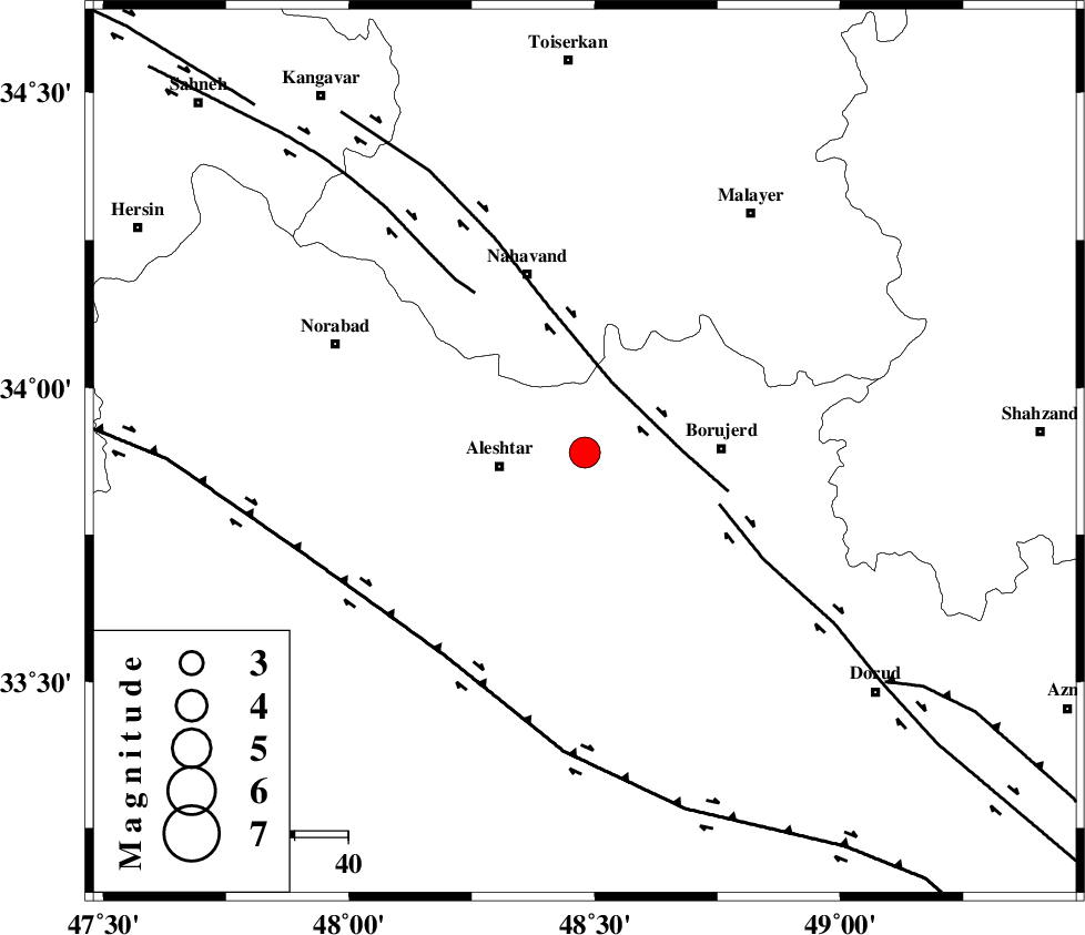
| Location | Lat:33.89 Lon: 48.48 |
| Region | Lorestan Province, 16 km East of Aleshtar |
Nearest Cities |
|
| 16 km North East of Aleshtar, Lorestan Province | |
| 18 km West of Bon dizeh, Lorestan Province | |
| 19 km North East of Dehrahim, Lorestan Province | |
| 19 km North East of Siyahpush, Lorestan Province | |
| 20 km South of Jaefarabad, Lorestan Province | |
| Depth | 15 km |
| Agency | |
Faults within 150 km: |
|
| NAHAVAND_F (Length: 102 km) , Distance to epicenter: 14 km | |
| DORUD (Length: 100 km) , Distance to epicenter: 27 km | |
| SAHANEH_F (Length: 77 km) , Distance to epicenter: 36 km | |
| Number of Phases | 6 |
| RMS | 0.4 |
| Number of Stations | 5 |
| Error in Latitude | >5.7 km |
| Error in Longitude | 5.3 km |
| Error in Depth | 12.3 km |
Download waveform in seisan format
to download seisan software Click here
to access information about IIEES stations Click here
Amplitude | ||||||||
| UID | Agency | Station | Component | Amplitude | Period | Arrival Time | Proccessing Time | Signal Clip |
| 59572 | IIEES | KHMZ | N | 1294.6 | 0.45 | 2009-12-24 17:17:59 | 2010-02-08 11:55:00 | n |
| 59573 | IIEES | ASAO | E | 1027.6 | 0.74 | 2009-12-24 17:18:05 | 2010-02-08 11:55:00 | n |
| 59574 | IIEES | ASAO | N | 1468 | 1.56 | 2009-12-24 17:18:12 | 2010-02-08 11:55:00 | n |
| 59575 | IIEES | SHGR | E | 1818.4 | 0.34 | 2009-12-24 17:18:17 | 2010-02-08 11:55:00 | n |
| 59576 | IIEES | SHGR | N | 1896.3 | 0.93 | 2009-12-24 17:18:21 | 2010-02-08 11:55:00 | n |
Phase | ||||||||||||
| Agency | Station | Component | Phase Type | Phase Quality | First Motion | Observed Arrival Time | Time Residual | Loc. Flag | Input Weight | Distance | Azimuth | |
| IIEES | KHMZ | Z | Pg | E | 2009-12-24 17:17:37 | -0.8 | y | 138 | 96 | |||
| IIEES | KHMZ | N | Sg | E | 2009-12-24 17:17:55 | 0.1 | y | 138 | 96 | |||
| IIEES | ASAO | Z | Pg | E | 2009-12-24 17:17:42 | 0.5 | y | 160 | 62 | |||
| IIEES | SNGE | Z | Pg | E | 2009-12-24 17:17:43 | -0.1 | y | 170 | 322 | |||
| IIEES | SHGR | Z | Pg | E | 2009-12-24 17:17:48 | 0.2 | y | 199 | 171 | |||
| IIEES | NASN | Z | Pn | E | 2009-12-24 17:18:15 | 0.2 | y | 420 | 105 | |||