
Magnitude |
:3.5 |
| Date & Time (UTC) | 2009-12-23 15:00:41.1 |
| Date & Time (Local) | 1388/10/2 18:30:41.1 |
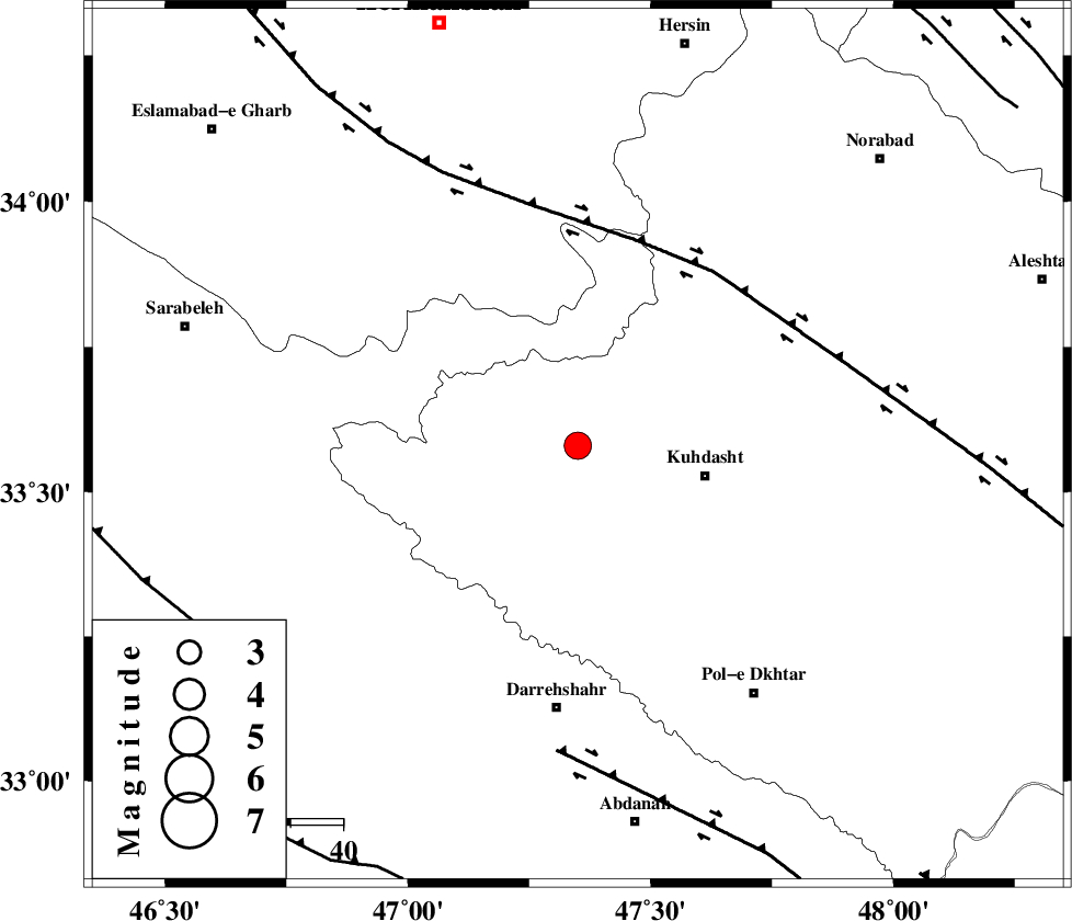
| Location | Lat:33.58 Lon: 47.35 |
| Region | Lorestan Province, 25 km West of Kuhdasht |
Nearest Cities |
|
| 15 km North of Garab, Lorestan Province | |
| 16 km North West of Ashtarheh golgol, Lorestan Province | |
| 20 km North of Kunani, Lorestan Province | |
| 25 km North West of Kuhdasht, Lorestan Province | |
| 29 km North of Suri, Lorestan Province | |
| Depth | 14 km |
| Agency | |
Faults within 150 km: |
|
| HZF4 (Length: 492 km) , Distance to epicenter: 41 km | |
| BALARUD_F_Z1 (Length: 87 km) , Distance to epicenter: 59 km | |
| MFF7 (Length: 99 km) , Distance to epicenter: 81 km | |
| Number of Phases | 6 |
| RMS | 0.2 |
| Number of Stations | 5 |
| Error in Latitude | >3.5 km |
| Error in Longitude | 4.9 km |
| Error in Depth | 6.6 km |
Download waveform in seisan format
to download seisan software Click here
to access information about IIEES stations Click here
Amplitude | ||||||||
| UID | Agency | Station | Component | Amplitude | Period | Arrival Time | Proccessing Time | Signal Clip |
| 59557 | IIEES | SNGE | N | 1029.3 | 0.44 | 2009-12-23 15:01:33 | 2010-02-08 11:55:00 | n |
| 59558 | IIEES | SHGR | E | 412.1 | 0.52 | 2009-12-23 15:01:50 | 2010-02-08 11:55:00 | n |
| 59559 | IIEES | SHGR | N | 484 | 0.44 | 2009-12-23 15:01:53 | 2010-02-08 11:55:00 | n |
| 59560 | IIEES | ASAO | E | 182.6 | 0.44 | 2009-12-23 15:02:08 | 2010-02-08 11:55:00 | n |
| 59561 | IIEES | ASAO | N | 218.1 | 0.52 | 2009-12-23 15:02:09 | 2010-02-08 11:55:00 | n |
| 59562 | IIEES | GHVR | N | 80.7 | 0.6 | 2009-12-23 15:02:36 | 2010-02-08 11:55:00 | n |
| 59563 | IIEES | GHVR | E | 95.1 | 0.68 | 2009-12-23 15:02:37 | 2010-02-08 11:55:00 | n |
Phase | ||||||||||||
| Agency | Station | Component | Phase Type | Phase Quality | First Motion | Observed Arrival Time | Time Residual | Loc. Flag | Input Weight | Distance | Azimuth | |
| IIEES | SNGE | Z | Pg | E | 2009-12-23 15:01:08 | -0.1 | y | 168 | 360 | |||
| IIEES | SHGR | Z | Pg | E | 2009-12-23 15:01:15 | -0.2 | y | 212 | 140 | |||
| IIEES | ASAO | Z | Pn | E | 2009-12-23 15:01:22 | 0.2 | y | 270 | 66 | |||
| IIEES | ASAO | N | Sg | E | 2009-12-23 15:01:57 | -0.1 | y | 270 | 66 | |||
| IIEES | ZNJK | Z | Pn | E | 2009-12-23 15:01:34 | -0.1 | y | 364 | 19 | |||
| IIEES | GHVR | Z | Pn | E | 2009-12-23 15:01:35 | 0.3 | y | 374 | 73 | |||