
Magnitude |
:3 |
| Date & Time (UTC) | 2009-10-13 00:45:20.5 |
| Date & Time (Local) | 1388/7/21 04:15:20.5 |
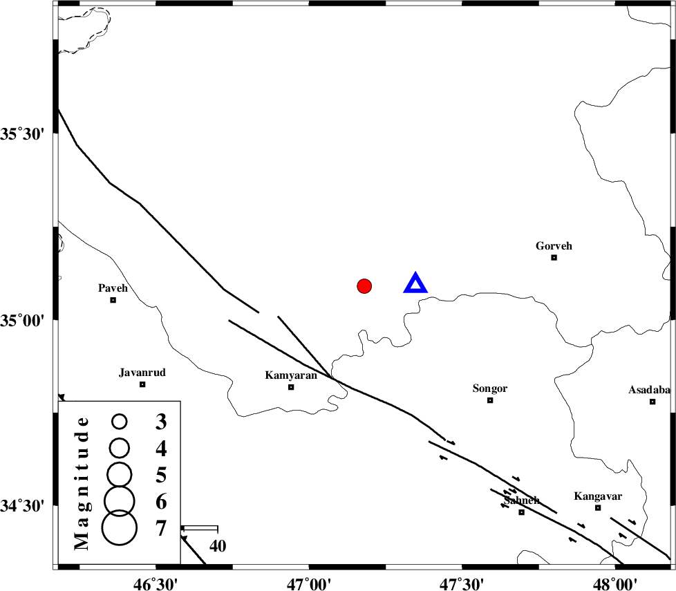
| Location | Lat:35.09 Lon: 47.18 |
| Region | Kordestan Province, 30 km South-East of Sanandaj |
Nearest Cities |
|
| 1 km of Muchesh, Kurdistan Province | |
| 21 km North East of Yoosefabad, Kurdistan Province | |
| 21 km East of Ali Abad, Kurdistan Province | |
| 23 km North East of Void, Kurdistan Province | |
| 23 km North East of Void, Kurdistan Province | |
| Depth | 14 km |
| Agency | |
Faults within 150 km: |
|
| MORVARID_F (Length: 24 km) , Distance to epicenter: 27 km | |
| SARTAKHT_F (Length: 78 km) , Distance to epicenter: 29 km | |
| PIRANSHAHR_F (Length: 253 km) , Distance to epicenter: 32 km | |
| Number of Phases | 5 |
| RMS | 0.2 |
| Number of Stations | 3 |
| Error in Latitude | >7 km |
| Error in Longitude | 12.5 km |
| Error in Depth | 11.9 km |
Download waveform in seisan format
to download seisan software Click here
to access information about IIEES stations Click here
Amplitude | ||||||||
| UID | Agency | Station | Component | Amplitude | Period | Arrival Time | Proccessing Time | Signal Clip |
| 58957 | IIEES | ASAO | E | 56.1 | 0.48 | 2009-10-13 00:46:40 | 2010-02-08 11:55:00 | n |
| 58958 | IIEES | ASAO | N | 63.1 | 0.64 | 2009-10-13 00:46:48 | 2010-02-08 11:55:00 | n |
| 58959 | IIEES | KHMZ | E | 82.7 | 0.68 | 2009-10-13 00:46:55 | 2010-02-08 11:55:00 | n |
| 58960 | IIEES | KHMZ | N | 61.5 | 0.52 | 2009-10-13 00:46:55 | 2010-02-08 11:55:00 | n |
Phase | ||||||||||||
| Agency | Station | Component | Phase Type | Phase Quality | First Motion | Observed Arrival Time | Time Residual | Loc. Flag | Input Weight | Distance | Azimuth | |
| IIEES | ZNJK | Z | Pg | E | 2009-10-13 00:45:56 | 0 | y | 222 | 37 | |||
| IIEES | ASAO | Z | Pn | E | 2009-10-13 00:46:01 | -0.2 | y | 267 | 102 | |||
| IIEES | ASAO | N | Sg | E | 2009-10-13 00:46:36 | 0.1 | y | 267 | 102 | |||
| IIEES | KHMZ | Z | Pn | E | 2009-10-13 00:46:05 | 0.2 | y | 297 | 120 | |||
| IIEES | KHMZ | N | Sg | E | 2009-10-13 00:46:44 | -0.1 | y | 297 | 120 | |||