
Magnitude |
:3 |
| Date & Time (UTC) | 2009-08-31 18:58:09.2 |
| Date & Time (Local) | 1388/6/9 23:28:09.2 |
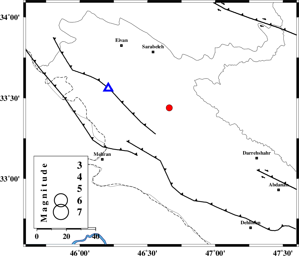
| Location | Lat:33.34 Lon: 46.6 |
| Region | Ilam Province, 37 km South-East of Ilam |
Nearest Cities |
|
| 11 km North of Gonbad-e pirmohammad, Ilam Province | |
| 16 km North East of Galeh-yedarre-hemalakshahi, Ilam Province | |
| 17 km South East of Mehr, Ilam Province | |
| 34 km North West of Meymeh, Ilam Province | |
| 35 km South of Sartang-e malehmaran, Ilam Province | |
| Depth | 44 km |
| Agency | |
Faults within 150 km: |
|
| MFF7 (Length: 99 km) , Distance to epicenter: 8 km | |
| MFF6 (Length: 144 km) , Distance to epicenter: 25 km | |
| ZFF4 (Length: 128 km) , Distance to epicenter: 27 km | |
| Number of Phases | 7 |
| RMS | 0.4 |
| Number of Stations | 5 |
| Error in Latitude | >7.7 km |
| Error in Longitude | 14.5 km |
| Error in Depth | 11 km |
Download waveform in seisan format
to download seisan software Click here
to access information about IIEES stations Click here
Amplitude | ||||||||
| UID | Agency | Station | Component | Amplitude | Period | Arrival Time | Proccessing Time | Signal Clip |
| 58412 | IIEES | KHMZ | E | 39.1 | 0.76 | 2009-08-31 18:59:56 | 2009-10-27 01:20:00 | n |
| 58413 | IIEES | GHVR | E | 20.8 | 0.47 | 2009-08-31 19:00:15 | 2009-10-27 01:20:00 | n |
Phase | ||||||||||||
| Agency | Station | Component | Phase Type | Phase Quality | First Motion | Observed Arrival Time | Time Residual | Loc. Flag | Input Weight | Distance | Azimuth | |
| IIEES | SNGE | Z | PN5 | E | 2009-08-31 18:58:40 | 0.1 | y | 206 | 19 | |||
| IIEES | SNGE | Z | Sg | E | 2009-08-31 18:59:07 | 0 | y | 206 | 19 | |||
| IIEES | KHMZ | Z | Pn | E | 2009-08-31 18:58:53 | -0.1 | y | 316 | 81 | |||
| IIEES | ASAO | Z | Pn | E | 2009-08-31 18:58:57 | 0.7 | y | 344 | 66 | |||
| IIEES | GHVR | Z | Pn | E | 2009-08-31 18:59:09 | -0.3 | y | 448 | 72 | |||
| IIEES | CHTH | Z | Pn | E | 2009-08-31 18:59:16 | -0.6 | y | 504 | 54 | |||
| IIEES | CHTH | E | Sn | 2009-08-31 19:00:06 | 0 | y | 504 | 54 | ||||