
Magnitude |
:2.8 |
| Date & Time (UTC) | 2010-03-24 23:02:49.2 |
| Date & Time (Local) | 1389/1/5 03:32:49.2 |
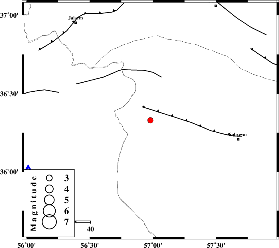
| Location | Lat:36.33 Lon: 56.98 |
| Region | Khorasan(center) Province, 64 km North-West of Sabzevar |
Nearest Cities |
|
| 8 km North of Sadkharu, Khorasan(center) Province | |
| 9 km East of Davarzan, Khorasan(center) Province | |
| 28 km South East of Frumad, Semnan Province | |
| 34 km North West of Rivand, Khorasan(center) Province | |
| 34 km South West of Abuchenari, Khorasan(center) Province | |
| Depth | 46 km |
| Agency | |
Faults within 150 km: |
|
| SABZEVAR_F (Length: 81 km) , Distance to epicenter: 11 km | |
| JOGHATAI_F (Length: 70 km) , Distance to epicenter: 32 km | |
| MEYAMEY_F (Length: 141 km) , Distance to epicenter: 67 km | |
| Number of Phases | 4 |
| RMS | 0.1 |
| Number of Stations | 4 |
| Error in Latitude | >2.3 km |
| Error in Longitude | 9.4 km |
| Error in Depth | 6.6 km |
Download waveform in seisan format
to download seisan software Click here
to access information about IIEES stations Click here
Amplitude | ||||||||
| UID | Agency | Station | Component | Amplitude | Period | Arrival Time | Proccessing Time | Signal Clip |
| 57550 | IIEES | MRVT | E | 117.8 | 0.52 | 2010-03-24 23:03:42 | 2010-03-24 11:12:00 | n |
| 57551 | IIEES | TABS | N | 36.8 | 0.56 | 2010-03-24 23:04:22 | 2010-03-24 11:12:00 | n |
| 57552 | IIEES | SHRT | E | 10.7 | 0.6 | 2010-03-24 23:05:00 | 2010-03-24 11:12:00 | n |
Phase | ||||||||||||
| Agency | Station | Component | Phase Type | Phase Quality | First Motion | Observed Arrival Time | Time Residual | Loc. Flag | Input Weight | Distance | Azimuth | |
| IIEES | BJRD | Z | P | E | 2010-03-24 23:03:13 | 0.1 | y | 157 | 14 | |||
| IIEES | TABS | Z | P | E | 2010-03-24 23:03:30 | -0.1 | y | 297 | 177 | |||
| IIEES | TABS | N | Sg | E | 2010-03-24 23:04:11 | 0.1 | y | 297 | 177 | |||
| IIEES | SHRT | Z | Pn | E | 2010-03-24 23:03:46 | 0 | y | 424 | 134 | |||