
Magnitude |
:3.3 |
| Date & Time (UTC) | 2010-01-30 11:56:46.3 |
| Date & Time (Local) | 1388/11/10 15:26:46.3 |
| Location | Lat:31.08 Lon: 49.4 |
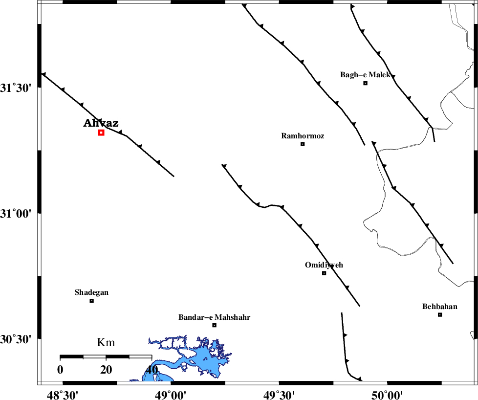
| Region | 29 km South-West of Ramhormoz, Khoozestan Province |
Nearest Cities |
|
| 9 km North of Meshrageh, Khoozestan Province | |
| 21 km North of Ramshir, Khoozestan Province | |
| 21 km South of Marbacheh, Khoozestan Province | |
| 29 km North West of Soltanabad, Khoozestan Province | |
| 29 km South West of Ramhormoz, Khoozestan Province | |
| Depth | 37 km |
| Agency | |
Faults within 150 km: |
|
| AGHAJARI_F (Length: 88 km) , Distance to epicenter: 4 km | |
| AHVAZ_F (Length: 99 km) , Distance to epicenter: 37 km | |
| DEZFUL_EMBAYMENT (Length: 228 km) , Distance to epicenter: 52 km | |
| Number of Phases | 7 |
| RMS | 0.2 |
| Number of Stations | 6 |
| Error in Latitude | >9.6 km |
| Error in Longitude | 8.5 km |
| Error in Depth | 6.9 km |
Download waveform in seisan format
to download seisan software Click here
to access information about IIEES stations Click here
Amplitude | ||||||||
| UID | Agency | Station | Component | Amplitude | Period | Arrival Time | Proccessing Time | Signal Clip |
| 54630 | IIEES | SHGR | E | 743.6 | 0.38 | 2010-01-30 11:57:30 | 2010-01-30 12:12:00 | n |
| 54631 | IIEES | SHGR | N | 829.9 | 0.49 | 2010-01-30 11:57:31 | 2010-01-30 12:12:00 | n |
| 54632 | IIEES | KHMZ | E | 97.6 | 0.45 | 2010-01-30 11:58:07 | 2010-01-30 12:12:00 | n |
| 54633 | IIEES | GHVR | E | 38 | 0.73 | 2010-01-30 11:58:36 | 2010-01-30 12:12:00 | n |
| 54634 | IIEES | SNGE | N | 32.9 | 0.43 | 2010-01-30 11:58:42 | 2010-01-30 12:12:00 | n |
Phase | ||||||||||||
| Agency | Station | Component | Phase Type | Phase Quality | First Motion | Observed Arrival Time | Time Residual | Loc. Flag | Input Weight | Distance | Azimuth | |
| IIEES | SHGR | Z | Pg | E | 2010-01-30 11:57:07 | -0.1 | y | 128 | 334 | |||
| IIEES | SHGR | E | Sg | E | 2010-01-30 11:57:23 | 0.1 | y | 128 | 334 | |||
| IIEES | KHMZ | Z | Pn | E | 2010-01-30 11:57:29 | -0.1 | y | 300 | 10 | |||
| IIEES | NASN | Z | Pn | E | 2010-01-30 11:57:38 | 0.1 | y | 374 | 58 | |||
| IIEES | ASAO | Z | Pn | E | 2010-01-30 11:57:40 | -0.3 | y | 389 | 8 | |||
| IIEES | GHVR | Z | Pn | E | 2010-01-30 11:57:43 | 0.2 | y | 415 | 24 | |||
| IIEES | SNGE | Z | Pn | E | 2010-01-30 11:57:52 | 0.2 | y | 485 | 337 | |||