
Magnitude |
:2.8 |
| Date & Time (UTC) | 2010-01-12 09:17:18.4 |
| Date & Time (Local) | 1388/10/22 12:47:18.4 |
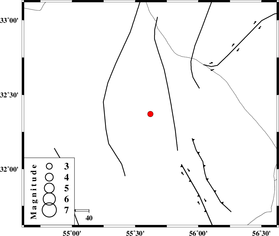
| Location | Lat:32.37 Lon: 55.62 |
| Region | 87 km North-East of Bafq, Yazd Province |
Nearest Cities |
|
| 68 km North West of Behabad, Yazd Province | |
| 72 km North West of Kushk, Yazd Province | |
| 72 km South of Robat-e posht-e badam, Yazd Province | |
| 83 km North West of Benestan, Yazd Province | |
| 85 km North East of Mobarake, Yazd Province | |
| Depth | 14 km |
| Agency | |
Faults within 150 km: |
|
| SARBALA_F (Length: 92 km) , Distance to epicenter: 17 km | |
| POSHT_E_BADAM_F (Length: 128 km) , Distance to epicenter: 35 km | |
| JAFARABAD_F (Length: 60 km) , Distance to epicenter: 36 km | |
| Number of Phases | 4 |
| RMS | 0.1 |
| Number of Stations | 3 |
| Error in Latitude | >1.9 km |
| Error in Longitude | 5.3 km |
| Error in Depth | 8.3 km |
Download waveform in seisan format
to download seisan software Click here
to access information about IIEES stations Click here
Amplitude | ||||||||
| UID | Agency | Station | Component | Amplitude | Period | Arrival Time | Proccessing Time | Signal Clip |
| 53850 | IIEES | NASN | E | 38.1 | 0.55 | 2010-01-12 09:18:35 | 2010-01-12 09:34:00 | n |
| 53851 | IIEES | KRBR | N | 52.5 | 0.69 | 2010-01-12 09:18:43 | 2010-01-12 09:34:00 | n |
Phase | ||||||||||||
| Agency | Station | Component | Phase Type | Phase Quality | First Motion | Observed Arrival Time | Time Residual | Loc. Flag | Input Weight | Distance | Azimuth | |
| IIEES | TABS | Z | Pg | E | 2010-01-12 09:17:51 | 0 | y | 200 | 44 | |||
| IIEES | NASN | Z | Pn | E | 2010-01-12 09:17:59 | -0.1 | y | 268 | 281 | |||
| IIEES | KRBR | Z | Pn | E | 2010-01-12 09:18:02 | 0.2 | y | 286 | 157 | |||
| IIEES | KRBR | N | Sg | E | 2010-01-12 09:18:39 | -0.1 | y | 286 | 157 | |||