
Magnitude |
:4.4 |
| Date & Time (UTC) | 2009-04-25 15:14:55.1 |
| Date & Time (Local) | 1388/2/5 19:44:55.1 |
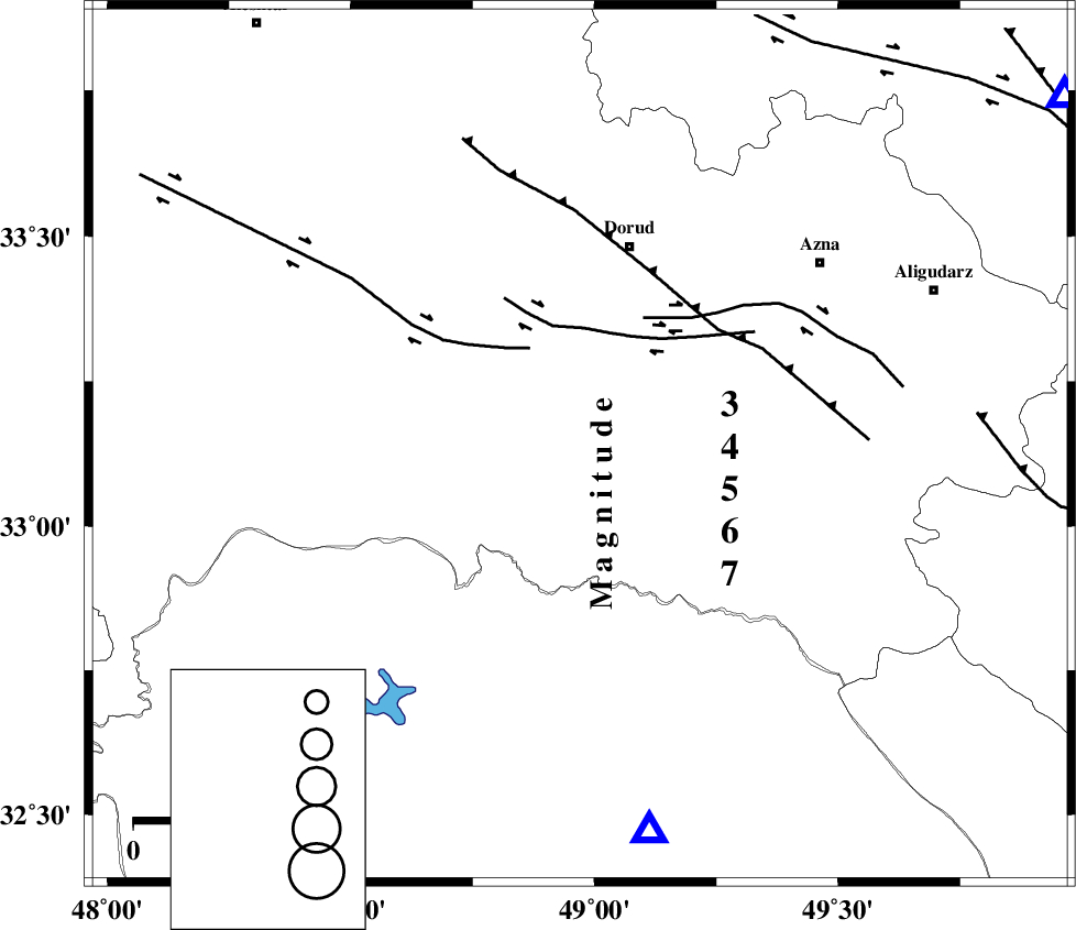
| Location | Lat:33.14 Lon: 48.97 |
| Region | 39 km South-West of Dorud, Lorestan Province |
Nearest Cities |
|
| 11 km North of Bargsar, Lorestan Province | |
| 14 km South of Sartang barzeh, Lorestan Province | |
| 16 km East of Chamsangar, Lorestan Province | |
| 20 km West of Shulabad, Lorestan Province | |
| 39 km South West of Dorud, Lorestan Province | |
| Depth | 15 km |
| Agency | |
Faults within 150 km: |
|
| HZF4 (Length: 492 km) , Distance to epicenter: 10 km | |
| DORUD (Length: 100 km) , Distance to epicenter: 35 km | |
| MFF2 (Length: 205 km) , Distance to epicenter: 39 km | |
| Number of Phases | 8 |
| RMS | 0.5 |
| Number of Stations | 8 |
| Error in Latitude | >7 km |
| Error in Longitude | 12.3 km |
| Error in Depth | 13.5 km |
Download waveform in seisan format
to download seisan software Click here
to access information about IIEES stations Click here
Amplitude | ||||||||
| UID | Agency | Station | Component | Amplitude | Period | Arrival Time | Proccessing Time | Signal Clip |
| 52539 | IIEES | KHMZ | N | 5114 | 1.58 | 2009-04-25 15:15:34 | 2009-07-13 01:52:00 | n |
| 52540 | IIEES | SHGR | N | 16230.2 | 0.86 | 2009-04-25 15:15:35 | 2009-07-13 01:52:00 | n |
| 52541 | IIEES | DAMV | N | 849 | 1.08 | 2009-04-25 15:16:55 | 2009-07-13 01:52:00 | n |
| 52542 | IIEES | DAMV | E | 784.5 | 0.5 | 2009-04-25 15:16:56 | 2009-07-13 01:52:00 | n |
Phase | ||||||||||||
| Agency | Station | Component | Phase Type | Phase Quality | First Motion | Observed Arrival Time | Time Residual | Loc. Flag | Input Weight | Distance | Azimuth | |
| IIEES | KHMZ | Z | Pg | E | 2009-04-25 15:15:13 | -0.8 | y | 114 | 54 | |||
| IIEES | SHGR | Z | Pg | E | 2009-04-25 15:15:14 | -0.2 | y | 115 | 188 | |||
| IIEES | THKV | Z | Pn | E | 2009-04-25 15:15:47 | 0.6 | y | 355 | 29 | |||
| IIEES | NASN | Z | Pn | E | 2009-04-25 15:15:48 | 0.6 | y | 361 | 95 | |||
| IIEES | CHTH | Z | Pn | E | 2009-04-25 15:15:48 | 0.2 | y | 366 | 32 | |||
| IIEES | DAMV | Z | Pn | E | 2009-04-25 15:15:51 | 0.2 | y | 391 | 44 | |||
| IIEES | ZNJK | Z | Pn | E | 2009-04-25 15:15:51 | -0.3 | y | 393 | 356 | |||
| IIEES | TABS | Z | Pn | E | 2009-04-25 15:16:36 | -0.2 | y | 761 | 83 | |||