
Magnitude |
:3.2 |
| Date & Time (UTC) | 2009-03-08 10:49:00.4 |
| Date & Time (Local) | 1387/12/18 14:19:00.4 |
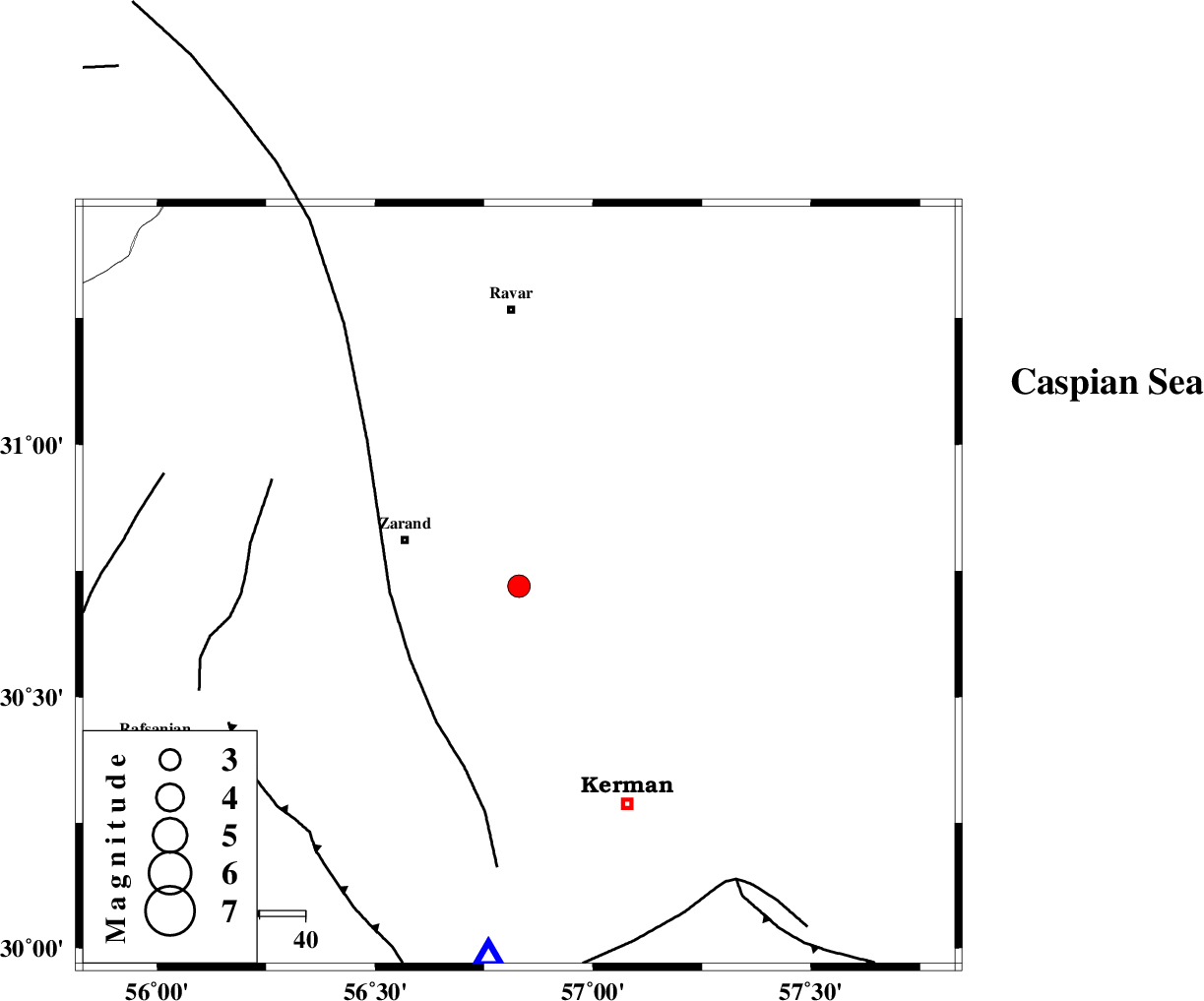
| Location | Lat:30.72 Lon: 56.83 |
| Region | 27 km East of Zarand, Kerman Province |
Nearest Cities |
|
| 4 km of Khankuk, Kerman Province | |
| 15 km South of Hatkan, Kerman Province | |
| 15 km West of Hejdak, Kerman Province | |
| 15 km North of Chatrud, Kerman Province | |
| 17 km North of Kazemabad, Kerman Province | |
| Depth | 14 km |
| Agency | |
Faults within 150 km: |
|
| KUHBANAN_F (Length: 189 km) , Distance to epicenter: 2 km | |
| CHATRUD_F (Length: 37 km) , Distance to epicenter: 17 km | |
| DARIVAN_F (Length: 131 km) , Distance to epicenter: 43 km | |
| Number of Phases | 4 |
| RMS | 0.1 |
| Number of Stations | 3 |
| Error in Latitude | >2.7 km |
| Error in Longitude | 3.4 km |
| Error in Depth | 6.7 km |
Download waveform in seisan format
to download seisan software Click here
to access information about IIEES stations Click here
Amplitude | ||||||||
| UID | Agency | Station | Component | Amplitude | Period | Arrival Time | Proccessing Time | Signal Clip |
| 52145 | IIEES | KRBR | E | 1095.6 | 0.3 | 2009-03-08 10:49:29 | 2009-06-27 08:52:00 | n |
| 52146 | IIEES | NASN | E | 23.8 | 0.62 | 2009-03-08 10:51:09 | 2009-06-27 08:52:00 | n |
Phase | ||||||||||||
| Agency | Station | Component | Phase Type | Phase Quality | First Motion | Observed Arrival Time | Time Residual | Loc. Flag | Input Weight | Distance | Azimuth | |
| IIEES | KRBR | Z | Pg | E | 2009-03-08 10:49:14 | 0 | y | 81.9 | 185 | |||
| IIEES | NASN | Z | Pn | E | 2009-03-08 10:50:03 | 0.1 | y | 446 | 302 | |||
| IIEES | NASN | N | Sg | E | 2009-03-08 10:51:04 | 0 | y | 446 | 302 | |||
| IIEES | SHRT | Z | Pn | E | 2009-03-08 10:50:05 | -0.1 | y | 460 | 44 | |||