
Magnitude |
:3.8 |
| Date & Time (UTC) | 2009-01-22 11:00:25.0 |
| Date & Time (Local) | 1387/11/3 14:30:25.0 |
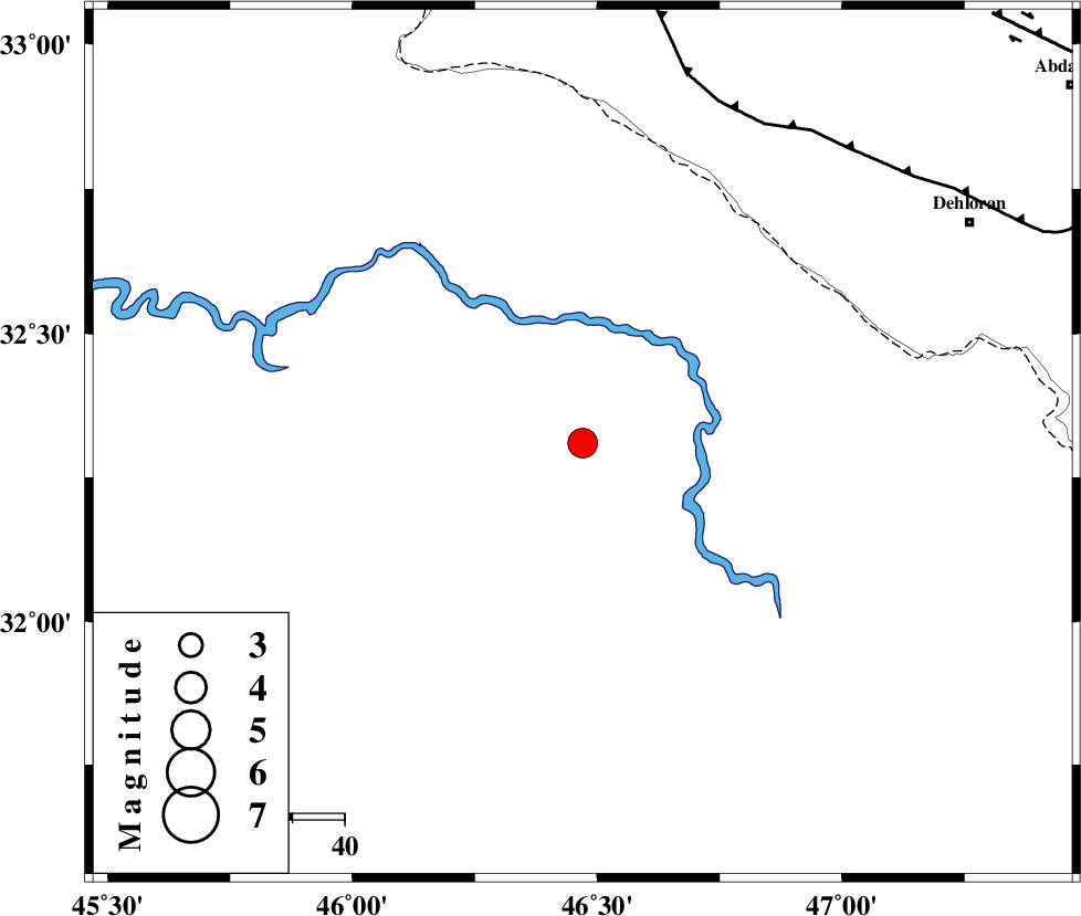
| Location | Lat:32.31 Lon: 46.47 |
| Region | 85 km South-West of Dehloran, Ilam Province |
Nearest Cities |
|
| 74 km South West of Bishehzar, Ilam Province | |
| 85 km South West of Dehloran, Ilam Province | |
| 88 km South West of Musian, Ilam Province | |
| 94 km South East of Mehran, Ilam Province | |
| 104 km South of Gonbad-e pirmohammad, Ilam Province | |
| Depth | 39 km |
| Agency | |
Faults within 150 km: |
|
| MFF6 (Length: 144 km) , Distance to epicenter: 71 km | |
| ZFF4 (Length: 128 km) , Distance to epicenter: 93 km | |
| MFF7 (Length: 99 km) , Distance to epicenter: 108 km | |
| Number of Phases | 6 |
| RMS | 0 |
| Number of Stations | 5 |
| Error in Latitude | >8.4 km |
| Error in Longitude | 4.9 km |
| Error in Depth | 6.2 km |
Download waveform in seisan format
to download seisan software Click here
to access information about IIEES stations Click here
Amplitude | ||||||||
| UID | Agency | Station | Component | Amplitude | Period | Arrival Time | Proccessing Time | Signal Clip |
| 51736 | IIEES | SHGR | E | 632.5 | 0.34 | 2009-01-22 11:01:27 | 2009-06-27 08:52:00 | n |
| 51737 | IIEES | ASAO | N | 120.4 | 0.58 | 2009-01-22 11:02:17 | 2009-06-27 08:52:00 | n |
| 51738 | IIEES | GHVR | E | 112.9 | 0.54 | 2009-01-22 11:02:24 | 2009-06-27 08:52:00 | n |
| 51739 | IIEES | GHVR | N | 85.7 | 0.54 | 2009-01-22 11:02:24 | 2009-06-27 08:52:00 | n |
Phase | ||||||||||||
| Agency | Station | Component | Phase Type | Phase Quality | First Motion | Observed Arrival Time | Time Residual | Loc. Flag | Input Weight | Distance | Azimuth | |
| IIEES | SHGR | Z | Pg | E | 2009-01-22 11:01:00 | 0 | y | 221 | 95 | |||
| IIEES | SHGR | E | Sg | E | 2009-01-22 11:01:26 | 0 | y | 221 | 95 | |||
| IIEES | KHMZ | Z | Pn | E | 2009-01-22 11:01:15 | 0 | y | 363 | 63 | |||
| IIEES | ASAO | Z | Pn | E | 2009-01-22 11:01:21 | 0 | y | 414 | 52 | |||
| IIEES | GHVR | Z | Pn | E | 2009-01-22 11:01:33 | 0 | y | 505 | 60 | |||
| IIEES | NASN | Z | Pn | E | 2009-01-22 11:01:44 | 0 | y | 598 | 83 | |||