
Magnitude |
:3.5 |
| Date & Time (UTC) | 2009-01-10 20:04:00.9 |
| Date & Time (Local) | 1387/10/21 23:34:00.9 |
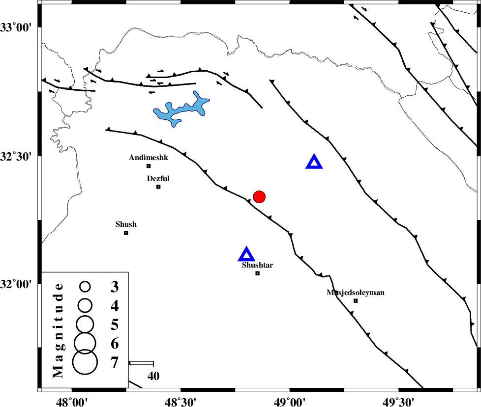
| Location | Lat:32.34 Lon: 48.86 |
| Region | 23 km West of Lali, Khoozestan Province |
Nearest Cities |
|
| 11 km North of Gatvand, Khoozestan Province | |
| 16 km North of Samaleh, Khoozestan Province | |
| 18 km South of Sardasht, Khoozestan Province | |
| 19 km East of Mahur berenji, Khoozestan Province | |
| 24 km West of Lali, Khoozestan Province | |
| Depth | 27 km |
| Agency | |
Faults within 150 km: |
|
| DEZFUL_EMBAYMENT (Length: 228 km) , Distance to epicenter: 5 km | |
| MFF2 (Length: 205 km) , Distance to epicenter: 38 km | |
| BALARUD_F_Z2 (Length: 58 km) , Distance to epicenter: 38 km | |
| Number of Phases | 8 |
| RMS | 0.1 |
| Number of Stations | 7 |
| Error in Latitude | >1.6 km |
| Error in Longitude | 3.1 km |
| Error in Depth | 2.2 km |
Download waveform in seisan format
to download seisan software Click here
to access information about IIEES stations Click here
Amplitude | ||||||||
| UID | Agency | Station | Component | Amplitude | Period | Arrival Time | Proccessing Time | Signal Clip |
| 51680 | IIEES | SHGR | E | 11409.8 | 0.63 | 2009-01-10 20:04:18 | 2009-06-27 08:52:00 | n |
| 51681 | IIEES | ASAO | N | 284.4 | 0.64 | 2009-01-10 20:05:19 | 2009-06-27 08:52:00 | n |
| 51682 | IIEES | GHVR | N | 105.8 | 0.64 | 2009-01-10 20:05:37 | 2009-06-27 08:52:00 | n |
| 51683 | IIEES | GHVR | E | 104.9 | 0.52 | 2009-01-10 20:05:38 | 2009-06-27 08:52:00 | n |
Phase | ||||||||||||
| Agency | Station | Component | Phase Type | Phase Quality | First Motion | Observed Arrival Time | Time Residual | Loc. Flag | Input Weight | Distance | Azimuth | |
| IIEES | SHGR | Z | Pg | E | 2009-01-10 20:04:07 | 0 | y | 26.4 | 193 | |||
| IIEES | ASAO | Z | Pn | E | 2009-01-10 20:04:40 | -0.1 | y | 268 | 23 | |||
| IIEES | ASAO | N | Sg | E | 2009-01-10 20:05:14 | 0 | y | 268 | 23 | |||
| IIEES | GHVR | Z | Pn | E | 2009-01-10 20:04:47 | 0.1 | y | 325 | 42 | |||
| IIEES | SNGE | Z | Pn | E | 2009-01-10 20:04:49 | 0 | y | 336 | 336 | |||
| IIEES | NASN | Z | Pn | E | 2009-01-10 20:04:54 | 0.1 | y | 374 | 81 | |||
| IIEES | CHTH | Z | Pn | E | 2009-01-10 20:05:03 | -0.1 | y | 447 | 27 | |||
| IIEES | TABS | Z | Pn | E | 2009-01-10 20:05:44 | -0.2 | y | 785 | 77 | |||