
Magnitude |
:3.4 |
| Date & Time (UTC) | 2009-01-03 15:08:45.7 |
| Date & Time (Local) | 1387/10/14 18:38:45.7 |
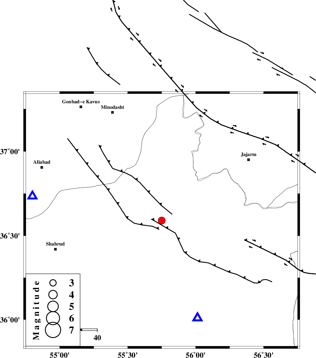
| Location | Lat:36.59 Lon: 55.75 |
| Region | 69 km South-West of Jajarm, Khorasan(north) Province |
Nearest Cities |
|
| 22 km North of Miamay, Semnan Province | |
| 40 km East of Kalateh khanj, Semnan Province | |
| 46 km South East of Qaleh qafeh, Semnan Province | |
| 49 km South of Nardin, Semnan Province | |
| 49 km South East of Farsian, Golestan Province | |
| Depth | 14 km |
| Agency | |
Faults within 150 km: |
|
| MEYAMEY_F (Length: 141 km) , Distance to epicenter: 17 km | |
| JAJARAM_F (Length: 77 km) , Distance to epicenter: 37 km | |
| ROBATE_QARABIL_F (Length: 168 km) , Distance to epicenter: 43 km | |
| Number of Phases | 6 |
| RMS | 0.2 |
| Number of Stations | 4 |
| Error in Latitude | >5.1 km |
| Error in Longitude | 5.6 km |
| Error in Depth | 11.8 km |
Download waveform in seisan format
to download seisan software Click here
to access information about IIEES stations Click here
Amplitude | ||||||||
| UID | Agency | Station | Component | Amplitude | Period | Arrival Time | Proccessing Time | Signal Clip |
| 51629 | IIEES | MRVT | E | 461.6 | 0.05 | 2009-01-03 15:09:28 | 2009-06-27 08:52:00 | n |
| 51630 | IIEES | DAMV | E | 89.4 | 0.63 | 2009-01-03 15:10:38 | 2009-06-27 08:52:00 | n |
| 51631 | IIEES | GHVR | N | 55.5 | 0.52 | 2009-01-03 15:11:21 | 2009-06-27 08:52:00 | n |
| 51632 | IIEES | GHVR | E | 52.6 | 0.33 | 2009-01-03 15:11:22 | 2009-06-27 08:52:00 | n |
Phase | ||||||||||||
| Agency | Station | Component | Phase Type | Phase Quality | First Motion | Observed Arrival Time | Time Residual | Loc. Flag | Input Weight | Distance | Azimuth | |
| IIEES | MRVT | Z | Pg | E | 2009-01-03 15:09:06 | 0.3 | y | 122 | 14 | |||
| IIEES | MRVT | E | Sg | E | 2009-01-03 15:09:21 | -0.3 | y | 122 | 14 | |||
| IIEES | TABS | Z | Pn | E | 2009-01-03 15:09:36 | -0.2 | y | 350 | 159 | |||
| IIEES | DAMV | Z | Pn | E | 2009-01-03 15:09:38 | 0.3 | y | 356 | 254 | |||
| IIEES | DAMV | N | Sg | E | 2009-01-03 15:10:25 | -0.2 | y | 356 | 254 | |||
| IIEES | GHVR | Z | Pn | E | 2009-01-03 15:09:52 | 0.1 | y | 471 | 241 | |||