
Magnitude |
:3.4 |
| Date & Time (UTC) | 2008-11-02 13:02:38.9 |
| Date & Time (Local) | 1387/8/12 16:32:38.9 |
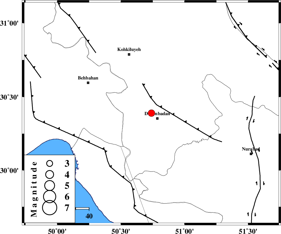
| Location | Lat:30.39 Lon: 50.74 |
| Region | 5 km Dogonbadan, Kohkiluieh va boyerahmad Province |
Nearest Cities |
|
| 6 km North of Dogonbadan, Kohkiluieh va boyerahmad Province | |
| 30 km West of Abdehgah, Kohkiluieh va boyerahmad Province | |
| 41 km North West of Basht, Kohkiluieh va boyerahmad Province | |
| 47 km South East of Dehdasht, Kohkiluieh va boyerahmad Province | |
| 50 km South East of Mansuriyeh, Khoozestan Province | |
| Depth | 17 km |
| Agency | |
Faults within 150 km: |
|
| MISHAN_F (Length: 76 km) , Distance to epicenter: 7 km | |
| ZFF3 (Length: 125 km) , Distance to epicenter: 45 km | |
| RAG_E_SEFID_F (Length: 84 km) , Distance to epicenter: 45 km | |
| Number of Phases | 7 |
| RMS | 0.1 |
| Number of Stations | 6 |
| Error in Latitude | >3.8 km |
| Error in Longitude | 4.5 km |
| Error in Depth | 9 km |
Download waveform in seisan format
to download seisan software Click here
to access information about IIEES stations Click here
Amplitude | ||||||||
| UID | Agency | Station | Component | Amplitude | Period | Arrival Time | Proccessing Time | Signal Clip |
| 51088 | IIEES | GHVR | N | 33.5 | 0.64 | 2008-11-02 13:04:40 | 2009-05-17 10:07:00 | n |
| 51089 | IIEES | ASAO | N | 66.2 | 0.68 | 2008-11-02 13:04:36 | 2009-05-17 10:07:00 | n |
Phase | ||||||||||||
| Agency | Station | Component | Phase Type | Phase Quality | First Motion | Observed Arrival Time | Time Residual | Loc. Flag | Input Weight | Distance | Azimuth | |
| IIEES | NASN | Z | Pn | E | 2008-11-02 13:03:27 | 0.1 | y | 332 | 36 | |||
| IIEES | GHVR | Z | Pn | E | 2008-11-02 13:03:42 | -0.1 | y | 457 | 6 | |||
| IIEES | GHVR | N | Sn | 2008-11-02 13:04:29 | 0 | y | 457 | 6 | ||||
| IIEES | ASAO | Z | Pn | E | 2008-11-02 13:03:44 | 0.1 | y | 467 | 352 | |||
| IIEES | SNGE | Z | Pn | E | 2008-11-02 13:04:02 | -0.1 | y | 611 | 330 | |||
| IIEES | BNDS | Z | Pn | E | 2008-11-02 13:04:04 | 0 | y | 624 | 121 | |||
| IIEES | TABS | Z | Pn | E | 2008-11-02 13:04:13 | -0.2 | y | 703 | 57 | |||