
Magnitude |
:2.9 |
| Date & Time (UTC) | 2008-09-20 05:53:01.9 |
| Date & Time (Local) | 1387/6/30 10:23:01.9 |
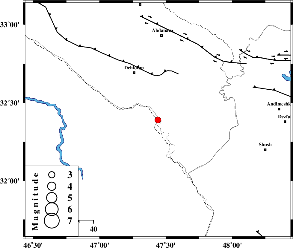
| Location | Lat:32.39 Lon: 47.44 |
| Region | 37 km South-East of Dehloran, Ilam Province |
Nearest Cities |
|
| 19 km South of Musian, Ilam Province | |
| 38 km South East of Dehloran, Ilam Province | |
| 58 km South West of Sarabbagh, Ilam Province | |
| 60 km South of Abdanan, Ilam Province | |
| 65 km South East of Bishehzar, Ilam Province | |
| Depth | 15 km |
| Agency | |
Faults within 150 km: |
|
| MFF6 (Length: 144 km) , Distance to epicenter: 32 km | |
| BALARUD_F_Z1 (Length: 87 km) , Distance to epicenter: 60 km | |
| DEZFUL_EMBAYMENT (Length: 228 km) , Distance to epicenter: 71 km | |
| Number of Phases | 4 |
| RMS | 0.1 |
| Number of Stations | 4 |
| Error in Latitude | >8.7 km |
| Error in Longitude | 2.1 km |
| Error in Depth | 0 km |
Download waveform in seisan format
to download seisan software Click here
to access information about IIEES stations Click here
Amplitude | ||||||||
| UID | Agency | Station | Component | Amplitude | Period | Arrival Time | Proccessing Time | Signal Clip |
| 50492 | IIEES | SNGE | E | 42 | 0.84 | 2008-09-20 05:54:42 | 2009-05-05 01:27:00 | n |
| 50493 | IIEES | ASAO | E | 48.1 | 0.59 | 2008-09-20 05:54:54 | 2009-05-05 01:27:00 | n |
Phase | ||||||||||||
| Agency | Station | Component | Phase Type | Phase Quality | First Motion | Observed Arrival Time | Time Residual | Loc. Flag | Input Weight | Distance | Azimuth | |
| IIEES | SNGE | Z | Pn | E | 2008-09-20 05:53:46 | 0 | y | 300 | 358 | |||
| IIEES | ASAO | Z | Pn | E | 2008-09-20 05:53:51 | 0.1 | y | 339 | 44 | |||
| IIEES | NASN | Z | Pn | E | 2008-09-20 05:54:12 | 0 | y | 506 | 83 | |||
| IIEES | DAMV | Z | Pn | E | 2008-09-20 05:54:18 | -0.1 | y | 552 | 48 | |||