
Magnitude |
:3.3 |
| Date & Time (UTC) | 2008-09-08 17:39:15.1 |
| Date & Time (Local) | 1387/6/18 22:09:15.1 |
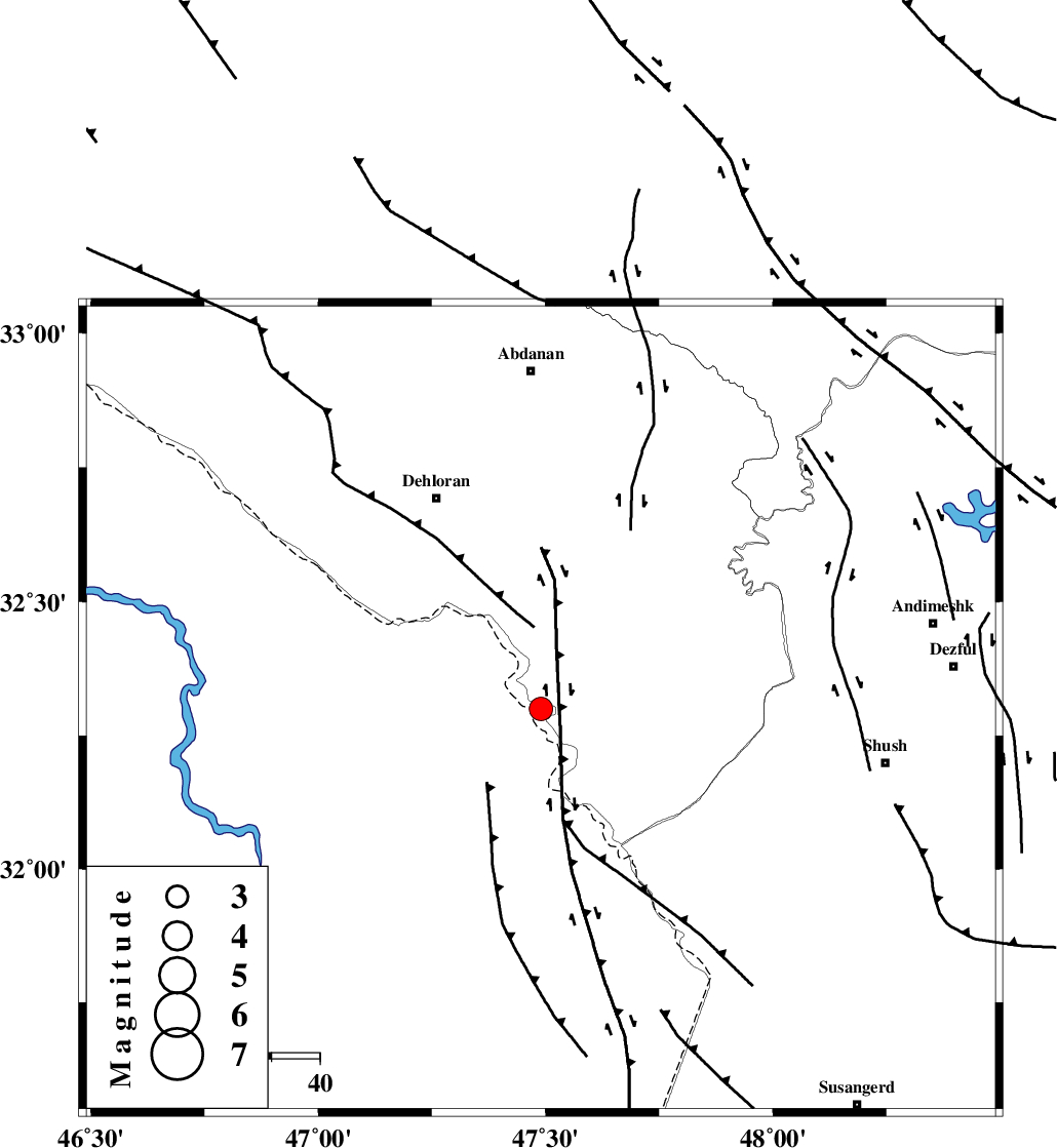
| Location | Lat:32.3 Lon: 47.49 |
| Region | 48 km South-East of Dehloran, Ilam Province |
Nearest Cities |
|
| 30 km South East of Musian, Ilam Province | |
| 49 km South East of Dehloran, Ilam Province | |
| 67 km South of Sarabbagh, Ilam Province | |
| 70 km South of Abdanan, Ilam Province | |
| 72 km North West of Shush, Khoozestan Province | |
| Depth | 14 km |
| Agency | |
Faults within 150 km: |
|
| MFF6 (Length: 144 km) , Distance to epicenter: 42 km | |
| BALARUD_F_Z1 (Length: 87 km) , Distance to epicenter: 65 km | |
| DEZFUL_EMBAYMENT (Length: 228 km) , Distance to epicenter: 71 km | |
| Number of Phases | 6 |
| RMS | 0.2 |
| Number of Stations | 4 |
| Error in Latitude | >3.2 km |
| Error in Longitude | 6.4 km |
| Error in Depth | 9.1 km |
Download waveform in seisan format
to download seisan software Click here
to access information about IIEES stations Click here
Amplitude | ||||||||
| UID | Agency | Station | Component | Amplitude | Period | Arrival Time | Proccessing Time | Signal Clip |
| 50186 | IIEES | SHGR | E | 1145.1 | 0.64 | 2008-09-08 17:39:57 | 2009-05-05 01:27:00 | n |
| 50187 | IIEES | SHGR | N | 1434.2 | 0.64 | 2008-09-08 17:39:57 | 2009-05-05 01:27:00 | n |
| 50188 | IIEES | SNGE | E | 94.9 | 0.6 | 2008-09-08 17:40:55 | 2009-05-05 01:27:00 | n |
| 50189 | IIEES | GHVR | N | 24.2 | 0.48 | 2008-09-08 17:41:05 | 2009-05-05 01:27:00 | n |
| 50190 | IIEES | GHVR | E | 23.6 | 0.4 | 2008-09-08 17:41:08 | 2009-05-05 01:27:00 | n |
Phase | ||||||||||||
| Agency | Station | Component | Phase Type | Phase Quality | First Motion | Observed Arrival Time | Time Residual | Loc. Flag | Input Weight | Distance | Azimuth | |
| IIEES | SHGR | Z | Pg | E | 2008-09-08 17:39:35 | -0.3 | y | 126 | 99 | |||
| IIEES | SHGR | E | Sg | E | 2008-09-08 17:39:51 | 0.2 | y | 126 | 99 | |||
| IIEES | SNGE | Z | Pn | E | 2008-09-08 17:40:01 | 0.1 | y | 310 | 358 | |||
| IIEES | ASAO | Z | Pn | E | 2008-09-08 17:40:05 | 0 | y | 343 | 43 | |||
| IIEES | ASAO | N | Sg | E | 2008-09-08 17:40:51 | -0.1 | y | 343 | 43 | |||
| IIEES | GHVR | Z | Pn | E | 2008-09-08 17:40:15 | 0.2 | y | 425 | 54 | |||