
Magnitude |
:3.7 |
| Date & Time (UTC) | 2007-10-18 20:44:23.0 |
| Date & Time (Local) | 1386/7/27 00:14:23.0 |
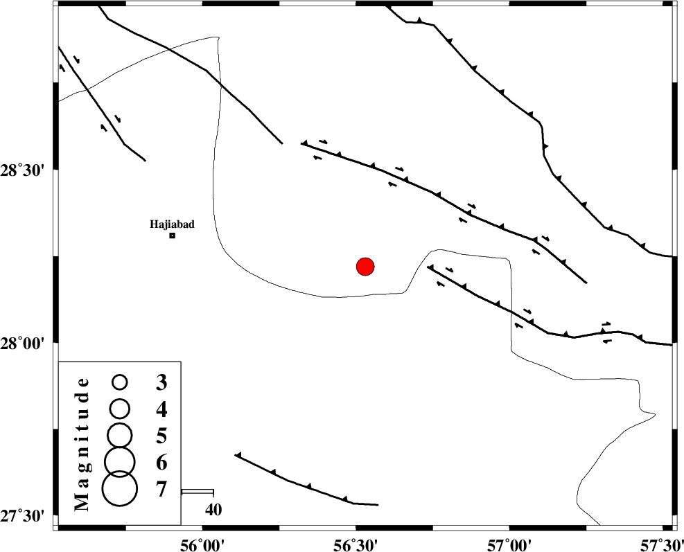
| Location | Lat:28.22 Lon: 56.53 |
| Region | 61 km East of Hajiabad, Hormozgan Province |
Nearest Cities |
|
| 29 km South East of Arzuieeh, Kerman Province | |
| 30 km South East of Shahmaran, Kerman Province | |
| 37 km South West of Sarkhan, Kerman Province | |
| 37 km North East of Fareqan, Hormozgan Province | |
| 62 km East of Hajiabad, Hormozgan Province | |
| Depth | 27 km |
| Agency | |
Faults within 150 km: |
|
| MAIN_ZAGROS_R_F (Length: 1106 km) , Distance to epicenter: 7 km | |
| HZF2 (Length: 437 km) , Distance to epicenter: 49 km | |
| ZENDAN_MINAB_F_Z1 (Length: 183 km) , Distance to epicenter: 76 km | |
| Number of Phases | 5 |
| RMS | 0 |
| Number of Stations | 5 |
| Error in Latitude | >5.1 km |
| Error in Longitude | 2.3 km |
| Error in Depth | 9.1 km |
Download waveform in seisan format
to download seisan software Click here
to access information about IIEES stations Click here
Amplitude | ||||||||
| UID | Agency | Station | Component | Amplitude | Period | Arrival Time | Proccessing Time | Signal Clip |
| 39867 | IIEES | BNDS | E | 3120 | 0.52 | 2007-10-18 20:44:59 | 2008-04-12 10:47:00 | n |
| 39868 | IIEES | BNDS | N | 2430.8 | 0.58 | 2007-10-18 20:45:00 | 2008-04-12 10:47:00 | n |
| 39869 | IIEES | GHIR | N | 155.2 | 0.64 | 2007-10-18 20:46:28 | 2008-04-12 10:47:00 | n |
Phase | ||||||||||||
| Agency | Station | Component | Phase Type | Phase Quality | First Motion | Observed Arrival Time | Time Residual | Loc. Flag | Input Weight | Distance | Azimuth | |
| IIEES | BNDS | Z | Pg | E | 2007-10-18 20:44:39 | 0 | y | 97.6 | 201 | |||
| IIEES | GHIR | Z | Pn | E | 2007-10-18 20:45:12 | 0 | y | 347 | 272 | |||
| IIEES | ZHSF | Z | Pn | E | 2007-10-18 20:45:24 | 0 | y | 442 | 69 | |||
| IIEES | NASN | Z | Pn | E | 2007-10-18 20:45:46 | 0 | y | 620 | 326 | |||
| IIEES | ASAO | Z | Pn | E | 2007-10-18 20:46:25 | 0 | y | 935 | 320 | |||