
Magnitude |
:3.2 |
| Date & Time (UTC) | 2007-08-31 02:12:46.3 |
| Date & Time (Local) | 1386/6/9 05:42:46.3 |
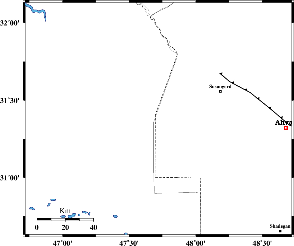
| Location | Lat:31.38 Lon: 47.72 |
| Region | 48 km South-West of Susangerd, Khoozestan Province |
Nearest Cities |
|
| 35 km West of Hoveizeh, Khoozestan Province | |
| 46 km South West of Bostan, Khoozestan Province | |
| 48 km South West of Susangerd, Khoozestan Province | |
| 55 km South West of Jalaliyeh, Khoozestan Province | |
| 68 km South West of Hamidiyeh, Khoozestan Province | |
| Depth | 14 km |
| Agency | |
Faults within 150 km: |
|
| AHVAZ_F (Length: 99 km) , Distance to epicenter: 55 km | |
| DEZFUL_EMBAYMENT (Length: 228 km) , Distance to epicenter: 142 km | |
| AGHAJARI_F (Length: 88 km) , Distance to epicenter: 145 km | |
| Number of Phases | 5 |
| RMS | 0.1 |
| Number of Stations | 4 |
| Error in Latitude | >5.5 km |
| Error in Longitude | 4.6 km |
| Error in Depth | 6.5 km |
Download waveform in seisan format
to download seisan software Click here
to access information about IIEES stations Click here
Amplitude | ||||||||
| UID | Agency | Station | Component | Amplitude | Period | Arrival Time | Proccessing Time | Signal Clip |
| 39624 | IIEES | SHGR | E | 658.7 | 0.36 | 2007-08-31 02:13:28 | 2007-11-04 01:43:00 | n |
| 39625 | IIEES | SHGR | N | 599.5 | 0.72 | 2007-08-31 02:13:36 | 2007-11-04 01:43:00 | n |
| 39626 | IIEES | ASAO | E | 29 | 0.48 | 2007-08-31 02:14:49 | 2007-11-04 01:43:00 | n |
| 39627 | IIEES | ASAO | N | 33.3 | 0.64 | 2007-08-31 02:15:06 | 2007-11-04 01:43:00 | n |
| 39628 | IIEES | SNGE | E | 32.8 | 0.52 | 2007-08-31 02:14:32 | 2007-11-04 01:43:00 | n |
| 39629 | IIEES | SNGE | N | 43.5 | 0.6 | 2007-08-31 02:14:38 | 2007-11-04 01:43:00 | n |
Phase | ||||||||||||
| Agency | Station | Component | Phase Type | Phase Quality | First Motion | Observed Arrival Time | Time Residual | Loc. Flag | Input Weight | Distance | Azimuth | |
| IIEES | SHGR | Z | Pg | E | 2007-08-31 02:13:08 | 0 | y | 131 | 51 | |||
| IIEES | SHGR | N | Sg | E | 2007-08-31 02:13:23 | 0 | y | 131 | 51 | |||
| IIEES | ASAO | Z | Pn | E | 2007-08-31 02:13:45 | 0.1 | y | 412 | 31 | |||
| IIEES | SNGE | Z | Pn | E | 2007-08-31 02:13:45 | -0.1 | y | 413 | 355 | |||
| IIEES | NASN | Z | Pn | E | 2007-08-31 02:13:57 | 0 | y | 506 | 71 | |||