
Magnitude |
:2.9 |
| Date & Time (UTC) | 2007-08-25 19:24:59.3 |
| Date & Time (Local) | 1386/6/3 22:54:59.3 |
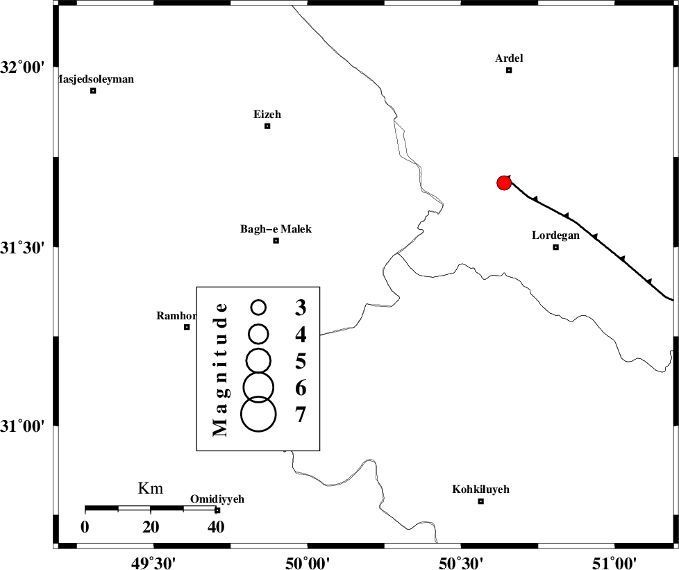
| Location | Lat:31.42 Lon: 50.19 |
| Region | 30 km East of Bagh Malek, Khoozestan Province |
Nearest Cities |
|
| 13 km North East of Seidun, Khoozestan Province | |
| 18 km North of Esfandan, Kohkiluieh va boyerahmad Province | |
| 24 km South East of Abolabbas, Khoozestan Province | |
| 24 km North West of Dishmuk, Kohkiluieh va boyerahmad Province | |
| 30 km East of Bagh Malek, Khoozestan Province | |
| Depth | 18 km |
| Agency | |
Faults within 150 km: |
|
| MFF2 (Length: 205 km) , Distance to epicenter: 9 km | |
| MFF4 (Length: 62 km) , Distance to epicenter: 29 km | |
| DEZFUL_EMBAYMENT (Length: 228 km) , Distance to epicenter: 33 km | |
| Number of Phases | 5 |
| RMS | 0.1 |
| Number of Stations | 4 |
| Error in Latitude | >3.5 km |
| Error in Longitude | 4.1 km |
| Error in Depth | 6.5 km |
Download waveform in seisan format
to download seisan software Click here
to access information about IIEES stations Click here
Amplitude | ||||||||
| UID | Agency | Station | Component | Amplitude | Period | Arrival Time | Proccessing Time | Signal Clip |
| 39489 | IIEES | SHGR | N | 249 | 0.82 | 2007-08-25 19:25:50 | 2007-11-04 01:43:00 | n |
| 39490 | IIEES | ASAO | E | 15.3 | 0.48 | 2007-08-25 19:26:40 | 2007-11-04 01:43:00 | n |
| 39491 | IIEES | SNGE | N | 15.5 | 0.29 | 2007-08-25 19:27:03 | 2007-11-04 01:43:00 | n |
Phase | ||||||||||||
| Agency | Station | Component | Phase Type | Phase Quality | First Motion | Observed Arrival Time | Time Residual | Loc. Flag | Input Weight | Distance | Azimuth | |
| IIEES | SHGR | Z | Pg | E | 2007-08-25 19:25:24 | 0 | y | 152 | 300 | |||
| IIEES | NASN | Z | Pn | E | 2007-08-25 19:25:42 | 0 | y | 290 | 58 | |||
| IIEES | ASAO | Z | Pn | E | 2007-08-25 19:25:50 | 0.2 | y | 347 | 357 | |||
| IIEES | ASAO | E | Sg | E | 2007-08-25 19:26:36 | 0 | y | 347 | 357 | |||
| IIEES | SNGE | Z | Pn | E | 2007-08-25 19:26:06 | -0.2 | y | 486 | 328 | |||