
Magnitude |
:2.8 |
| Date & Time (UTC) | 2007-08-21 06:12:56.7 |
| Date & Time (Local) | 1386/5/30 09:42:56.7 |
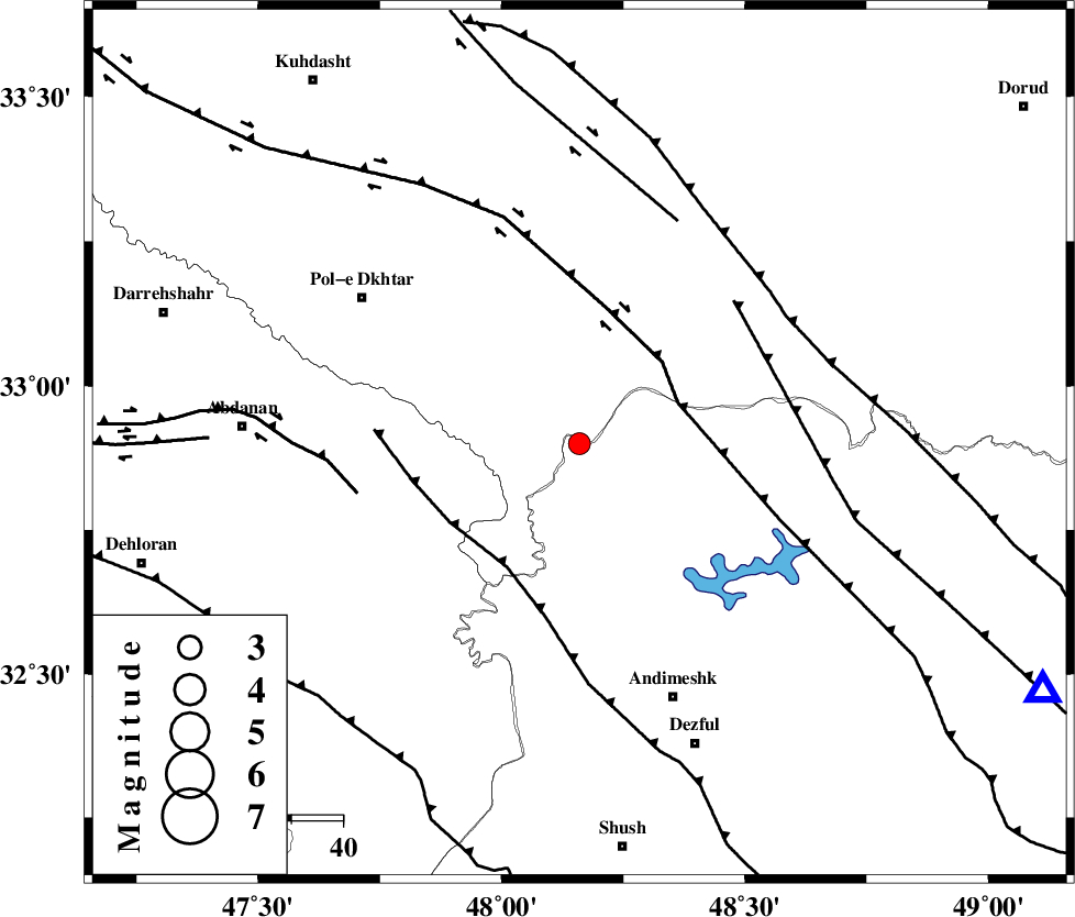
| Location | Lat:32.9 Lon: 48.16 |
| Region | 50 km South-East of Pol-e dokhtar, Lorestan Province |
Nearest Cities |
|
| 18 km North of Bidruyeh, Khoozestan Province | |
| 21 km North West of Sorkhakan, Khoozestan Province | |
| 26 km North of Hoseinieh, Khoozestan Province | |
| 49 km South East of Sarab hammam, Lorestan Province | |
| 50 km South East of Pol-e dokhtar, Lorestan Province | |
| Depth | 14 km |
| Agency | |
Faults within 150 km: |
|
| BALARUD_F_Z3 (Length: 53 km) , Distance to epicenter: 11 km | |
| BALARUD_F_Z1 (Length: 87 km) , Distance to epicenter: 17 km | |
| BALARUD_F_Z2 (Length: 58 km) , Distance to epicenter: 20 km | |
| Number of Phases | 5 |
| RMS | 0.1 |
| Number of Stations | 4 |
| Error in Latitude | >2.6 km |
| Error in Longitude | 6.7 km |
| Error in Depth | 8.1 km |
Download waveform in seisan format
to download seisan software Click here
to access information about IIEES stations Click here
Amplitude | ||||||||
| UID | Agency | Station | Component | Amplitude | Period | Arrival Time | Proccessing Time | Signal Clip |
| 39405 | IIEES | SHGR | N | 276.4 | 0.41 | 2007-08-21 06:13:34 | 2007-11-04 01:43:00 | n |
| 39406 | IIEES | SHGR | E | 268.2 | 0.45 | 2007-08-21 06:13:39 | 2007-11-04 01:43:00 | n |
| 39407 | IIEES | ASAO | E | 48.6 | 0.67 | 2007-08-21 06:14:19 | 2007-11-04 01:43:00 | n |
| 39408 | IIEES | ASAO | N | 54.1 | 0.54 | 2007-08-21 06:14:20 | 2007-11-04 01:43:00 | n |
| 39409 | IIEES | SNGE | E | 44.9 | 0.54 | 2007-08-21 06:14:18 | 2007-11-04 01:43:00 | n |
| 39410 | IIEES | SNGE | N | 45.2 | 0.48 | 2007-08-21 06:14:20 | 2007-11-04 01:43:00 | n |
Phase | ||||||||||||
| Agency | Station | Component | Phase Type | Phase Quality | First Motion | Observed Arrival Time | Time Residual | Loc. Flag | Input Weight | Distance | Azimuth | |
| IIEES | SHGR | Z | Pg | E | 2007-08-21 06:13:14 | -0.2 | y | 106 | 146 | |||
| IIEES | SHGR | E | Sg | E | 2007-08-21 06:13:27 | 0.1 | y | 106 | 146 | |||
| IIEES | ASAO | Z | Pg | E | 2007-08-21 06:13:37 | -0.1 | y | 251 | 43 | |||
| IIEES | SNGE | Z | Pg | E | 2007-08-21 06:13:38 | 0.1 | y | 254 | 343 | |||
| IIEES | NASN | Z | Pn | E | 2007-08-21 06:13:58 | 0.2 | y | 435 | 90 | |||