
Magnitude |
:3.1 |
| Date & Time (UTC) | 2007-08-20 20:32:46.2 |
| Date & Time (Local) | 1386/5/30 00:02:46.2 |
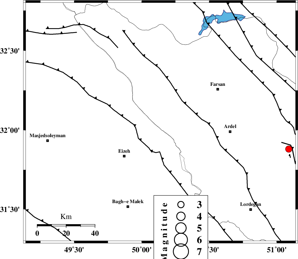
| Location | Lat:32.05 Lon: 50.14 |
| Region | 34 km North-East of Izeh, Khoozestan Province |
Nearest Cities |
|
| 30 km North East of Torshak, Khoozestan Province | |
| 35 km North East of Izeh, Khoozestan Province | |
| 36 km North West of Dehdez, Khoozestan Province | |
| 37 km North East of Rasvand, Khoozestan Province | |
| 38 km West of Rostamabad, Chaharmahal Bakhtiari Province | |
| Depth | 18 km |
| Agency | |
Faults within 150 km: |
|
| ZARDKUH_F (Length: 139 km) , Distance to epicenter: 9 km | |
| DOPOLAN_F (Length: 107 km) , Distance to epicenter: 12 km | |
| SABZKUH_F (Length: 67 km) , Distance to epicenter: 22 km | |
| Number of Phases | 6 |
| RMS | 0.1 |
| Number of Stations | 4 |
| Error in Latitude | >3.8 km |
| Error in Longitude | 3.4 km |
| Error in Depth | 6.1 km |
Download waveform in seisan format
to download seisan software Click here
to access information about IIEES stations Click here
Amplitude | ||||||||
| UID | Agency | Station | Component | Amplitude | Period | Arrival Time | Proccessing Time | Signal Clip |
| 39396 | IIEES | SHGR | E | 426.6 | 0.55 | 2007-08-20 20:33:28 | 2007-11-04 01:43:00 | n |
| 39397 | IIEES | SHGR | N | 390.5 | 0.41 | 2007-08-20 20:33:30 | 2007-11-04 01:43:00 | n |
| 39398 | IIEES | ASAO | N | 66 | 0.56 | 2007-08-20 20:34:04 | 2007-11-04 01:43:00 | n |
| 39399 | IIEES | GHVR | E | 70.9 | 0.85 | 2007-08-20 20:34:14 | 2007-11-04 01:43:00 | n |
Phase | ||||||||||||
| Agency | Station | Component | Phase Type | Phase Quality | First Motion | Observed Arrival Time | Time Residual | Loc. Flag | Input Weight | Distance | Azimuth | |
| IIEES | SHGR | Z | Pg | E | 2007-08-20 20:33:07 | 0.1 | y | 127 | 273 | |||
| IIEES | SHGR | N | Sg | E | 2007-08-20 20:33:22 | 0 | y | 127 | 273 | |||
| IIEES | NASN | Z | Pn | E | 2007-08-20 20:33:26 | 0 | y | 264 | 71 | |||
| IIEES | ASAO | Z | Pn | E | 2007-08-20 20:33:27 | -0.3 | y | 278 | 358 | |||
| IIEES | GHVR | Z | Pn | E | 2007-08-20 20:33:29 | 0.2 | y | 289 | 21 | |||
| IIEES | GHVR | E | Sg | E | 2007-08-20 20:34:07 | 0.1 | y | 289 | 21 | |||