
Magnitude |
:3.6 |
| Date & Time (UTC) | 2007-08-17 22:46:16.7 |
| Date & Time (Local) | 1386/5/27 02:16:16.7 |
| Location | Lat:32.74 Lon: 48.1 |
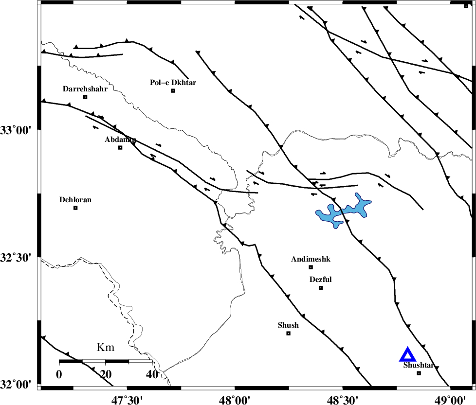
| Region | 38 km North-West of Andimeshk, Khoozestan Province |
Nearest Cities |
|
| 13 km West of Bidruyeh, Khoozestan Province | |
| 15 km North West of Hoseinieh, Khoozestan Province | |
| 22 km West of Sorkhakan, Khoozestan Province | |
| 39 km North West of Andimeshk, Khoozestan Province | |
| 49 km North West of Dezful, Khoozestan Province | |
| Depth | 14 km |
| Agency | |
Faults within 150 km: |
|
| BALARUD_F_Z1 (Length: 87 km) , Distance to epicenter: 2 km | |
| BALARUD_F_Z3 (Length: 53 km) , Distance to epicenter: 8 km | |
| DEZFUL_EMBAYMENT (Length: 228 km) , Distance to epicenter: 16 km | |
| Number of Phases | 6 |
| RMS | 0.2 |
| Number of Stations | 5 |
| Error in Latitude | >3 km |
| Error in Longitude | 7.5 km |
| Error in Depth | 9.1 km |
Download waveform in seisan format
to download seisan software Click here
to access information about IIEES stations Click here
Amplitude | ||||||||
| UID | Agency | Station | Component | Amplitude | Period | Arrival Time | Proccessing Time | Signal Clip |
| 39289 | IIEES | SHGR | E | 1817.1 | 0.44 | 2007-08-17 22:46:51 | 2007-11-04 01:43:00 | n |
| 39290 | IIEES | SHGR | N | 2387.4 | 0.48 | 2007-08-17 22:46:56 | 2007-11-04 01:43:00 | n |
| 39291 | IIEES | ASAO | N | 279.8 | 0.6 | 2007-08-17 22:47:42 | 2007-11-04 01:43:00 | n |
| 39292 | IIEES | ASAO | E | 276.8 | 0.76 | 2007-08-17 22:47:43 | 2007-11-04 01:43:00 | n |
Phase | ||||||||||||
| Agency | Station | Component | Phase Type | Phase Quality | First Motion | Observed Arrival Time | Time Residual | Loc. Flag | Input Weight | Distance | Azimuth | |
| IIEES | SHGR | Z | Pg | E | 2007-08-17 22:46:32 | -0.1 | y | 96.1 | 136 | |||
| IIEES | ASAO | Z | Pn | E | 2007-08-17 22:46:58 | 0.4 | y | 269 | 41 | |||
| IIEES | ASAO | N | Sg | E | 2007-08-17 22:47:32 | -0.1 | y | 269 | 41 | |||
| IIEES | SNGE | Z | Pn | E | 2007-08-17 22:46:58 | -0.1 | y | 270 | 345 | |||
| IIEES | DAMV | Z | Pn | E | 2007-08-17 22:47:24 | -0.1 | y | 480 | 47 | |||
| IIEES | KRBR | Z | Pn | E | 2007-08-17 22:48:13 | 0 | y | 879 | 108 | |||