
Magnitude |
:3.5 |
| Date & Time (UTC) | 2007-07-17 05:24:08.3 |
| Date & Time (Local) | 1386/4/26 08:54:08.3 |
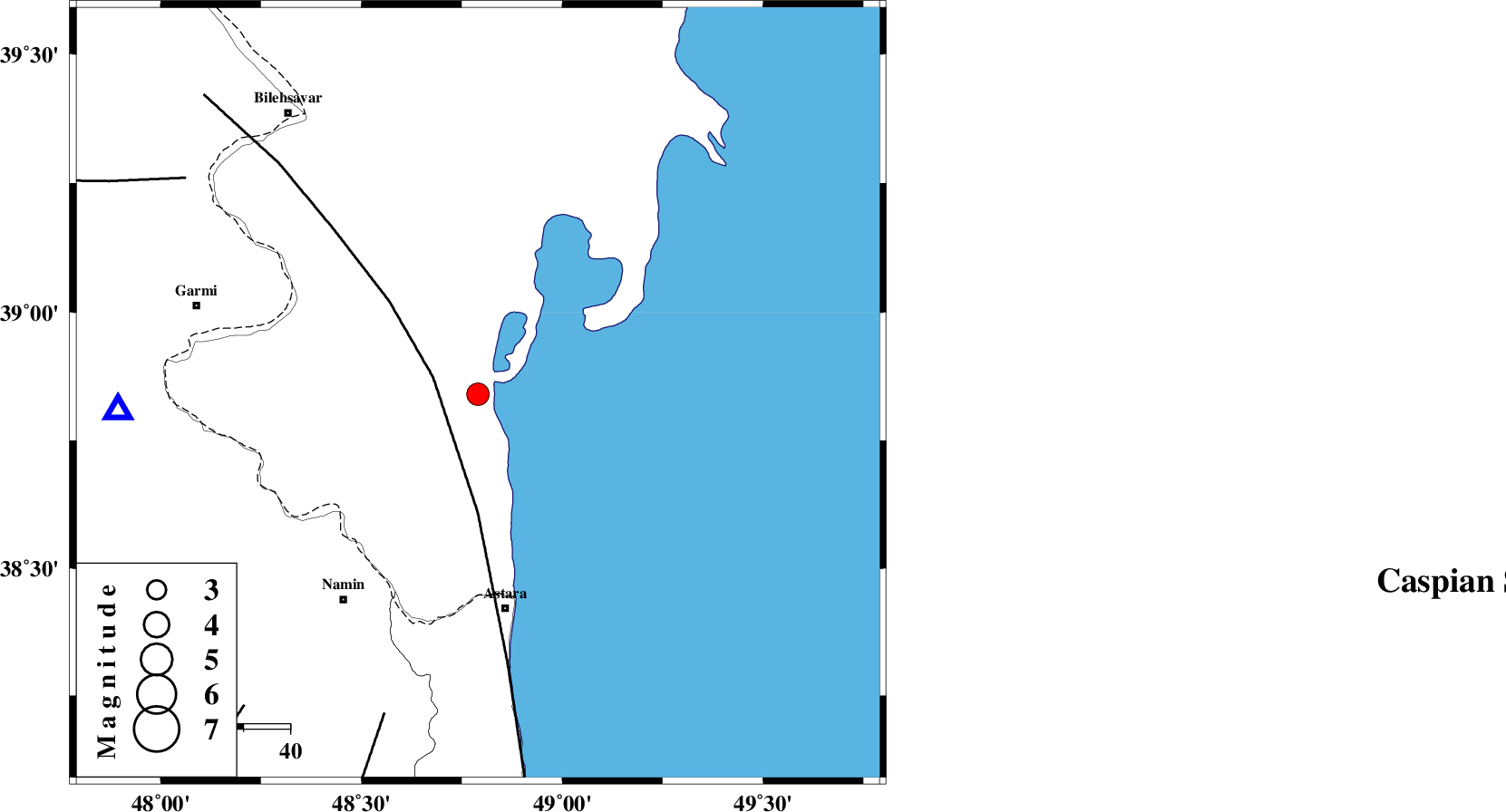
| Location | Lat:38.84 Lon: 48.79 |
| Region | 46 km North of Astara, Gilan Province |
Nearest Cities |
|
| 47 km North of Astara, Gilan Province | |
| 48 km North East of Anbaran, Ardebil Province | |
| 49 km North East of Lurun, Ardebil Province | |
| 50 km South East of Hasan khanlu, Ardebil Province | |
| 53 km North East of Kiladeh, Gilan Province | |
| Depth | 15 km |
| Agency | |
Faults within 150 km: |
|
| TALESH_F (Length: 258 km) , Distance to epicenter: 10 km | |
| SANGAVAR_F (Length: 61 km) , Distance to epicenter: 72 km | |
| DASHT_E_MOGHAN__ (Length: 104 km) , Distance to epicenter: 78 km | |
| Number of Phases | 4 |
| RMS | 0 |
| Number of Stations | 4 |
| Error in Latitude | >3.4 km |
| Error in Longitude | 2 km |
| Error in Depth | 0 km |
Download waveform in seisan format
to download seisan software Click here
to access information about IIEES stations Click here
Amplitude | ||||||||
| UID | Agency | Station | Component | Amplitude | Period | Arrival Time | Proccessing Time | Signal Clip |
| 39283 | IIEES | GRMI | N | 1128.1 | 0.18 | 2007-07-17 05:24:30 | 2007-11-04 01:43:00 | n |
| 39284 | IIEES | MRVT | N | 21.6 | 0.31 | 2007-07-17 05:26:44 | 2007-11-04 01:43:00 | n |
| 39285 | IIEES | MRVT | E | 21.6 | 0.26 | 2007-07-17 05:26:44 | 2007-11-04 01:43:00 | n |
Phase | ||||||||||||
| Agency | Station | Component | Phase Type | Phase Quality | First Motion | Observed Arrival Time | Time Residual | Loc. Flag | Input Weight | Distance | Azimuth | |
| IIEES | GRMI | Z | Pg | E | 2007-07-17 05:24:21 | 0 | y | 77.9 | 268 | |||
| IIEES | CHTH | Z | Pn | E | 2007-07-17 05:25:04 | 0 | y | 386 | 147 | |||
| IIEES | SNGE | Z | Pn | E | 2007-07-17 05:25:10 | 0 | y | 435 | 198 | |||
| IIEES | MRVT | Z | Pn | E | 2007-07-17 05:25:36 | 0 | y | 652 | 99 | |||