
Magnitude |
:3.2 |
| Date & Time (UTC) | 2007-08-15 06:06:13.7 |
| Date & Time (Local) | 1386/5/24 09:36:13.7 |
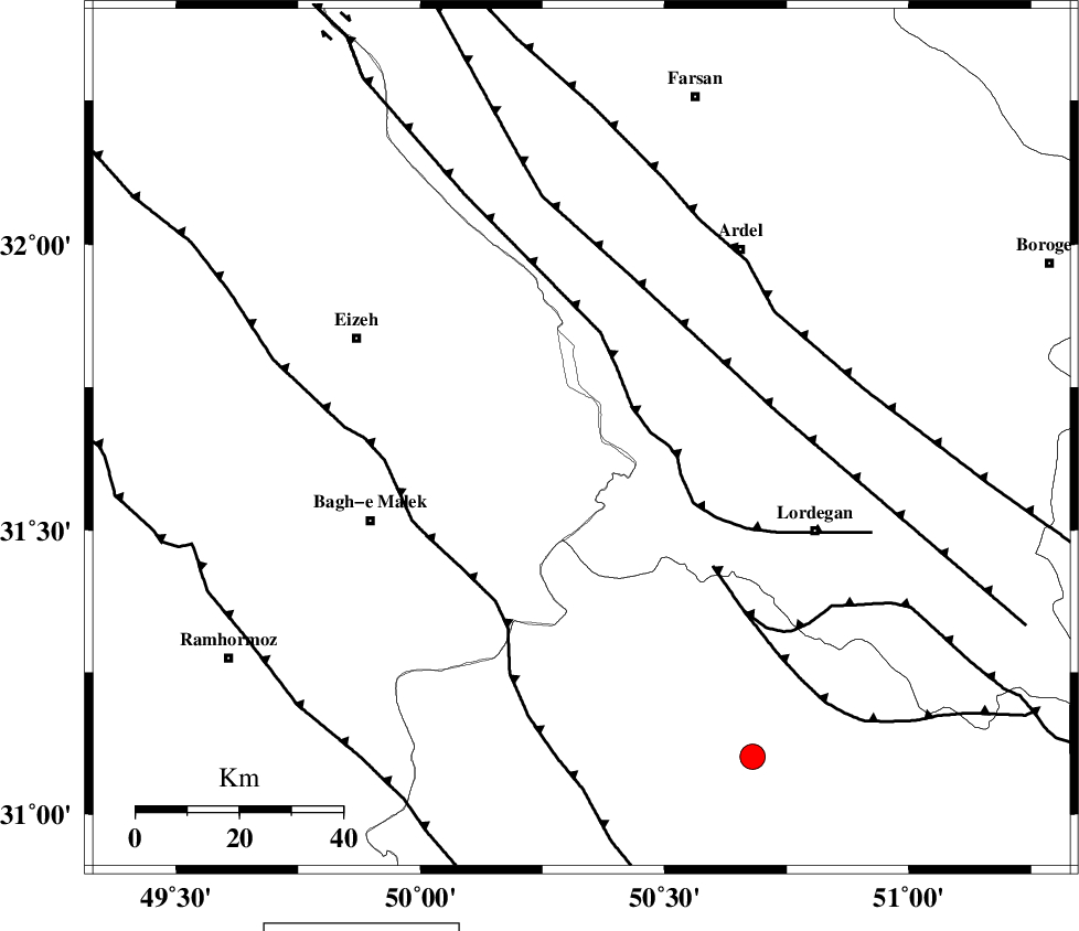
| Location | Lat:31.66 Lon: 50.33 |
| Region | 43 km North-East of Bagh Malek, Khoozestan Province |
Nearest Cities |
|
| 11 km of Dehdez, Khoozestan Province | |
| 23 km West of Sarkhun, Chaharmahal Bakhtiari Province | |
| 35 km North East of Abolabbas, Khoozestan Province | |
| 39 km South West of Dupelan, Chaharmahal Bakhtiari Province | |
| 41 km North East of Seidun, Khoozestan Province | |
| Depth | 14 km |
| Agency | |
Faults within 150 km: |
|
| SABZKUH_F (Length: 67 km) , Distance to epicenter: 18 km | |
| DOPOLAN_F (Length: 107 km) , Distance to epicenter: 25 km | |
| MFF2 (Length: 205 km) , Distance to epicenter: 32 km | |
| Number of Phases | 6 |
| RMS | 0.2 |
| Number of Stations | 4 |
| Error in Latitude | >5.1 km |
| Error in Longitude | 5 km |
| Error in Depth | 10.6 km |
Download waveform in seisan format
to download seisan software Click here
to access information about IIEES stations Click here
Amplitude | ||||||||
| UID | Agency | Station | Component | Amplitude | Period | Arrival Time | Proccessing Time | Signal Clip |
| 39227 | IIEES | ASAO | N | 70.5 | 0.67 | 2007-08-15 06:07:52 | 2007-11-04 01:43:00 | n |
| 39228 | IIEES | SNGE | N | 33.6 | 0.61 | 2007-08-15 06:08:39 | 2007-11-04 01:43:00 | n |
Phase | ||||||||||||
| Agency | Station | Component | Phase Type | Phase Quality | First Motion | Observed Arrival Time | Time Residual | Loc. Flag | Input Weight | Distance | Azimuth | |
| IIEES | SHGR | Z | Pg | E | 2007-08-15 06:06:38 | -0.4 | y | 153 | 289 | |||
| IIEES | SHGR | E | Sg | E | 2007-08-15 06:06:57 | 0.2 | y | 153 | 289 | |||
| IIEES | NASN | Z | Pn | E | 2007-08-15 06:06:54 | 0 | y | 266 | 61 | |||
| IIEES | ASAO | Z | Pn | E | 2007-08-15 06:07:01 | 0.3 | y | 322 | 355 | |||
| IIEES | ASAO | N | Sg | E | 2007-08-15 06:07:44 | -0.2 | y | 322 | 355 | |||
| IIEES | SNGE | Z | Pn | E | 2007-08-15 06:07:20 | 0.1 | y | 471 | 325 | |||