
Magnitude |
:3.6 |
| Date & Time (UTC) | 2007-08-14 00:58:25.0 |
| Date & Time (Local) | 1386/5/23 04:28:25.0 |
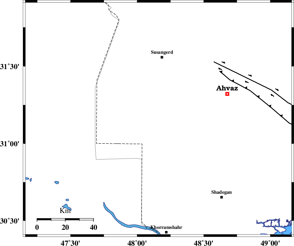
| Location | Lat:31.16 Lon: 48.16 |
| Region | 44 km South of Susangerd, Khoozestan Province |
Nearest Cities |
|
| 34 km South of Hoveizeh, Khoozestan Province | |
| 37 km West of Bahr, Khoozestan Province | |
| 43 km South West of Jalaliyeh, Khoozestan Province | |
| 43 km North West of Abunangeh, Khoozestan Province | |
| 44 km South West of Hamidiyeh, Khoozestan Province | |
| Depth | 14 km |
| Agency | |
Faults within 150 km: |
|
| AHVAZ_F (Length: 99 km) , Distance to epicenter: 49 km | |
| AGHAJARI_F (Length: 88 km) , Distance to epicenter: 102 km | |
| DEZFUL_EMBAYMENT (Length: 228 km) , Distance to epicenter: 133 km | |
| Number of Phases | 6 |
| RMS | 0.1 |
| Number of Stations | 6 |
| Error in Latitude | >4.2 km |
| Error in Longitude | 6.9 km |
| Error in Depth | 5.1 km |
Download waveform in seisan format
to download seisan software Click here
to access information about IIEES stations Click here
Amplitude | ||||||||
| UID | Agency | Station | Component | Amplitude | Period | Arrival Time | Proccessing Time | Signal Clip |
| 39177 | IIEES | SHGR | N | 1184.3 | 0.8 | 2007-08-14 00:59:03 | 2007-11-04 01:43:00 | n |
| 39178 | IIEES | SHGR | E | 1417.4 | 0.56 | 2007-08-14 00:59:19 | 2007-11-04 01:43:00 | n |
| 39179 | IIEES | ASAO | N | 93.6 | 0.68 | 2007-08-14 01:00:25 | 2007-11-04 01:43:00 | n |
Phase | ||||||||||||
| Agency | Station | Component | Phase Type | Phase Quality | First Motion | Observed Arrival Time | Time Residual | Loc. Flag | Input Weight | Distance | Azimuth | |
| IIEES | SHGR | Z | Pg | E | 2007-08-14 00:58:45 | 0 | y | 121 | 30 | |||
| IIEES | ASAO | Z | Pn | E | 2007-08-14 00:59:24 | 0 | y | 414 | 24 | |||
| IIEES | SNGE | Z | Pn | E | 2007-08-14 00:59:27 | 0 | y | 443 | 350 | |||
| IIEES | NASN | Z | Pn | E | 2007-08-14 00:59:32 | 0.1 | y | 475 | 66 | |||
| IIEES | GHIR | Z | Pn | E | 2007-08-14 00:59:42 | -0.1 | y | 565 | 123 | |||
| IIEES | CHTH | Z | Pn | E | 2007-08-14 00:59:46 | -0.2 | y | 594 | 27 | |||