
Magnitude |
:3 |
| Date & Time (UTC) | 2007-08-13 04:22:06.5 |
| Date & Time (Local) | 1386/5/22 07:52:06.5 |
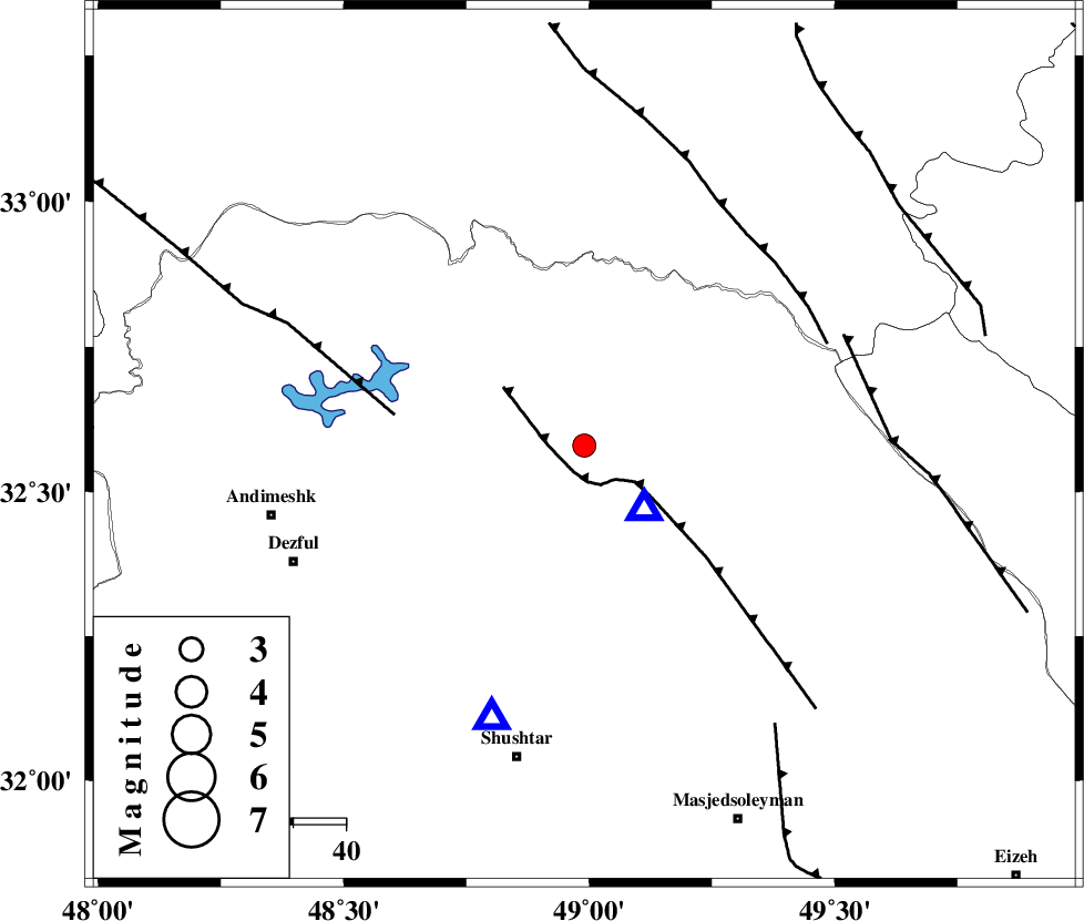
| Location | Lat:32.58 Lon: 48.99 |
| Region | 23 km North-West of Lali, Khoozestan Province |
Nearest Cities |
|
| 17 km North East of Sardasht, Khoozestan Province | |
| 24 km North West of Lali, Khoozestan Province | |
| 29 km South East of Shuy, Khoozestan Province | |
| 36 km North West of Jaefarabad, Khoozestan Province | |
| 37 km North East of Mahur berenji, Khoozestan Province | |
| Depth | 16 km |
| Agency | |
Faults within 150 km: |
|
| MFF2 (Length: 205 km) , Distance to epicenter: 9 km | |
| BALARUD_F_Z2 (Length: 58 km) , Distance to epicenter: 16 km | |
| DEZFUL_EMBAYMENT (Length: 228 km) , Distance to epicenter: 33 km | |
| Number of Phases | 7 |
| RMS | 0.2 |
| Number of Stations | 6 |
| Error in Latitude | >2.8 km |
| Error in Longitude | 5.8 km |
| Error in Depth | 5.9 km |
Download waveform in seisan format
to download seisan software Click here
to access information about IIEES stations Click here
Amplitude | ||||||||
| UID | Agency | Station | Component | Amplitude | Period | Arrival Time | Proccessing Time | Signal Clip |
| 39148 | IIEES | ASAO | N | 107.1 | 0.68 | 2007-08-13 04:23:22 | 2007-11-04 01:43:00 | n |
| 39149 | IIEES | SNGE | N | 39.4 | 0.68 | 2007-08-13 04:23:51 | 2007-11-04 01:43:00 | n |
| 39150 | IIEES | NASN | E | 35.7 | 0.41 | 2007-08-13 04:23:55 | 2007-11-04 01:43:00 | n |
| 39151 | IIEES | DAMV | E | 25.9 | 0.68 | 2007-08-13 04:24:21 | 2007-11-04 01:43:00 | n |
Phase | ||||||||||||
| Agency | Station | Component | Phase Type | Phase Quality | First Motion | Observed Arrival Time | Time Residual | Loc. Flag | Input Weight | Distance | Azimuth | |
| IIEES | SHGR | Z | Pg | E | 2007-08-13 04:22:16 | 0 | y | 55.1 | 199 | |||
| IIEES | ASAO | Z | Pn | E | 2007-08-13 04:22:44 | 0.5 | y | 239 | 23 | |||
| IIEES | ASAO | E | Sg | E | 2007-08-13 04:23:14 | 0 | y | 239 | 23 | |||
| IIEES | SNGE | Z | Pn | E | 2007-08-13 04:22:53 | -0.1 | y | 318 | 332 | |||
| IIEES | NASN | Z | Pn | E | 2007-08-13 04:22:58 | -0.1 | y | 359 | 85 | |||
| IIEES | CHTH | Z | Pn | E | 2007-08-13 04:23:06 | -0.2 | y | 418 | 27 | |||
| IIEES | DAMV | Z | Pn | E | 2007-08-13 04:23:08 | -0.2 | y | 436 | 38 | |||