
Magnitude |
:2.7 |
| Date & Time (UTC) | 2007-09-06 18:22:09.0 |
| Date & Time (Local) | 1386/6/15 21:52:09.0 |
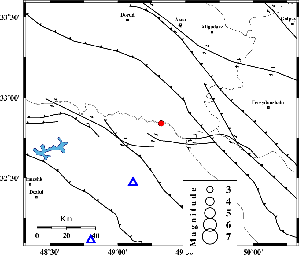
| Location | Lat:32.84 Lon: 49.32 |
| Region | 53 km North-East of Lali, Khoozestan Province |
Nearest Cities |
|
| 16 km West of Parchal, Lorestan Province | |
| 41 km South East of Shulabad, Lorestan Province | |
| 43 km South East of Bargsar, Lorestan Province | |
| 48 km North East of Shuy, Khoozestan Province | |
| 50 km West of Masir, Esfahan Province | |
| Depth | 14 km |
| Agency | |
Faults within 150 km: |
|
| HZF4 (Length: 492 km) , Distance to epicenter: 19 km | |
| ZARDKUH_F (Length: 139 km) , Distance to epicenter: 20 km | |
| MFF2 (Length: 205 km) , Distance to epicenter: 33 km | |
| Number of Phases | 5 |
| RMS | 0.3 |
| Number of Stations | 4 |
| Error in Latitude | >4.3 km |
| Error in Longitude | 8.3 km |
| Error in Depth | 10.7 km |
Download waveform in seisan format
to download seisan software Click here
to access information about IIEES stations Click here
Amplitude | ||||||||
| UID | Agency | Station | Component | Amplitude | Period | Arrival Time | Proccessing Time | Signal Clip |
| 38961 | IIEES | SHGR | E | 429 | 0.56 | 2007-09-06 18:22:46 | 2007-11-04 01:43:00 | n |
| 38962 | IIEES | SHGR | N | 297.1 | 0.68 | 2007-09-06 18:22:47 | 2007-11-04 01:43:00 | n |
| 38963 | IIEES | ASAO | N | 68.1 | 0.72 | 2007-09-06 18:23:10 | 2007-11-04 01:43:00 | n |
| 38964 | IIEES | ASAO | E | 66.5 | 0.52 | 2007-09-06 18:23:11 | 2007-11-04 01:43:00 | n |
| 38965 | IIEES | SNGE | N | 27.3 | 0.64 | 2007-09-06 18:23:49 | 2007-11-04 01:43:00 | n |
Phase | ||||||||||||
| Agency | Station | Component | Phase Type | Phase Quality | First Motion | Observed Arrival Time | Time Residual | Loc. Flag | Input Weight | Distance | Azimuth | |
| IIEES | SHGR | Z | Pg | E | 2007-09-06 18:22:25 | 0.1 | y | 94.4 | 211 | |||
| IIEES | ASAO | Z | Pg | E | 2007-09-06 18:22:41 | -0.6 | y | 201 | 19 | |||
| IIEES | ASAO | N | Sg | E | 2007-09-06 18:23:06 | 0.4 | y | 201 | 19 | |||
| IIEES | SNGE | Z | Pn | E | 2007-09-06 18:22:55 | 0 | y | 310 | 324 | |||
| IIEES | NASN | Z | Pn | E | 2007-09-06 18:22:57 | 0.1 | y | 326 | 90 | |||