
Magnitude |
:3.3 |
| Date & Time (UTC) | 2006-07-30 22:05:15.1 |
| Date & Time (Local) | 1385/5/9 01:35:15.1 |
| Location | Lat:28.07 Lon: 57.23 |
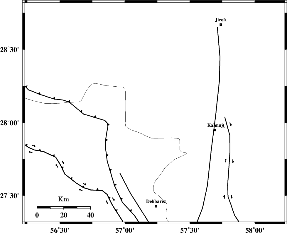
| Region | 47 km North-West of Kahnuj, Kerman Province |
Nearest Cities |
|
| 4 km North of Faryab, Kerman Province | |
| 16 km South of Hurpasefid, Kerman Province | |
| 18 km West of Mehrueye-e paeen, Kerman Province | |
| 29 km North of Fariab, Hormozgan Province | |
| 35 km South West of Bolock, Kerman Province | |
| Depth | 40 km |
| Agency | |
Faults within 150 km: |
|
| MAIN_ZAGROS_R_F (Length: 1106 km) , Distance to epicenter: 37 km | |
| SABZEVARAN_F (Length: 190 km) , Distance to epicenter: 46 km | |
| JIROFT_F (Length: 144 km) , Distance to epicenter: 53 km | |
| Number of Phases | 4 |
| RMS | 0 |
| Number of Stations | 3 |
| Error in Latitude | >4.7 km |
| Error in Longitude | 9.1 km |
| Error in Depth | 3.6 km |
Download waveform in seisan format
to download seisan software Click here
to access information about IIEES stations Click here
Amplitude | ||||||||
| UID | Agency | Station | Component | Amplitude | Period | Arrival Time | Proccessing Time | Signal Clip |
| 36227 | IIEES | BNDS | N | 464.6 | 0.24 | 2006-07-30 22:05:54 | 2006-10-17 03:59:00 | n |
| 36228 | IIEES | KRBR | E | 277.3 | 0.36 | 2006-07-30 22:06:20 | 2006-10-17 03:59:00 | n |
| 36229 | IIEES | KRBR | N | 205.8 | 0.48 | 2006-07-30 22:06:21 | 2006-10-17 03:59:00 | n |
| 36230 | IIEES | GHIR | N | 47.3 | 0.2 | 2006-07-30 22:07:19 | 2006-10-17 03:59:00 | n |
Phase | ||||||||||||
| Agency | Station | Component | Phase Type | Phase Quality | First Motion | Observed Arrival Time | Time Residual | Loc. Flag | Input Weight | Distance | Azimuth | |
| IIEES | BNDS | Z | PG | E | 2006-07-30 22:05:36 | 0 | y | 127 | 235 | |||
| IIEES | BNDS | N | SG | E | 2006-07-30 22:05:52 | 0 | y | 127 | 235 | |||
| IIEES | KRBR | Z | PG | E | 2006-07-30 22:05:50 | 0 | y | 217 | 348 | |||
| IIEES | GHIR | Z | PN | E | 2006-07-30 22:06:12 | 0 | y | 417 | 274 | |||