
Magnitude |
:2.8 |
| Date & Time (UTC) | 2006-06-23 18:32:59.2 |
| Date & Time (Local) | 1385/4/2 22:02:59.2 |
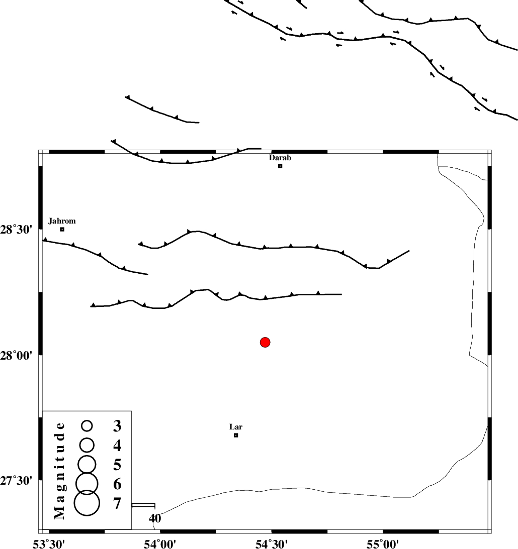
| Location | Lat:28.05 Lon: 54.47 |
| Region | 42 km North-East of Lar, Fars Province |
Nearest Cities |
|
| 22 km North of Dehkuyeh, Fars Province | |
| 32 km South East of Shahr-e pir, Fars Province | |
| 35 km South of Hajiabad, Fars Province | |
| 40 km North of Latifi, Fars Province | |
| 43 km North East of Lar, Fars Province | |
| Depth | 18 km |
| Agency | |
Faults within 150 km: |
|
| BERIZ_F (Length: 49 km) , Distance to epicenter: 33 km | |
| HZF2 (Length: 437 km) , Distance to epicenter: 45 km | |
| LAR_F (Length: 99 km) , Distance to epicenter: 56 km | |
| Number of Phases | 5 |
| RMS | 0 |
| Number of Stations | 3 |
| Error in Latitude | >2.9 km |
| Error in Longitude | 2.4 km |
| Error in Depth | 2.7 km |
Download waveform in seisan format
to download seisan software Click here
to access information about IIEES stations Click here
Amplitude | ||||||||
| UID | Agency | Station | Component | Amplitude | Period | Arrival Time | Proccessing Time | Signal Clip |
| 35064 | IIEES | GHIR | E | 231.8 | 0.48 | 2006-06-23 18:33:51 | 2008-03-02 12:02:00 | n |
| 35065 | IIEES | GHIR | N | 204.6 | 0.44 | 2006-06-23 18:33:53 | 2008-03-02 12:02:00 | n |
| 35066 | IIEES | BNDS | E | 74.2 | 0.6 | 2006-06-23 18:34:01 | 2008-03-02 12:02:00 | n |
| 35067 | IIEES | BNDS | N | 71 | 0.52 | 2006-06-23 18:34:07 | 2008-03-02 12:02:00 | n |
Phase | ||||||||||||
| Agency | Station | Component | Phase Type | Phase Quality | First Motion | Observed Arrival Time | Time Residual | Loc. Flag | Input Weight | Distance | Azimuth | |
| IIEES | GHIR | Z | PG | E | 2006-06-23 18:33:23 | 0 | y | 148 | 281 | |||
| IIEES | BNDS | Z | PG | E | 2006-06-23 18:33:29 | 0 | y | 182 | 113 | |||
| IIEES | BNDS | N | Sn | 2006-06-23 18:33:51 | 0 | y | 182 | 113 | ||||
| IIEES | NASN | Z | PN | E | 2006-06-23 18:34:15 | 0.1 | y | 551 | 344 | |||
| IIEES | NASN | E | SN | 2006-06-23 18:35:10 | 0 | y | 551 | 344 | ||||