
Magnitude |
:3.5 |
| Date & Time (UTC) | 2006-06-09 04:12:39.4 |
| Date & Time (Local) | 1385/3/19 07:42:39.4 |
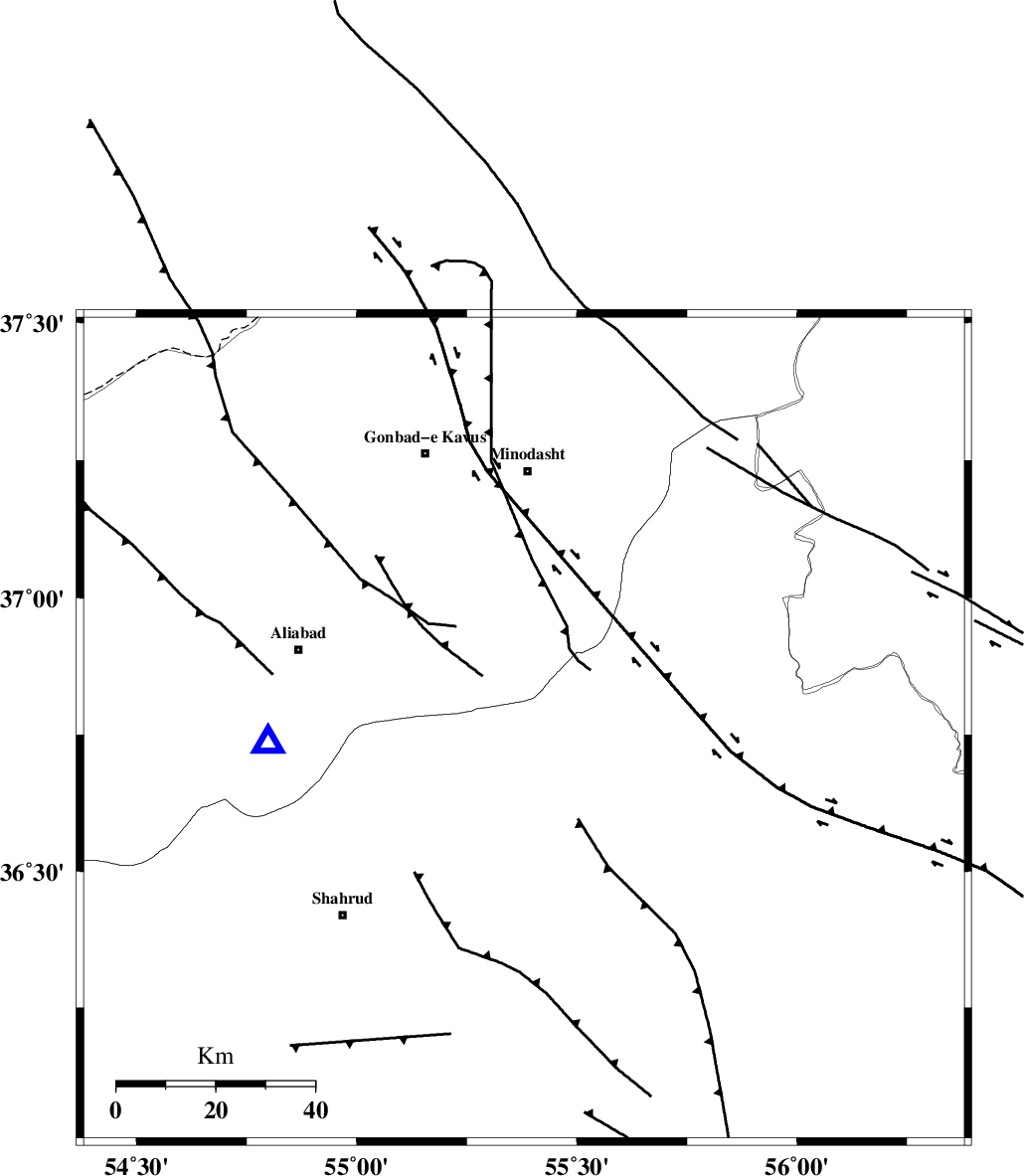
| Location | Lat:36.76 Lon: 55.38 |
| Region | 35 km South-East of Ramian, Golestan Province |
Nearest Cities |
|
| 12 km North of Kalateh khanj, Semnan Province | |
| 22 km South of Farsian, Golestan Province | |
| 28 km North East of Qaleh-ye nokharqan, Semnan Province | |
| 33 km South West of Qale-ye qafeh, Golestan Province | |
| 34 km South West of Qaleh qafeh, Semnan Province | |
| Depth | 15 km |
| Agency | |
Faults within 150 km: |
|
| ROBATE_QARABIL_F (Length: 168 km) , Distance to epicenter: 15 km | |
| SHAVAR_F (Length: 87 km) , Distance to epicenter: 15 km | |
| MEYAMEY_F (Length: 141 km) , Distance to epicenter: 42 km | |
| Number of Phases | 6 |
| RMS | 0.2 |
| Number of Stations | 5 |
| Error in Latitude | >4.2 km |
| Error in Longitude | 5.6 km |
| Error in Depth | 0 km |
Download waveform in seisan format
to download seisan software Click here
to access information about IIEES stations Click here
Amplitude | ||||||||
| UID | Agency | Station | Component | Amplitude | Period | Arrival Time | Proccessing Time | Signal Clip |
| 34878 | IIEES | DAMV | E | 153.3 | 0.36 | 2006-06-09 04:14:13 | 2008-03-02 12:02:00 | n |
| 34879 | IIEES | DAMV | N | 111.4 | 0.68 | 2006-06-09 04:14:18 | 2008-03-02 12:02:00 | n |
| 34880 | IIEES | THKV | N | 80.5 | 0.44 | 2006-06-09 04:14:38 | 2008-03-02 12:02:00 | n |
Phase | ||||||||||||
| Agency | Station | Component | Phase Type | Phase Quality | First Motion | Observed Arrival Time | Time Residual | Loc. Flag | Input Weight | Distance | Azimuth | |
| IIEES | MRVT | Z | PG | E | 2006-06-09 04:12:59 | -0.2 | y | 119 | 32 | |||
| IIEES | MRVT | E | Sg | E | 2006-06-09 04:13:14 | 0.2 | y | 119 | 32 | |||
| IIEES | DAMV | Z | PN | E | 2006-06-09 04:13:28 | 0 | y | 331 | 249 | |||
| IIEES | CHTH | Z | PN | E | 2006-06-09 04:13:35 | -0.1 | y | 393 | 257 | |||
| IIEES | THKV | Z | PN | E | 2006-06-09 04:13:38 | 0.1 | y | 414 | 258 | |||
| IIEES | NASN | Z | PN | E | 2006-06-09 04:13:49 | 0.1 | y | 498 | 209 | |||