
Magnitude |
:3.1 |
| Date & Time (UTC) | 2006-04-29 17:22:21.3 |
| Date & Time (Local) | 1385/2/9 20:52:21.3 |
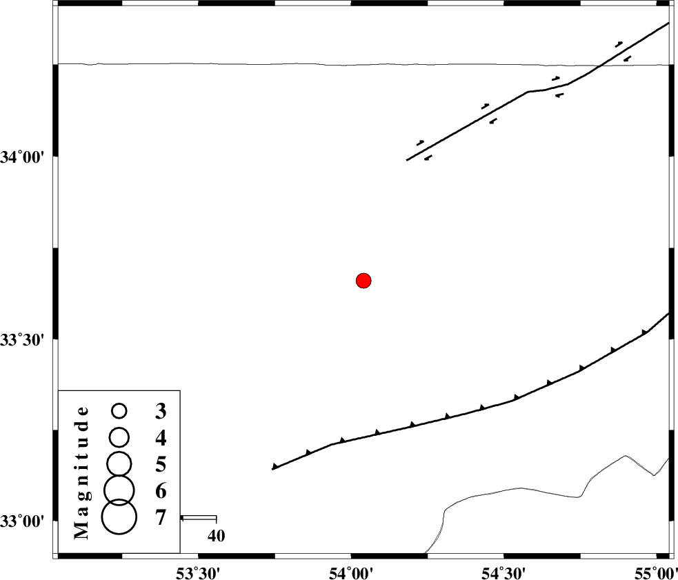
| Location | Lat:33.66 Lon: 54.04 |
| Region | 124 km North-East of Nain, Esfahan Province |
Nearest Cities |
|
| 31 km North West of Chupanan, Esfahan Province | |
| 50 km North East of Anarak, Esfahan Province | |
| 55 km South West of Jondaq, Esfahan Province | |
| 64 km North East of Maedan, Esfahan Province | |
| 86 km South West of Farrokhi, Esfahan Province | |
| Depth | 18 km |
| Agency | |
Faults within 150 km: |
|
| DORUNEH_F (Length: 713 km) , Distance to epicenter: 39 km | |
| BIABANAK_F (Length: 162 km) , Distance to epicenter: 47 km | |
| CHAH_ZANGUL_F (Length: 123 km) , Distance to epicenter: 107 km | |
| Number of Phases | 5 |
| RMS | 0.1 |
| Number of Stations | 4 |
| Error in Latitude | >2.5 km |
| Error in Longitude | 13.8 km |
| Error in Depth | 7.1 km |
Download waveform in seisan format
to download seisan software Click here
to access information about IIEES stations Click here
Amplitude | ||||||||
| UID | Agency | Station | Component | Amplitude | Period | Arrival Time | Proccessing Time | Signal Clip |
| 34656 | IIEES | DAMV | E | 79.2 | 0.32 | 2006-04-29 17:23:44 | 2008-03-02 12:02:00 | n |
| 34657 | IIEES | DAMV | N | 42.4 | 0.27 | 2006-04-29 17:23:44 | 2008-03-02 12:02:00 | n |
| 34658 | IIEES | THKV | E | 65 | 0.62 | 2006-04-29 17:24:20 | 2008-03-02 12:02:00 | n |
| 34659 | IIEES | THKV | N | 43.5 | 0.47 | 2006-04-29 17:24:21 | 2008-03-02 12:02:00 | n |
Phase | ||||||||||||
| Agency | Station | Component | Phase Type | Phase Quality | First Motion | Observed Arrival Time | Time Residual | Loc. Flag | Input Weight | Distance | Azimuth | |
| IIEES | NASN | Z | PG | E | 2006-04-29 17:22:46 | 0 | y | 149 | 231 | |||
| IIEES | DAMV | Z | Pn | E | 2006-04-29 17:23:04 | 0 | y | 289 | 320 | |||
| IIEES | DAMV | N | SG | E | 2006-04-29 17:23:42 | 0 | y | 289 | 320 | |||
| IIEES | THKV | Z | Pn | E | 2006-04-29 17:23:16 | 0.1 | y | 382 | 312 | |||
| IIEES | ASAO | Z | Pn | E | 2006-04-29 17:23:16 | -0.1 | y | 383 | 286 | |||