
Magnitude |
:2.8 |
| Date & Time (UTC) | 2004-12-19 08:14:50.8 |
| Date & Time (Local) | 1383/9/29 11:44:50.8 |
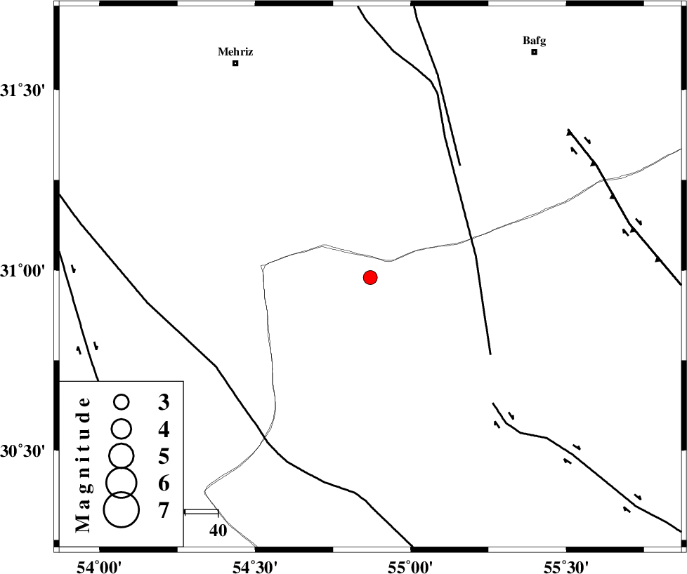
| Location | Lat:30.98 Lon: 54.87 |
| Region | 77 km South-East of Mehriz, Yazd Province |
Nearest Cities |
|
| 32 km North of Dehaj, Kerman Province | |
| 39 km South of Bahadoran, Yazd Province | |
| 40 km North West of Anar, Kerman Province | |
| 48 km North West of Hoseiynabad-e amin, Kerman Province | |
| 51 km North East of Khabar, Kerman Province | |
| Depth | 14 km |
| Agency | |
Faults within 150 km: |
|
| ANAR_F (Length: 127 km) , Distance to epicenter: 33 km | |
| ANAR_F (Length: 91 km) , Distance to epicenter: 44 km | |
| RAFSANJAN_F (Length: 129 km) , Distance to epicenter: 54 km | |
| Number of Phases | 6 |
| RMS | 0.3 |
| Number of Stations | 4 |
| Error in Latitude | >8.8 km |
| Error in Longitude | 9.5 km |
| Error in Depth | 14.4 km |
Download waveform in seisan format
to download seisan software Click here
to access information about IIEES stations Click here
Amplitude | ||||||||
| UID | Agency | Station | Component | Amplitude | Period | Arrival Time | Proccessing Time | Signal Clip |
| 31398 | IIEES | KRBR | N | 103.9 | 0.45 | 2004-12-19 08:16:03 | 2006-03-15 11:56:00 | n |
| 31399 | IIEES | GHIR | N | 18.9 | 0.64 | 2004-12-19 08:16:43 | 2006-03-15 11:56:00 | n |
| 31400 | IIEES | GHIR | E | 25.5 | 0.48 | 2004-12-19 08:16:44 | 2006-03-15 11:56:00 | n |
Phase | ||||||||||||
| Agency | Station | Component | Phase Type | Phase Quality | First Motion | Observed Arrival Time | Time Residual | Loc. Flag | Input Weight | Distance | Azimuth | |
| IIEES | KRBR | Z | PG | E | 2004-12-19 08:15:25 | -0.6 | y | 212 | 121 | |||
| IIEES | KRBR | E | SG | E | 2004-12-19 08:15:51 | 0.5 | y | 212 | 121 | |||
| IIEES | NASN | Z | PN | E | 2004-12-19 08:15:33 | -0.1 | y | 281 | 316 | |||
| IIEES | NASN | N | SG | E | 2004-12-19 08:16:10 | 0.2 | y | 281 | 316 | |||
| IIEES | GHIR | Z | PN | E | 2004-12-19 08:15:42 | 0 | y | 350 | 212 | |||
| IIEES | BNDS | Z | PN | E | 2004-12-19 08:15:50 | 0.1 | y | 416 | 162 | |||