
Magnitude |
:2.9 |
| Date & Time (UTC) | 2004-11-25 16:46:42.8 |
| Date & Time (Local) | 1383/9/5 20:16:42.8 |
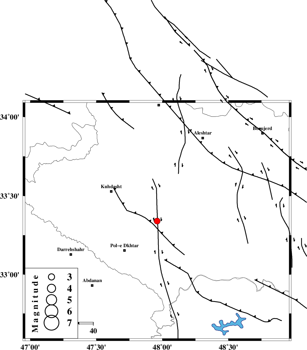
| Location | Lat:33.34 Lon: 47.96 |
| Region | 30 km North-East of Pol-e dokhtar, Lorestan Province |
Nearest Cities |
|
| 4 km of Maeulan, Lorestan Province | |
| 18 km South of Mahmudvand, Lorestan Province | |
| 21 km South West of Godar-e mahmudvand, Lorestan Province | |
| 23 km West of Shoorab-e sofla, Lorestan Province | |
| 25 km North East of Morani, Lorestan Province | |
| Depth | 17 km |
| Agency | |
Faults within 150 km: |
|
| HZF4 (Length: 492 km) , Distance to epicenter: 31 km | |
| BALARUD_F_Z1 (Length: 87 km) , Distance to epicenter: 56 km | |
| BALARUD_F_Z3 (Length: 53 km) , Distance to epicenter: 56 km | |
| Number of Phases | 5 |
| RMS | 0.1 |
| Number of Stations | 5 |
| Error in Latitude | >2.4 km |
| Error in Longitude | 5 km |
| Error in Depth | 5 km |
Download waveform in seisan format
to download seisan software Click here
to access information about IIEES stations Click here
Amplitude | ||||||||
| UID | Agency | Station | Component | Amplitude | Period | Arrival Time | Proccessing Time | Signal Clip |
| 31219 | IIEES | SHGO | E | 121.3 | 0.5 | 2004-11-25 16:47:35 | 2006-03-15 11:56:00 | n |
| 31220 | IIEES | SHGO | N | 183 | 0.5 | 2004-11-25 16:47:38 | 2006-03-15 11:56:00 | n |
| 31221 | IIEES | SNGE | N | 251.4 | 0.44 | 2004-11-25 16:47:47 | 2006-03-15 11:56:00 | n |
| 31222 | IIEES | ASAO | N | 111.6 | 0.56 | 2004-11-25 16:47:58 | 2006-03-15 11:56:00 | n |
| 31223 | IIEES | ASAO | E | 54.3 | 0.76 | 2004-11-25 16:48:06 | 2006-03-15 11:56:00 | n |
Phase | ||||||||||||
| Agency | Station | Component | Phase Type | Phase Quality | First Motion | Observed Arrival Time | Time Residual | Loc. Flag | Input Weight | Distance | Azimuth | |
| IIEES | SHGO | Z | PG | E | 2004-11-25 16:47:08 | 0.1 | y | 158 | 150 | |||
| IIEES | SNGE | Z | PG | E | 2004-11-25 16:47:16 | 0 | y | 202 | 344 | |||
| IIEES | ASAO | E | PG | E | 2004-11-25 16:47:21 | 0 | y | 233 | 54 | |||
| IIEES | THKV | Z | PN | E | 2004-11-25 16:47:39 | 0.2 | y | 392 | 42 | |||
| IIEES | NASN | Z | PN | E | 2004-11-25 16:47:47 | -0.2 | y | 457 | 96 | |||