
Magnitude |
:3.3 |
| Date & Time (UTC) | 2004-11-21 22:25:25.0 |
| Date & Time (Local) | 1383/9/2 01:55:25.0 |
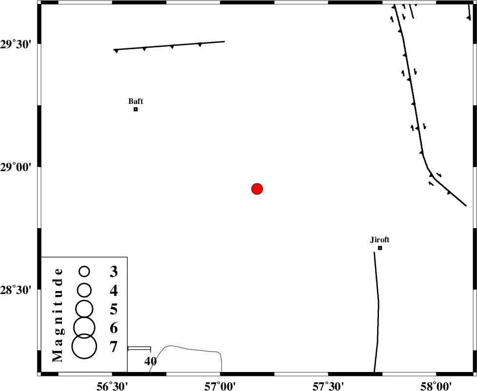
| Location | Lat:28.91 Lon: 57.17 |
| Region | 61 km North-West of Jiroft, Kerman Province |
Nearest Cities |
|
| 20 km West of Eslamabad, Kerman Province | |
| 23 km North of Dolatabad, Kerman Province | |
| 41 km South West of Sahebabad, Kerman Province | |
| 43 km West of Delfard, Kerman Province | |
| 45 km South East of Kahnuj, Kerman Province | |
| Depth | 37 km |
| Agency | |
Faults within 150 km: |
|
| SABZEVARAN_F (Length: 190 km) , Distance to epicenter: 60 km | |
| LALEHZAR_F (Length: 52 km) , Distance to epicenter: 68 km | |
| GOWK_F (Length: 152 km) , Distance to epicenter: 76 km | |
| Number of Phases | 4 |
| RMS | 0 |
| Number of Stations | 4 |
| Error in Latitude | >1.8 km |
| Error in Longitude | 2.6 km |
| Error in Depth | 3.3 km |
Download waveform in seisan format
to download seisan software Click here
to access information about IIEES stations Click here
Amplitude | ||||||||
| UID | Agency | Station | Component | Amplitude | Period | Arrival Time | Proccessing Time | Signal Clip |
| 31149 | IIEES | KRBR | N | 382 | 0.34 | 2004-11-21 22:26:02 | 2006-03-15 11:56:00 | n |
| 31150 | IIEES | BNDS | N | 390.3 | 0.48 | 2004-11-21 22:26:22 | 2006-03-15 11:56:00 | n |
| 31151 | IIEES | BNDS | E | 296.2 | 0.4 | 2004-11-21 22:26:22 | 2006-03-15 11:56:00 | n |
Phase | ||||||||||||
| Agency | Station | Component | Phase Type | Phase Quality | First Motion | Observed Arrival Time | Time Residual | Loc. Flag | Input Weight | Distance | Azimuth | |
| IIEES | KRBR | Z | PG | E | 2004-11-21 22:25:46 | 0 | y | 126 | 341 | |||
| IIEES | BNDS | Z | PG | E | 2004-11-21 22:25:56 | 0 | y | 194 | 211 | |||
| IIEES | ZHSF | Z | PN | E | 2004-11-21 22:26:15 | 0 | y | 359 | 77 | |||
| IIEES | GHIR | Z | PN | E | 2004-11-21 22:26:22 | 0 | y | 415 | 261 | |||