
Magnitude |
:4.1 |
| Date & Time (UTC) | 2004-11-20 02:10:54.5 |
| Date & Time (Local) | 1383/8/30 05:40:54.5 |
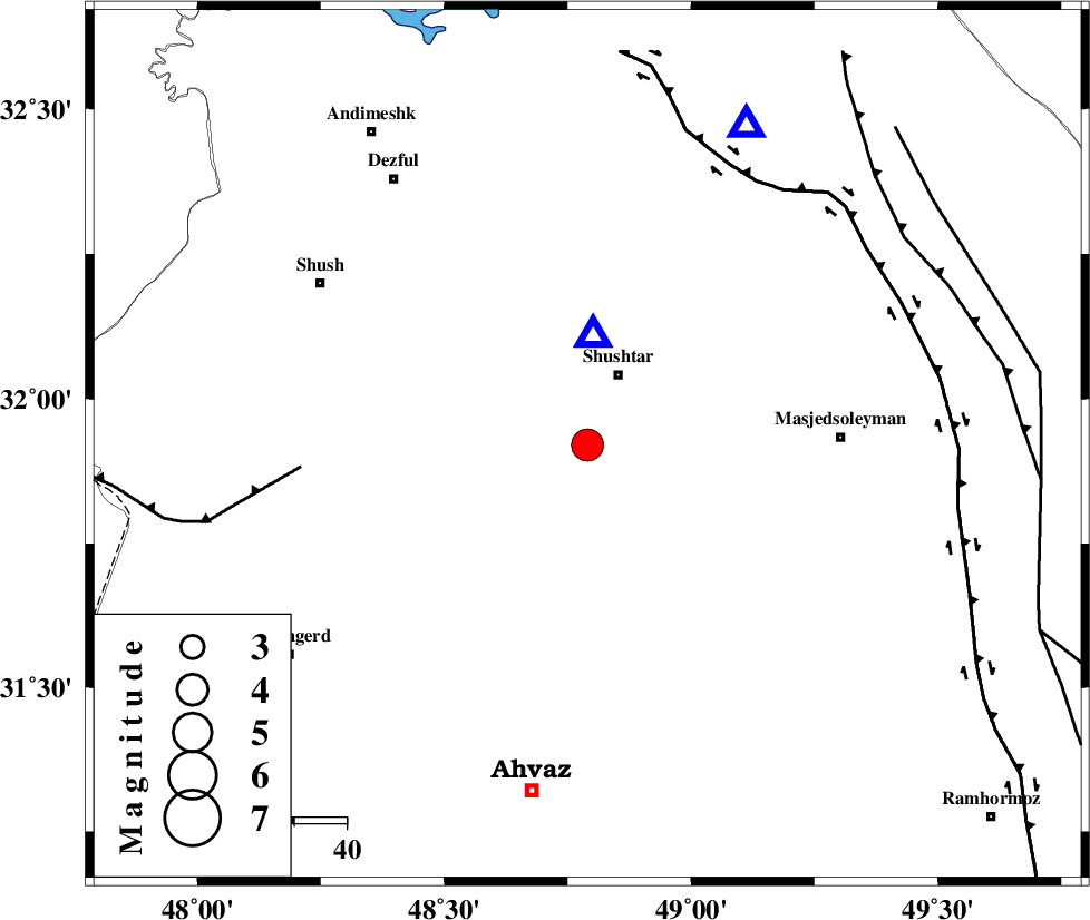
| Location | Lat:31.92 Lon: 48.79 |
| Region | 14 km South of Shushtar, Khoozestan Province |
Nearest Cities |
|
| 6 km of Mehdiabad, Khoozestan Province | |
| 11 km of Sardarabad, Khoozestan Province | |
| 14 km North West of Arabhasan, Khoozestan Province | |
| 15 km South of Shushtar, Khoozestan Province | |
| 32 km South of Samaleh, Khoozestan Province | |
| Depth | 15 km |
| Agency | |
Faults within 150 km: |
|
| DEZFUL_EMBAYMENT (Length: 228 km) , Distance to epicenter: 31 km | |
| AHVAZ_F (Length: 99 km) , Distance to epicenter: 55 km | |
| MFF2 (Length: 205 km) , Distance to epicenter: 71 km | |
| Number of Phases | 8 |
| RMS | 0.4 |
| Number of Stations | 8 |
| Error in Latitude | >7 km |
| Error in Longitude | 4.9 km |
| Error in Depth | 0 km |
Download waveform in seisan format
to download seisan software Click here
to access information about IIEES stations Click here
Amplitude | ||||||||
| UID | Agency | Station | Component | Amplitude | Period | Arrival Time | Proccessing Time | Signal Clip |
| 31057 | IIEES | ASAO | N | 750.3 | 0.71 | 2004-11-20 02:12:27 | 2006-03-15 11:56:00 | n |
| 31058 | IIEES | SNGE | N | 588 | 0.62 | 2004-11-20 02:12:45 | 2006-03-15 11:56:00 | n |
| 31059 | IIEES | THKV | E | 141.1 | 0.74 | 2004-11-20 02:13:24 | 2006-03-15 11:56:00 | n |
| 31060 | IIEES | DAMV | E | 131.7 | 0.37 | 2004-11-20 02:13:20 | 2006-03-15 11:56:00 | n |
| 31061 | IIEES | GHIR | N | 144 | 0.6 | 2004-11-20 02:14:51 | 2006-03-15 11:56:00 | n |
Phase | ||||||||||||
| Agency | Station | Component | Phase Type | Phase Quality | First Motion | Observed Arrival Time | Time Residual | Loc. Flag | Input Weight | Distance | Azimuth | |
| IIEES | ASAO | Z | PN | E | 2004-11-20 02:11:41 | 0.1 | y | 313 | 21 | |||
| IIEES | SNGE | Z | PN | E | 2004-11-20 02:11:49 | 0.4 | y | 377 | 340 | |||
| IIEES | NASN | Z | PN | E | 2004-11-20 02:11:51 | 0.6 | y | 390 | 74 | |||
| IIEES | THKV | Z | PN | E | 2004-11-20 02:12:02 | -0.1 | y | 483 | 23 | |||
| IIEES | DAMV | Z | PN | E | 2004-11-20 02:12:04 | -0.5 | y | 506 | 35 | |||
| IIEES | GHIR | Z | PN | E | 2004-11-20 02:12:13 | 0 | y | 571 | 134 | |||
| IIEES | GRMI | Z | PN | E | 2004-11-20 02:12:37 | -0.7 | y | 769 | 354 | |||
| IIEES | BNDS | Z | PN | E | 2004-11-20 02:12:49 | -0.6 | y | 872 | 123 | |||