
Magnitude |
:2.2 |
| Date & Time (UTC) | 2004-11-13 17:09:02.0 |
| Date & Time (Local) | 1383/8/23 20:39:02.0 |
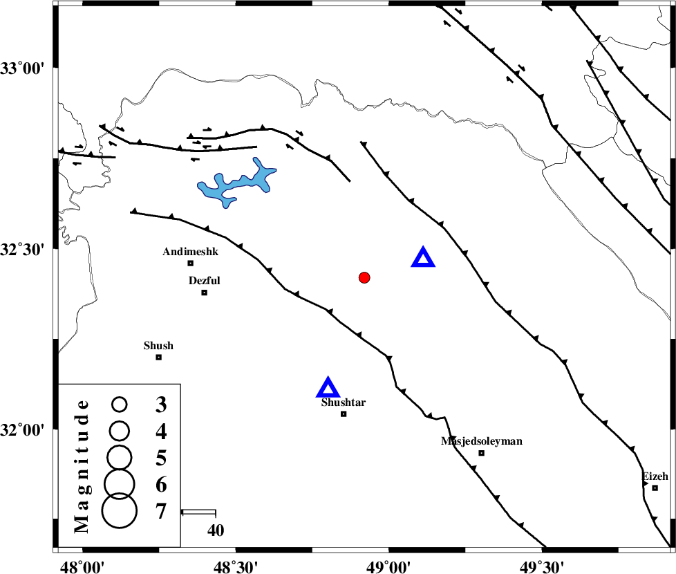
| Location | Lat:32.42 Lon: 48.92 |
| Region | 17 km West of Lali, Khoozestan Province |
Nearest Cities |
|
| 12 km of Sardasht, Khoozestan Province | |
| 18 km North West of Lali, Khoozestan Province | |
| 22 km North East of Gatvand, Khoozestan Province | |
| 24 km North East of Mahur berenji, Khoozestan Province | |
| 25 km North West of Jaefarabad, Khoozestan Province | |
| Depth | 38 km |
| Agency | |
Faults within 150 km: |
|
| DEZFUL_EMBAYMENT (Length: 228 km) , Distance to epicenter: 15 km | |
| MFF2 (Length: 205 km) , Distance to epicenter: 28 km | |
| BALARUD_F_Z2 (Length: 58 km) , Distance to epicenter: 30 km | |
| Number of Phases | 4 |
| RMS | 0 |
| Number of Stations | 4 |
| Error in Latitude | >7.4 km |
| Error in Longitude | 5.5 km |
| Error in Depth | 8.8 km |
Download waveform in seisan format
to download seisan software Click here
to access information about IIEES stations Click here
Amplitude | ||||||||
| UID | Agency | Station | Component | Amplitude | Period | Arrival Time | Proccessing Time | Signal Clip |
| 30944 | IIEES | SHGR | E | 224.4 | 0.2 | 2004-11-13 17:09:20 | 2006-03-15 11:56:00 | n |
| 30945 | IIEES | SHGR | N | 329.8 | 0.39 | 2004-11-13 17:09:24 | 2006-03-15 11:56:00 | n |
| 30946 | IIEES | SNGE | N | 10.9 | 0.65 | 2004-11-13 17:10:40 | 2006-03-15 11:56:00 | n |
| 30947 | IIEES | NASN | E | 3.5 | 0.6 | 2004-11-13 17:10:47 | 2006-03-15 11:56:00 | n |
| 30948 | IIEES | NASN | N | 3.9 | 0.62 | 2004-11-13 17:10:49 | 2006-03-15 11:56:00 | n |
Phase | ||||||||||||
| Agency | Station | Component | Phase Type | Phase Quality | First Motion | Observed Arrival Time | Time Residual | Loc. Flag | Input Weight | Distance | Azimuth | |
| IIEES | SHGR | Z | PG | E | 2004-11-13 17:09:10 | 0 | y | 36 | 199 | |||
| IIEES | ASAO | E | PN | E | 2004-11-13 17:09:39 | 0 | y | 258 | 23 | |||
| IIEES | SNGE | Z | PN | E | 2004-11-13 17:09:48 | 0 | y | 331 | 334 | |||
| IIEES | NASN | Z | PN | E | 2004-11-13 17:09:53 | 0 | y | 367 | 82 | |||