
Magnitude |
:3.2 |
| Date & Time (UTC) | 2004-11-12 01:06:57.2 |
| Date & Time (Local) | 1383/8/22 04:36:57.2 |
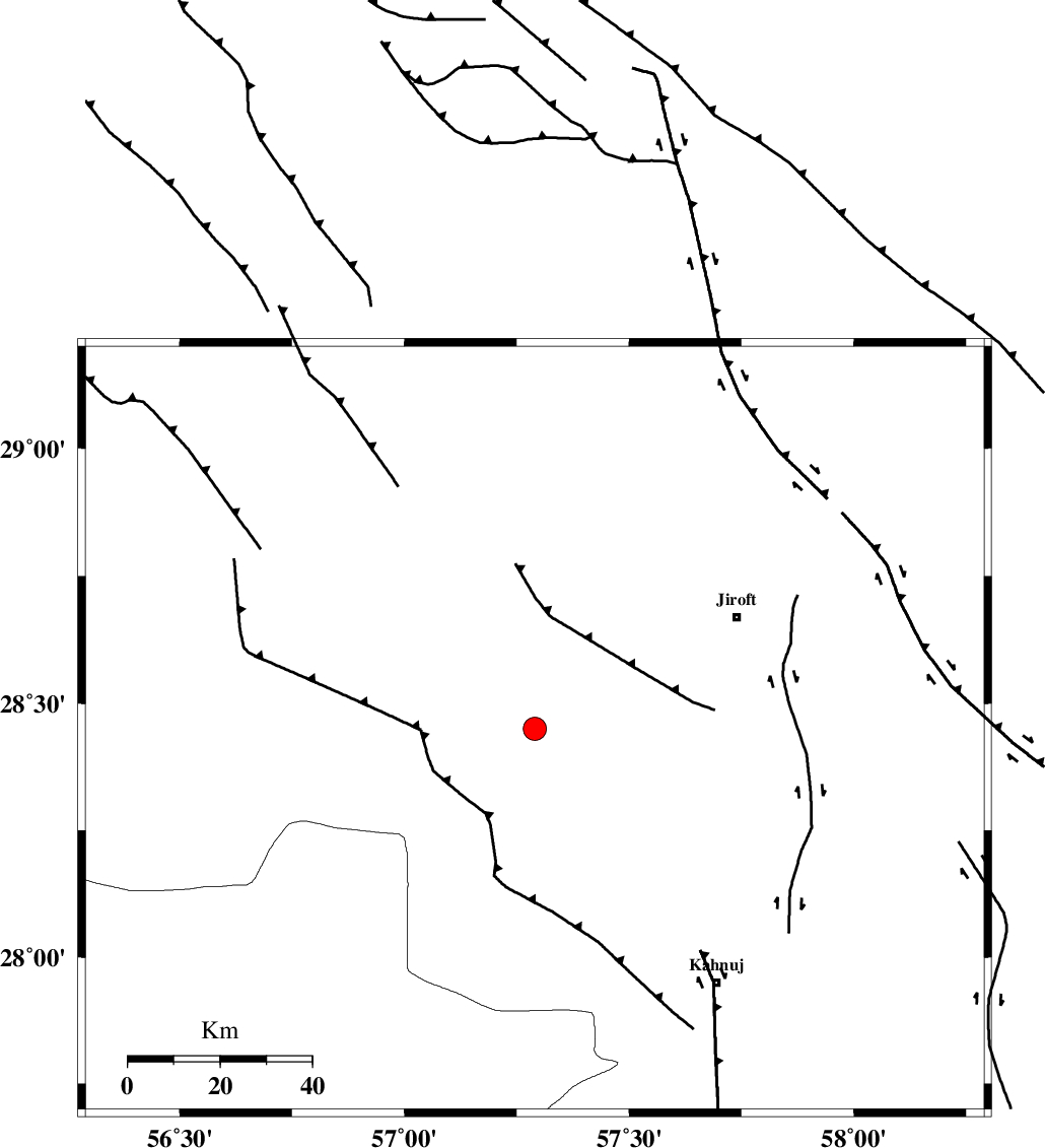
| Location | Lat:28.45 Lon: 57.29 |
| Region | 50 km South-West of Jiroft, Kerman Province |
Nearest Cities |
|
| 28 km North of Hurpasefid, Kerman Province | |
| 36 km South East of Dolatabad, Kerman Province | |
| 36 km North West of Bolock, Kerman Province | |
| 42 km North West of Mehrueye-e paeen, Kerman Province | |
| 42 km North East of Sarkhan, Kerman Province | |
| Depth | 38 km |
| Agency | |
Faults within 150 km: |
|
| SABZEVARAN_F (Length: 190 km) , Distance to epicenter: 43 km | |
| MAIN_ZAGROS_R_F (Length: 1106 km) , Distance to epicenter: 65 km | |
| JIROFT_F (Length: 144 km) , Distance to epicenter: 65 km | |
| Number of Phases | 5 |
| RMS | 0.1 |
| Number of Stations | 4 |
| Error in Latitude | >3.2 km |
| Error in Longitude | 3.9 km |
| Error in Depth | 6.7 km |
Download waveform in seisan format
to download seisan software Click here
to access information about IIEES stations Click here
Amplitude | ||||||||
| UID | Agency | Station | Component | Amplitude | Period | Arrival Time | Proccessing Time | Signal Clip |
| 30902 | IIEES | BNDS | E | 285 | 0.55 | 2004-11-12 01:07:43 | 2006-03-15 11:56:00 | n |
| 30903 | IIEES | BNDS | N | 334.5 | 0.53 | 2004-11-12 01:07:47 | 2006-03-15 11:56:00 | n |
| 30904 | IIEES | KRBR | N | 311.7 | 0.45 | 2004-11-12 01:07:49 | 2006-03-15 11:56:00 | n |
| 30905 | IIEES | KRBR | E | 298.6 | 0.44 | 2004-11-12 01:07:49 | 2006-03-15 11:56:00 | n |
| 30906 | IIEES | GHIR | N | 47.4 | 0.17 | 2004-11-12 01:08:43 | 2006-03-15 11:56:00 | n |
| 30907 | IIEES | GHIR | E | 36.4 | 0.67 | 2004-11-12 01:08:51 | 2006-03-15 11:56:00 | n |
Phase | ||||||||||||
| Agency | Station | Component | Phase Type | Phase Quality | First Motion | Observed Arrival Time | Time Residual | Loc. Flag | Input Weight | Distance | Azimuth | |
| IIEES | BNDS | Z | PG | E | 2004-11-12 01:07:23 | 0.3 | y | 160 | 224 | |||
| IIEES | BNDS | N | SG | E | 2004-11-12 01:07:42 | -0.2 | y | 160 | 224 | |||
| IIEES | KRBR | Z | PG | E | 2004-11-12 01:07:26 | 0 | y | 178 | 343 | |||
| IIEES | ZHSF | Z | PG | E | 2004-11-12 01:07:54 | -0.1 | y | 363 | 68 | |||
| IIEES | GHIR | Z | PN | E | 2004-11-12 01:07:55 | 0 | y | 422 | 269 | |||