
Magnitude |
:4.1 |
| Date & Time (UTC) | 2004-11-12 00:30:26.1 |
| Date & Time (Local) | 1383/8/22 04:00:26.1 |
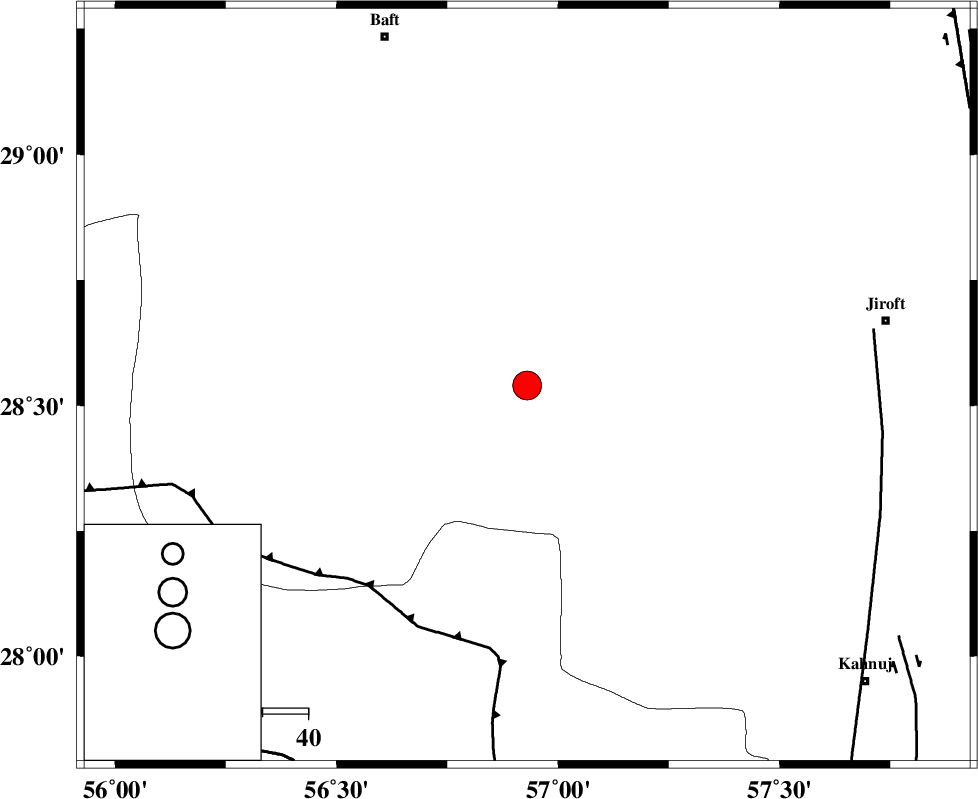
| Location | Lat:28.54 Lon: 56.93 |
| Region | 80 km South-West of Jiroft, Kerman Province |
Nearest Cities |
|
| 23 km North of Sarkhan, Kerman Province | |
| 25 km South West of Dolatabad, Kerman Province | |
| 54 km North West of Hurpasefid, Kerman Province | |
| 54 km North East of Shahmaran, Kerman Province | |
| 56 km South East of Kashkueyeh, Kerman Province | |
| Depth | 16 km |
| Agency | |
Faults within 150 km: |
|
| MAIN_ZAGROS_R_F (Length: 1106 km) , Distance to epicenter: 56 km | |
| SABZEVARAN_F (Length: 190 km) , Distance to epicenter: 77 km | |
| HZF2 (Length: 437 km) , Distance to epicenter: 98 km | |
| Number of Phases | 5 |
| RMS | 0.1 |
| Number of Stations | 4 |
| Error in Latitude | >2.3 km |
| Error in Longitude | 4.3 km |
| Error in Depth | 5.7 km |
Download waveform in seisan format
to download seisan software Click here
to access information about IIEES stations Click here
Amplitude | ||||||||
| UID | Agency | Station | Component | Amplitude | Period | Arrival Time | Proccessing Time | Signal Clip |
| 30897 | IIEES | BNDS | E | 5694.2 | 0.37 | 2004-11-12 00:31:09 | 2006-03-15 11:56:00 | n |
| 30898 | IIEES | BNDS | N | 5134.6 | 0.48 | 2004-11-12 00:31:11 | 2006-03-15 11:56:00 | n |
| 30899 | IIEES | KRBR | E | 1208.2 | 0.52 | 2004-11-12 00:31:23 | 2006-03-15 11:56:00 | n |
| 30900 | IIEES | GHIR | E | 349.4 | 0.65 | 2004-11-12 00:32:39 | 2006-03-15 11:56:00 | n |
| 30901 | IIEES | GHIR | N | 426.6 | 0.68 | 2004-11-12 00:32:42 | 2006-03-15 11:56:00 | n |
Phase | ||||||||||||
| Agency | Station | Component | Phase Type | Phase Quality | First Motion | Observed Arrival Time | Time Residual | Loc. Flag | Input Weight | Distance | Azimuth | |
| IIEES | BNDS | Z | PG | E | 2004-11-12 00:30:50 | -0.2 | y | 147 | 211 | |||
| IIEES | BNDS | E | SG | E | 2004-11-12 00:31:08 | 0.2 | y | 147 | 211 | |||
| IIEES | KRBR | Z | PG | E | 2004-11-12 00:30:52 | 0.1 | y | 161 | 354 | |||
| IIEES | GHIR | Z | PN | E | 2004-11-12 00:31:21 | 0 | y | 387 | 267 | |||
| IIEES | ZHSF | Z | PN | E | 2004-11-12 00:31:22 | 0 | y | 393 | 71 | |||