
Magnitude |
:4.6 |
| Date & Time (UTC) | 2004-11-08 20:03:19.4 |
| Date & Time (Local) | 1383/8/18 23:33:19.4 |
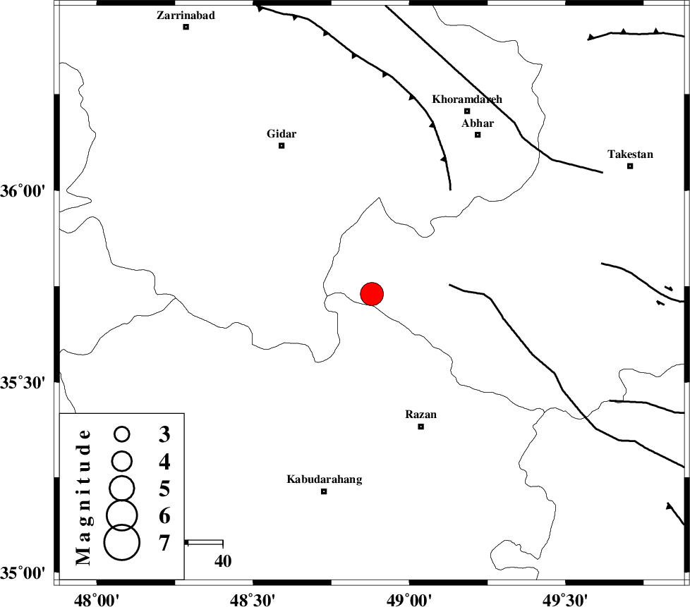
| Location | Lat:35.73 Lon: 48.88 |
| Region | 41 km North-West of Razan, Hamedan Province |
Nearest Cities |
|
| 19 km North East of Kahla, Zanjan Province | |
| 25 km North of Khorandeh, Hamedan Province | |
| 33 km North of Damag, Hamedan Province | |
| 34 km North East of Babanazar, Hamedan Province | |
| 36 km North West of Avaj, Ghazvin Province | |
| Depth | 15 km |
| Agency | |
Faults within 150 km: |
|
| KUSHK_E_NOSRAT_F (Length: 230 km) , Distance to epicenter: 22 km | |
| SOLTANIYEH_F (Length: 119 km) , Distance to epicenter: 38 km | |
| ZANJAN_F (Length: 137 km) , Distance to epicenter: 63 km | |
| Number of Phases | 9 |
| RMS | 0.5 |
| Number of Stations | 7 |
| Error in Latitude | >6.9 km |
| Error in Longitude | 4.1 km |
| Error in Depth | 9.1 km |
Download waveform in seisan format
to download seisan software Click here
to access information about IIEES stations Click here
Amplitude | ||||||||
| UID | Agency | Station | Component | Amplitude | Period | Arrival Time | Proccessing Time | Signal Clip |
| 30837 | IIEES | THKV | E | 4761 | 0.6 | 2004-11-08 20:04:15 | 2006-03-15 11:56:00 | n |
| 30838 | IIEES | THKV | N | 5426.7 | 0.6 | 2004-11-08 20:04:24 | 2006-03-15 11:56:00 | n |
| 30839 | IIEES | DAMV | N | 4361.3 | 0.48 | 2004-11-08 20:04:40 | 2006-03-15 11:56:00 | n |
| 30840 | IIEES | DAMV | E | 3460.7 | 0.6 | 2004-11-08 20:04:45 | 2006-03-15 11:56:00 | n |
Phase | ||||||||||||
| Agency | Station | Component | Phase Type | Phase Quality | First Motion | Observed Arrival Time | Time Residual | Loc. Flag | Input Weight | Distance | Azimuth | |
| IIEES | SNGE | Z | PG | E | 2004-11-08 20:03:44 | -0.6 | y | 156 | 243 | |||
| IIEES | SNGE | N | SG | E | 2004-11-08 20:04:04 | -0.2 | y | 156 | 243 | |||
| IIEES | THKV | Z | PG | E | 2004-11-08 20:03:48 | -0.5 | y | 182 | 83 | |||
| IIEES | THKV | E | SG | E | 2004-11-08 20:04:11 | -0.2 | y | 182 | 83 | |||
| IIEES | DAMV | Z | PN | E | 2004-11-08 20:04:01 | -0.1 | y | 280 | 91 | |||
| IIEES | GRMI | Z | PN | E | 2004-11-08 20:04:11 | 0.2 | y | 353 | 346 | |||
| IIEES | SHGR | Z | PN | E | 2004-11-08 20:04:17 | 0.9 | y | 402 | 181 | |||
| IIEES | NASN | Z | PN | E | 2004-11-08 20:04:28 | 0.6 | y | 487 | 131 | |||
| IIEES | MAKU | Z | PN | E | 2004-11-08 20:04:35 | 0.6 | y | 547 | 319 | |||