
Magnitude |
:3.7 |
| Date & Time (UTC) | 2004-11-05 16:58:09.0 |
| Date & Time (Local) | 1383/8/15 20:28:09.0 |
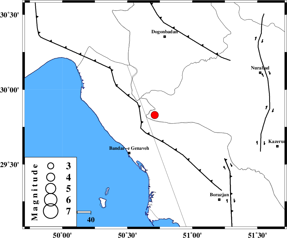
| Location | Lat:29.83 Lon: 50.71 |
| Region | 34 km North-East of Bandar-e genaveh, Bushehr Province |
Nearest Cities |
|
| 23 km North of Mohammad salehi, Bushehr Province | |
| 32 km North of Chehar rustaee, Bushehr Province | |
| 34 km North East of Bandar-e genaveh, Bushehr Province | |
| 39 km North of Bandarehrig, Bushehr Province | |
| 43 km East of Emamhasan, Bushehr Province | |
| Depth | 14 km |
| Agency | |
Faults within 150 km: |
|
| ZFF3 (Length: 125 km) , Distance to epicenter: 11 km | |
| RAG_E_SEFID_F (Length: 84 km) , Distance to epicenter: 47 km | |
| BORAZJAN_F (Length: 168 km) , Distance to epicenter: 61 km | |
| Number of Phases | 5 |
| RMS | 0.3 |
| Number of Stations | 4 |
| Error in Latitude | >10.3 km |
| Error in Longitude | 12.1 km |
| Error in Depth | 16.8 km |
Download waveform in seisan format
to download seisan software Click here
to access information about IIEES stations Click here
Amplitude | ||||||||
| UID | Agency | Station | Component | Amplitude | Period | Arrival Time | Proccessing Time | Signal Clip |
| 30757 | IIEES | GHIR | E | 248.2 | 0.44 | 2004-11-05 16:59:35 | 2006-03-15 11:56:00 | n |
| 30758 | IIEES | GHIR | N | 152.8 | 0.44 | 2004-11-05 16:59:44 | 2006-03-15 11:56:00 | n |
| 30759 | IIEES | SHGR | N | 401 | 0.68 | 2004-11-05 17:00:02 | 2006-03-15 11:56:00 | n |
| 30760 | IIEES | SHGR | E | 447.5 | 0.72 | 2004-11-05 17:00:07 | 2006-03-15 11:56:00 | n |
Phase | ||||||||||||
| Agency | Station | Component | Phase Type | Phase Quality | First Motion | Observed Arrival Time | Time Residual | Loc. Flag | Input Weight | Distance | Azimuth | |
| IIEES | GHIR | Z | PN | E | 2004-11-05 16:58:51 | 0.3 | y | 280 | 127 | |||
| IIEES | GHIR | N | SG | E | 2004-11-05 16:59:27 | -0.3 | y | 280 | 127 | |||
| IIEES | SHGR | Z | PN | E | 2004-11-05 16:58:55 | -0.1 | y | 311 | 325 | |||
| IIEES | KRBR | Z | PN | E | 2004-11-05 16:59:30 | 0.4 | y | 585 | 87 | |||
| IIEES | DAMV | Z | PN | E | 2004-11-05 16:59:37 | -0.2 | y | 654 | 10 | |||