
Magnitude |
:3.5 |
| Date & Time (UTC) | 2004-10-27 00:49:28.5 |
| Date & Time (Local) | 1383/8/6 04:19:28.5 |
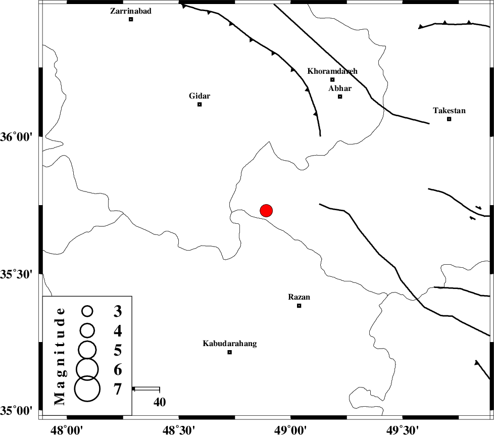
| Location | Lat:35.73 Lon: 48.89 |
| Region | 40 km North-West of Razan, Hamedan Province |
Nearest Cities |
|
| 20 km North East of Kahla, Zanjan Province | |
| 25 km North of Khorandeh, Hamedan Province | |
| 33 km North of Damag, Hamedan Province | |
| 34 km North East of Babanazar, Hamedan Province | |
| 35 km North West of Avaj, Ghazvin Province | |
| Depth | 14 km |
| Agency | |
Faults within 150 km: |
|
| KUSHK_E_NOSRAT_F (Length: 230 km) , Distance to epicenter: 22 km | |
| SOLTANIYEH_F (Length: 119 km) , Distance to epicenter: 37 km | |
| ZANJAN_F (Length: 137 km) , Distance to epicenter: 62 km | |
| Number of Phases | 7 |
| RMS | 0.2 |
| Number of Stations | 5 |
| Error in Latitude | >3.8 km |
| Error in Longitude | 2.2 km |
| Error in Depth | 8.7 km |
Download waveform in seisan format
to download seisan software Click here
to access information about IIEES stations Click here
Amplitude | ||||||||
| UID | Agency | Station | Component | Amplitude | Period | Arrival Time | Proccessing Time | Signal Clip |
| 30715 | IIEES | SNGE | N | 626.4 | 0.75 | 2004-10-27 00:50:15 | 2006-03-15 11:56:00 | n |
| 30716 | IIEES | ASAO | E | 811 | 0.62 | 2004-10-27 00:50:18 | 2006-03-15 11:56:00 | n |
| 30717 | IIEES | THKV | E | 391.3 | 0.43 | 2004-10-27 00:50:24 | 2006-03-15 11:56:00 | n |
| 30718 | IIEES | THKV | N | 432.8 | 0.53 | 2004-10-27 00:50:25 | 2006-03-15 11:56:00 | n |
| 30719 | IIEES | DAMV | E | 238 | 0.51 | 2004-10-27 00:50:49 | 2006-03-15 11:56:00 | n |
| 30720 | IIEES | DAMV | N | 273.6 | 0.49 | 2004-10-27 00:50:51 | 2006-03-15 11:56:00 | n |
Phase | ||||||||||||
| Agency | Station | Component | Phase Type | Phase Quality | First Motion | Observed Arrival Time | Time Residual | Loc. Flag | Input Weight | Distance | Azimuth | |
| IIEES | SNGE | Z | PG | E | 2004-10-27 00:49:54 | -0.4 | y | 157 | 244 | |||
| IIEES | SNGE | N | SG | E | 2004-10-27 00:50:13 | 0.2 | y | 157 | 244 | |||
| IIEES | ASAO | Z | PG | E | 2004-10-27 00:49:56 | 0 | y | 167 | 141 | |||
| IIEES | ASAO | N | SG | E | 2004-10-27 00:50:16 | 0.1 | y | 167 | 141 | |||
| IIEES | THKV | Z | PG | E | 2004-10-27 00:49:58 | -0.2 | y | 181 | 83 | |||
| IIEES | DAMV | Z | PN | E | 2004-10-27 00:50:11 | 0.1 | y | 279 | 91 | |||
| IIEES | GRMI | Z | PN | E | 2004-10-27 00:50:20 | 0.2 | y | 353 | 346 | |||