
Magnitude |
:3.9 |
| Date & Time (UTC) | 2004-10-14 10:48:07.2 |
| Date & Time (Local) | 1383/7/23 14:18:07.2 |
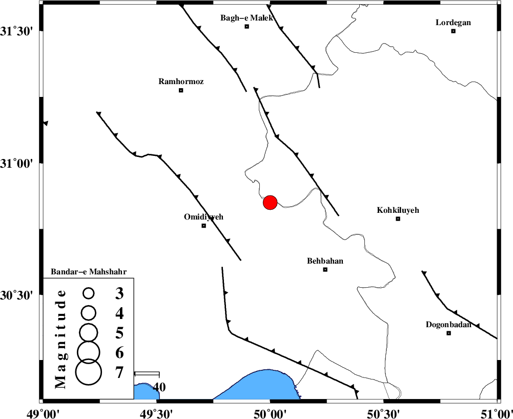
| Location | Lat:30.85 Lon: 50 |
| Region | 29 km East of Omidiyeh, Khoozestan Province |
Nearest Cities |
|
| 10 km North of Jolaki, Khoozestan Province | |
| 15 km East of Jayzan, Khoozestan Province | |
| 23 km North West of Dodange-ye bozorg, Khoozestan Province | |
| 23 km North East of Aghajari, Khoozestan Province | |
| 29 km North East of Chah-e salem, Khoozestan Province | |
| Depth | 36 km |
| Agency | |
Faults within 150 km: |
|
| MFF4 (Length: 62 km) , Distance to epicenter: 21 km | |
| AGHAJARI_F (Length: 88 km) , Distance to epicenter: 27 km | |
| RAG_E_SEFID_F (Length: 84 km) , Distance to epicenter: 34 km | |
| Number of Phases | 6 |
| RMS | 0.4 |
| Number of Stations | 6 |
| Error in Latitude | >11.2 km |
| Error in Longitude | 18.8 km |
| Error in Depth | 18.7 km |
Download waveform in seisan format
to download seisan software Click here
to access information about IIEES stations Click here
Amplitude | ||||||||
| UID | Agency | Station | Component | Amplitude | Period | Arrival Time | Proccessing Time | Signal Clip |
| 30555 | IIEES | SHGR | N | 1618.9 | 0.67 | 2004-10-14 10:49:02 | 2006-03-15 11:56:00 | n |
| 30556 | IIEES | SHGR | E | 1372.9 | 0.74 | 2004-10-14 10:49:08 | 2006-03-15 11:56:00 | n |
| 30557 | IIEES | DAMV | E | 59.9 | 0.32 | 2004-10-14 10:50:22 | 2006-03-15 11:56:00 | n |
Phase | ||||||||||||
| Agency | Station | Component | Phase Type | Phase Quality | First Motion | Observed Arrival Time | Time Residual | Loc. Flag | Input Weight | Distance | Azimuth | |
| IIEES | SHGR | Z | PG | E | 2004-10-14 10:48:36 | 0 | y | 180 | 321 | |||
| IIEES | GHIR | Z | PN | E | 2004-10-14 10:49:03 | -0.1 | y | 406 | 134 | |||
| IIEES | ASAO | Z | PN | E | 2004-10-14 10:49:04 | 0.7 | y | 410 | 0 | |||
| IIEES | SNGE | Z | PN | E | 2004-10-14 10:49:18 | -0.2 | y | 531 | 333 | |||
| IIEES | DAMV | Z | PN | E | 2004-10-14 10:49:22 | -0.8 | y | 561 | 19 | |||
| IIEES | KRBR | Z | PN | E | 2004-10-14 10:49:35 | 0.3 | y | 657 | 97 | |||